Millersport, Ohio
| Millersport, Ohio | |
|---|---|
| Village | |
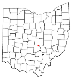 Location of Millersport, Ohio | |
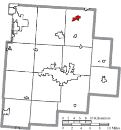 Location of Millersport in Fairfield County | |
| Coordinates: 39°54′1″N 82°31′57″W / 39.90028°N 82.53250°WCoordinates: 39°54′1″N 82°31′57″W / 39.90028°N 82.53250°W | |
| Country | United States |
| State | Ohio |
| County | Fairfield |
| Area[1] | |
| • Total | 0.90 sq mi (2.33 km2) |
| • Land | 0.87 sq mi (2.25 km2) |
| • Water | 0.03 sq mi (0.08 km2) |
| Elevation[2] | 899 ft (274 m) |
| Population (2010)[3] | |
| • Total | 1,044 |
| • Estimate (2012[4]) | 1,047 |
| • Density | 1,200.0/sq mi (463.3/km2) |
| Time zone | Eastern (EST) (UTC-5) |
| • Summer (DST) | EDT (UTC-4) |
| ZIP code | 43046 |
| Area code(s) | 740 |
| FIPS code | 39-50400[5] |
| GNIS feature ID | 1043380[2] |
Millersport is a village in Fairfield County, Ohio, United States. The population was 1,044 at the 2010 census. Millersport is most notable as the home of the Sweet Corn Festival, which is held in Millersport annually during the first week of September.
History
Millersport was laid out in 1825 by Mathias Miller, and named for him.[6] A post office called Millersport has been in operation since 1839.[7]
Geography
Millersport is located at 39°54′1″N 82°31′57″W / 39.90028°N 82.53250°W (39.900205, -82.532500).[8]
According to the United States Census Bureau, the village has a total area of 0.90 square miles (2.33 km2), of which 0.87 square miles (2.25 km2) is land and 0.03 square miles (0.08 km2) is water.[1]
Demographics
| Historical population | |||
|---|---|---|---|
| Census | Pop. | %± | |
| 1850 | 149 | — | |
| 1870 | 149 | — | |
| 1920 | 370 | — | |
| 1930 | 393 | 6.2% | |
| 1940 | 460 | 17.0% | |
| 1950 | 605 | 31.5% | |
| 1960 | 752 | 24.3% | |
| 1970 | 777 | 3.3% | |
| 1980 | 844 | 8.6% | |
| 1990 | 1,010 | 19.7% | |
| 2000 | 963 | −4.7% | |
| 2010 | 1,044 | 8.4% | |
| Est. 2015 | 1,049 | [9] | 0.5% |
2010 census
As of the census[3] of 2010, there were 1,044 people, 440 households, and 295 families residing in the village. The population density was 1,200.0 inhabitants per square mile (463.3/km2). There were 497 housing units at an average density of 571.3 per square mile (220.6/km2). The racial makeup of the village was 98.1% White, 0.4% African American, 0.4% Native American, 0.1% Pacific Islander, 0.1% from other races, and 1.0% from two or more races. Hispanic or Latino of any race were 1.1% of the population.
There were 440 households of which 33.0% had children under the age of 18 living with them, 44.3% were married couples living together, 17.7% had a female householder with no husband present, 5.0% had a male householder with no wife present, and 33.0% were non-families. 28.4% of all households were made up of individuals and 10.9% had someone living alone who was 65 years of age or older. The average household size was 2.37 and the average family size was 2.87.
The median age in the village was 39.1 years. 23.5% of residents were under the age of 18; 10.9% were between the ages of 18 and 24; 23.3% were from 25 to 44; 28.3% were from 45 to 64; and 14.1% were 65 years of age or older. The gender makeup of the village was 47.2% male and 52.8% female.
2000 census
As of the census[5] of 2000, there were 963 people, 403 households, and 276 families residing in the village. The population density was 967.6 people per square mile (371.8/km²). There were 447 housing units at an average density of 449.1 per square mile (172.6/km²). The racial makeup of the village was 98.44% White, 0.10% Native American, 0.42% from other races, and 1.04% from two or more races. Hispanic or Latino of any race were 0.73% of the population.
There were 403 households out of which 34.5% had children under the age of 18 living with them, 51.6% were married couples living together, 13.4% had a female householder with no husband present, and 31.3% were non-families. 25.6% of all households were made up of individuals and 8.9% had someone living alone who was 65 years of age or older. The average household size was 2.39 and the average family size was 2.85.
In the village the population was spread out with 25.8% under the age of 18, 8.1% from 18 to 24, 31.0% from 25 to 44, 23.2% from 45 to 64, and 11.9% who were 65 years of age or older. The median age was 37 years. For every 100 females there were 84.8 males. For every 100 females age 18 and over, there were 81.5 males.
The median income for a household in the village was $42,361, and the median income for a family was $47,596. Males had a median income of $36,333 versus $24,598 for females. The per capita income for the village was $19,678. About 6.2% of families and 5.9% of the population were below the poverty line, including 9.4% of those under age 18 and none of those age 65 or over.
Notable person
- Roman Atwood American comedian and YouTube prankster/vlogger. Owner/Founder of Smile More company
References
- 1 2 "US Gazetteer files 2010". United States Census Bureau. Retrieved 2013-01-06.
- 1 2 "US Board on Geographic Names". United States Geological Survey. 2007-10-25. Retrieved 2008-01-31.
- 1 2 "American FactFinder". United States Census Bureau. Retrieved 2013-01-06.
- ↑ "Population Estimates". United States Census Bureau. Retrieved 2013-06-17.
- 1 2 "American FactFinder". United States Census Bureau. Retrieved 2008-01-31.
- ↑ Miller, Charles Christian (1912). History of Fairfield County, Ohio, and representative citizens. Chicago, Richmond-Arnold Pub. Co. p. 198.
- ↑ "Fairfield County". Jim Forte Postal History. Retrieved 17 December 2015.
- ↑ "US Gazetteer files: 2010, 2000, and 1990". United States Census Bureau. 2011-02-12. Retrieved 2011-04-23.
- ↑ "Annual Estimates of the Resident Population for Incorporated Places: April 1, 2010 to July 1, 2015". Retrieved July 2, 2016.
- ↑ "Census of Population and Housing". Census.gov. Retrieved June 4, 2015.
External links
Municipalities and communities of Fairfield County, Ohio, United States | ||
|---|---|---|
| Cities | 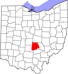 | |
| Villages | ||
| Townships | ||
| CDPs | ||
| Unincorporated communities | ||
| Footnotes | ‡This populated place also has portions in an adjacent county or counties | |