Mill Spring, Missouri
| Mill Spring, Missouri | |
|---|---|
| Village | |
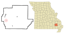 Location of Mill Spring, Missouri | |
| Coordinates: 37°3′48″N 90°40′54″W / 37.06333°N 90.68167°WCoordinates: 37°3′48″N 90°40′54″W / 37.06333°N 90.68167°W | |
| Country | United States |
| State | Missouri |
| County | Wayne |
| Area[1] | |
| • Total | 0.44 sq mi (1.14 km2) |
| • Land | 0.44 sq mi (1.14 km2) |
| • Water | 0 sq mi (0 km2) |
| Elevation | 436 ft (133 m) |
| Population (2010)[2] | |
| • Total | 189 |
| • Estimate (2012[3]) | 184 |
| • Density | 429.5/sq mi (165.8/km2) |
| Time zone | Central (CST) (UTC-6) |
| • Summer (DST) | CDT (UTC-5) |
| ZIP code | 63952 |
| Area code(s) | 573 |
| FIPS code | 29-48386[4] |
| GNIS feature ID | 0722359[5] |
Mill Spring is a village in Wayne County, Missouri, United States, along the Black River. The population was 189 at the 2010 census.
History
Mill Spring was laid out in 1871.[6] It takes its name from a large spring which once powered lumber mills.[7]
Geography
Mill Spring is located at 37°3′48″N 90°40′54″W / 37.06333°N 90.68167°W (37.063306, -90.681616).[8]
According to the United States Census Bureau, the village has a total area of 0.44 square miles (1.14 km2), all of it land.[1]
Demographics
| Historical population | |||
|---|---|---|---|
| Census | Pop. | %± | |
| 1880 | 174 | — | |
| 1960 | 226 | — | |
| 1970 | 207 | −8.4% | |
| 1980 | 257 | 24.2% | |
| 1990 | 252 | −1.9% | |
| 2000 | 219 | −13.1% | |
| 2010 | 189 | −13.7% | |
| Est. 2015 | 183 | [9] | −3.2% |
2010 census
As of the census[2] of 2010, there were 189 people, 81 households, and 46 families residing in the village. The population density was 429.5 inhabitants per square mile (165.8/km2). There were 106 housing units at an average density of 240.9 per square mile (93.0/km2). The racial makeup of the village was 96.8% White, 1.1% African American, 0.5% from other races, and 1.6% from two or more races. Hispanic or Latino of any race were 0.5% of the population.
There were 81 households of which 25.9% had children under the age of 18 living with them, 38.3% were married couples living together, 13.6% had a female householder with no husband present, 4.9% had a male householder with no wife present, and 43.2% were non-families. 30.9% of all households were made up of individuals and 13.6% had someone living alone who was 65 years of age or older. The average household size was 2.33 and the average family size was 3.02.
The median age in the village was 37.8 years. 21.7% of residents were under the age of 18; 9.9% were between the ages of 18 and 24; 26% were from 25 to 44; 27% were from 45 to 64; and 15.3% were 65 years of age or older. The gender makeup of the village was 51.9% male and 48.1% female.
2000 census
As of the census[4] of 2000, there were 219 people, 81 households, and 55 families residing in the village. The population density was 1,041.8 people per square mile (402.6/km²). There were 104 housing units at an average density of 494.7 per square mile (191.2/km²). The racial makeup of the village was 96.35% White, 0.46% Native American, 0.91% Pacific Islander, and 2.28% from two or more races.
There were 81 households out of which 30.9% had children under the age of 18 living with them, 45.7% were married couples living together, 13.6% had a female householder with no husband present, and 30.9% were non-families. 24.7% of all households were made up of individuals and 16.0% had someone living alone who was 65 years of age or older. The average household size was 2.70 and the average family size was 3.13.
In the village the population was spread out with 28.8% under the age of 18, 8.7% from 18 to 24, 24.2% from 25 to 44, 17.8% from 45 to 64, and 20.5% who were 65 years of age or older. The median age was 37 years. For every 100 females there were 104.7 males. For every 100 females age 18 and over, there were 97.5 males.
The median income for a household in the village was $22,750, and the median income for a family was $26,389. Males had a median income of $18,125 versus $14,063 for females. The per capita income for the village was $9,723. About 13.5% of families and 22.7% of the population were below the poverty line, including 25.0% of those under the age of eighteen and 20.0% of those sixty five or over.
Notable people
- Bernarr Macfadden, magazine publisher and fitness authority
References
- 1 2 "US Gazetteer files 2010". United States Census Bureau. Retrieved 2012-07-08.
- 1 2 "American FactFinder". United States Census Bureau. Retrieved 2012-07-08.
- ↑ "Population Estimates". United States Census Bureau. Retrieved 2013-05-30.
- 1 2 "American FactFinder". United States Census Bureau. Retrieved 2008-01-31.
- ↑ "US Board on Geographic Names". United States Geological Survey. 2007-10-25. Retrieved 2008-01-31.
- ↑ Eaton, David Wolfe (1918). How Missouri Counties, Towns and Streams Were Named. The State Historical Society of Missouri. p. 371.
- ↑ History of Southeast Missouri: A Narrative Account of Its Historical Progress, Its People and Its Principal Interests, Volume 1. Lewis Publishing Company. 1912. p. 393.
- ↑ "US Gazetteer files: 2010, 2000, and 1990". United States Census Bureau. 2011-02-12. Retrieved 2011-04-23.
- ↑ "Annual Estimates of the Resident Population for Incorporated Places: April 1, 2010 to July 1, 2015". Retrieved July 2, 2016.
- ↑ "Census of Population and Housing". Census.gov. Retrieved June 4, 2015.
Municipalities and communities of Wayne County, Missouri, United States | ||
|---|---|---|
| Cities | 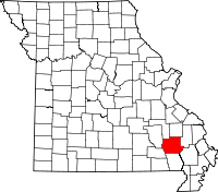 | |
| Village | ||
| Townships |
| |
| Unincorporated communities | ||