Mill Creek, Pennsylvania
| Mill Creek, Pennsylvania | |
|---|---|
| Borough | |
|
Main Street | |
 Mill Creek, Pennsylvania | |
| Coordinates: 40°26′12″N 77°55′52″W / 40.43667°N 77.93111°WCoordinates: 40°26′12″N 77°55′52″W / 40.43667°N 77.93111°W | |
| Country | United States |
| State | Pennsylvania |
| County | Huntingdon |
| Settled | 1848 |
| Incorporated | 1905 |
| Government | |
| • Type | Borough Council |
| • Mayor | Lester W. Haney (R) |
| Population (2010) | |
| • Total | 328 |
| Time zone | Eastern (EST) (UTC-5) |
| • Summer (DST) | EDT (UTC-4) |
| Zip code | 17060 |
| Area code(s) | 814 |
| School District: | Huntingdon Area School District |
| Local phone exchanges: 641, 643, 644 | |

Mill Creek is a borough in Huntingdon County, Pennsylvania, United States. The population was 351 at the 2000 census.
History
Mill Creek was named for the creek or stream on which it is located. The creek, or the stream was the main source of power for many of mills in the settlement years of 1700s and much of 1800s.
 Post office
Geography
Mill Creek is located at 40°26′12″N 77°55′52″W / 40.43667°N 77.93111°W (40.436666, -77.931033).[1]
Adjacent Municipalities
All listed municipalities are located in Huntingdon County unless otherwise noted.
According to the United States Census Bureau, the borough has a total area of 0.4 square miles (1.0 km2), all of it land.
Demographics
| Historical population | |||
|---|---|---|---|
| Census | Pop. | %± | |
| 1880 | 288 | — | |
| 1910 | 308 | — | |
| 1920 | 286 | −7.1% | |
| 1930 | 334 | 16.8% | |
| 1940 | 362 | 8.4% | |
| 1950 | 417 | 15.2% | |
| 1960 | 400 | −4.1% | |
| 1970 | 421 | 5.3% | |
| 1980 | 367 | −12.8% | |
| 1990 | 392 | 6.8% | |
| 2000 | 351 | −10.5% | |
| 2010 | 328 | −6.6% | |
| Est. 2015 | 328 | [2] | 0.0% |
| Sources:[3][4][5] | |||
As of the census[4] of 2000, there were 351 people, 126 households, and 98 families residing in the borough. The population density was 945.6 people per square mile (366.3/km²). There were 139 housing units at an average density of 374.5 per square mile (145.0/km²). The racial makeup of the borough was 99.15% White, 0.28% African American, and 0.57% from two or more races.
There were 126 households, out of which 38.1% had children under the age of 18 living with them, 61.1% were married couples living together, 11.9% had a female householder with no husband present, and 22.2% were non-families. 17.5% of all households were made up of individuals, and 11.9% had someone living alone who was 65 years of age or older. The average household size was 2.79 and the average family size was 3.09.
In the borough the population was spread out, with 30.2% under the age of 18, 6.8% from 18 to 24, 27.9% from 25 to 44, 19.1% from 45 to 64, and 16.0% who were 65 years of age or older. The median age was 32 years. For every 100 females there were 96.1 males. For every 100 females age 18 and over, there were 91.4 males.
The median income for a household in the borough was $28,571, and the median income for a family was $30,833. Males had a median income of $26,250 versus $18,750 for females. The per capita income for the borough was $11,177. About 17.7% of families and 19.7% of the population were below the poverty line, including 32.4% of those under age 18 and 3.4% of those age 65 or over.
Education
Vocational/Technical Education
- Huntingdon County Career and Technology Center (11893 Technology Drive, Mill Creek, PA 17060)
- Huntingdon County Career and Technology Center: Annex Building (Practical Nursing Program; 13221 Big Valley Pike, Mill Creek, PA 17060)
Public Education
- Brady Henderson-Mill Creek Elementary School (Closed: 2012; formerly at 12045 Technology Drive, Mill Creek, PA 17060)
References
- ↑ "US Gazetteer files: 2010, 2000, and 1990". United States Census Bureau. 2011-02-12. Retrieved 2011-04-23.
- ↑ "Annual Estimates of the Resident Population for Incorporated Places: April 1, 2010 to July 1, 2015". Retrieved July 2, 2016.
- ↑ "Census of Population and Housing". U.S. Census Bureau. Retrieved 11 December 2013.
- 1 2 "American FactFinder". United States Census Bureau. Retrieved 2008-01-31.
- ↑ "Incorporated Places and Minor Civil Divisions Datasets: Subcounty Resident Population Estimates: April 1, 2010 to July 1, 2012". Population Estimates. U.S. Census Bureau. Retrieved 11 December 2013.
External links
- Mill Creek Volunteer Fire Department
- Mill Creek, Pennsylvania (PA) Detailed Profile
- Community Website
Municipalities and communities of Huntingdon County, Pennsylvania, United States | ||
|---|---|---|
| Boroughs | 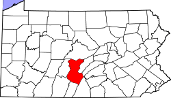 | |
| Townships | ||
| CDPs | ||
| Unincorporated communities | ||