Miles Township, Centre County, Pennsylvania
| Miles Township, Pennsylvania | |
|---|---|
| Township | |
|
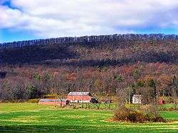
A farm in Miles Township | |
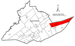 Map of Centre County, Pennsylvania highlighting Miles Township | |
 Map of Centre County, Pennsylvania | |
| Country | United States |
| State | Pennsylvania |
| County | Centre |
| Settled | 1791 |
| Incorporated | 1797 |
| Area | |
| • Total | 62.5 sq mi (162.0 km2) |
| • Land | 62.5 sq mi (162.0 km2) |
| • Water | 0.0 sq mi (0.0 km2) |
| Population (2010) | |
| • Total | 1,983 |
| • Density | 32/sq mi (12.2/km2) |
| Time zone | EST (UTC-5) |
| • Summer (DST) | EDT (UTC-4) |
Miles Township is a township in Centre County, Pennsylvania, United States. It is part of the State College, Pennsylvania Metropolitan Statistical Area. The population was 1,983 at the 2010 census,[1] up from 1,573 at the 2000 census. Miles Township and nearby Milesburg were named after Colonel Samuel Miles, who co-owned the Centre Furnace, along with Colonel John Patton.
History
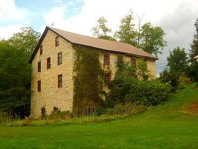
Centre Mills, Simon Pickle Stone House, and the Rebersburg Historic District are listed on the National Register of Historic Places.[2]

Geography
According to the United States Census Bureau, the township has a total area of 62.5 square miles (162.0 km2), all of it land.[1]
Miles Township is bordered by Clinton County to the north, Union County to the east, Haines and Penn townships to the south, Gregg Township to the west, and Walker Township to the northwest. It is part of the Penns Valley region of Centre County, bordered by the long ridges of Shriner Mountain to the south and Nittany Mountain to the north.
Recreation
Miles Township is home to McCalls Dam State Park. The park is in a remote location on a dirt road between R. B. Winter State Park on Pennsylvania Route 192 and Eastville on Pennsylvania Route 880. In the winter months the park can only be accessed by snowmobiling or cross-country skiing.[3]
McCalls Dam State Park has a small camping area and a small picnic area with a few tables and charcoal grills. There are no modern restroom facilities at the park, and visitors are asked to carry out all trash as there is no trash pick up at the park.[3]
The park is named for the splash dam that Johnny McCall built on White Deer Creek in 1850. He used the waters that flowed from the dam to power a sawmill. Sixteen years later the dam was rebuilt to provide water for a series of splash dams that were used to float white pine logs to the sawmills on the West Branch Susquehanna River at Watsontown. The park's facilities were originally constructed by the Civilian Conservation Corps in the 1933. The mill and dam are long since gone, but they are remembered along with Johnny McCall in the name of McCalls Dam State Park.[3]
Demographics

As of the census[4] of 2000, there were 1,573 people, 526 households, and 419 families residing in the township. The population density was 25.1 people per square mile (9.7/km²). There were 693 housing units at an average density of 11.0/sq mi (4.3/km²). The racial makeup of the township was 98.66% White, 0.70% African American, 0.19% Native American, 0.13% Asian, and 0.32% from two or more races. Hispanic or Latino of any race were 0.13% of the population.
There were 526 households, out of which 36.7% had children under the age of 18 living with them, 71.3% were married couples living together, 6.3% had a female householder with no husband present, and 20.2% were non-families. 17.7% of all households were made up of individuals, and 9.1% had someone living alone who was 65 years of age or older. The average household size was 2.96 and the average family size was 3.40.
In the township the population was spread out, with 32.5% under the age of 18, 8.2% from 18 to 24, 24.7% from 25 to 44, 21.7% from 45 to 64, and 12.9% who were 65 years of age or older. The median age was 33 years. For every 100 females there were 94.2 males. For every 100 females age 18 and over, there were 97.8 males.
The median income for a household in the township was $33,074, and the median income for a family was $36,063. Males had a median income of $24,205 versus $23,500 for females. The per capita income for the township was $13,180. About 9.4% of families and 15.0% of the population were below the poverty line, including 24.5% of those under age 18 and 7.9% of those age 65 or over.
References
- 1 2 "Geographic Identifiers: 2010 Census Summary File 1 (G001): Miles township, Centre County, Pennsylvania". U.S. Census Bureau, American Factfinder. Retrieved April 10, 2015.
- ↑ National Park Service (2010-07-09). "National Register Information System". National Register of Historic Places. National Park Service.
- 1 2 3 "McCalls Dam State Park". Pennsylvania Department of Conservation and Natural Resources. Retrieved 2009-11-03.
- ↑ "American FactFinder". United States Census Bureau. Retrieved 2008-01-31.
External links
Coordinates: 40°56′00″N 77°30′59″W / 40.93333°N 77.51639°W