Midland Provincial Park
| Midland Provincial Park | |
|---|---|
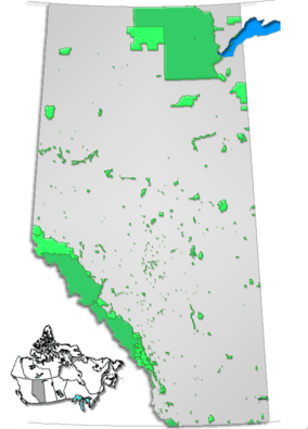 Location of Midland Provincial Park in Alberta | |
| Location | Drumheller / Starland County, Alberta, Canada |
| Nearest city | Drumheller |
| Coordinates | 51°28′41″N 112°46′20″W / 51.47806°N 112.77222°WCoordinates: 51°28′41″N 112°46′20″W / 51.47806°N 112.77222°W |
| Area | 6.3 km² |
| Established | 5 Jun 1979 |
| Governing body | Alberta Tourism, Parks and Recreation |
Midland Provincial Park is a provincial park located in Alberta, Canada.
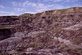
Badlands in Midland Provincial Park
Once the site of the Midland Coal Mine, it was designated as a provincial park on June 5, 1979. It now hosts the Royal Tyrrell Museum of Palaeontology. The Midland Coal Mine was the site of a large mining disaster in the mid-1920s, many men lost their lives in a mine explosion.
It is located 6 km west of Drumheller on Highway 838 (North Dinosaur Trail).
Activities in the park include canoeing, kayaking, fishing, wildlife viewing and hiking through willows and cottonwoods along the Red Deer River. Points of interest are fossil beds, a mine site and the Royal Tyrrell Museum of Palaeontology.
See also
External links
- Park page at Alberta Development
- Virtual tour
- Drumheller Mining History
- The Dangers of Coal Mining in Drumheller
This article is issued from Wikipedia - version of the 11/19/2016. The text is available under the Creative Commons Attribution/Share Alike but additional terms may apply for the media files.