Mid-City New Orleans
| Mid-City | |
| New Orleans neighborhood | |
 Canal Streetcar in Mid-City | |
| Country | United States |
|---|---|
| State | Louisiana |
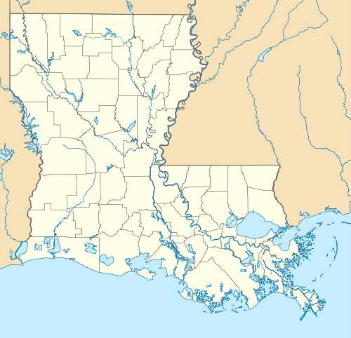
| City | New Orleans |
| Planning District | District 4, Mid-City District |
| Elevation | 0 ft (0.0 m) |
| Coordinates | 29°58′19″N 90°05′49″W / 29.97194°N 90.09694°WCoordinates: 29°58′19″N 90°05′49″W / 29.97194°N 90.09694°W |
| Area | 1.66 sq mi (4.3 km2) |
| - land | 1.66 sq mi (4 km2) |
| - water | 0.00 sq mi (0 km2), 0% |
| Population | 6,217 (2010) |
| Density | 3,745/sq mi (1,446/km2) |
| Timezone | CST (UTC-6) |
| - summer (DST) | CDT (UTC-5) |
| Area code | 504 |
| Website: | |
|
Mid-City Historic District | |
  | |
| Location | Roughly bounded by Derbigny St., Conti St., City Park Ave. and I-10, New Orleans, Louisiana |
| Area | 850 acres (340 ha) |
| Architect | Multiple |
| Architectural style | Bungalow/Craftsman, Colonial Revival, Italianate |
| NRHP Reference # | 93001394[1] |
| Added to NRHP | December 10, 1993 |
Mid-City is a neighborhood of the city of New Orleans. A sub-district of the Mid-City District Area, its boundaries as defined by the City Planning Commission are: City Park Avenue, Toulouse Street, North Carrollton, Orleans Avenue, Bayou St. John and St. Louis Street to the north, North Broad Street to the east, and the Pontchartrain Expressway to the west. It is a historic district on the National Register of Historic Places.[2] In common usage, a somewhat larger area surrounding these borders is often also referred to as part of Mid-City.
Geography
Mid-City is located at 29°58′19″N 90°05′49″W / 29.97194°N 90.09694°W [3] and has an elevation of 0 feet (0.0 m).[4] According to the United States Census Bureau, the district has a total area of 1.66 square miles (4.3 km2). 1.66 square miles (4.3 km2) of which is land and 0.00 square miles (0.0 km2) (0.0%) of which is water.
Mid-City is located, as the name indicates, in the middle of New Orleans on what was once the backslope of the Mississippi River natural levee, a gradually declining section of the river's flood plain. As such, it was not settled as early as adjacent neighborhoods and was called the "back of town"—the city ended at the swamp, unlike today, when the city reaches the lake. The Esplanade Ridge and the adjoining Metairie Ridge formed a natural spur from the River; but what is now Mid-City, surrounded by these higher-elevated sections, was part of the "backswamp" until development in the late nineteenth and early twentieth centuries.[2][5]
Adjacent neighborhoods
- Navarre (north)
- City Park (north)
- Bayou St. John (north)
- Tulane/Gravier (east)
- Gert Town (south)
- Dixon (west)
- Lakewood (west)
Boundaries
The City Planning Commission defines the boundaries of Mid-City as these streets: City Park Avenue, Toulouse Street, North Carrollton Avenue, Orleans Avenues, Bayou St. John, St. Louis Street, North Broad Street and the Pontchartrain Expressway.[6]
Demographics
As of the census of 2000, there were 19,909 people, 5,830 households, and 2,939 families residing in the neighborhood.[7] The population density was 11,993 /mi² (4,630 /km²).
As of the census of 2010, there were 14,633 people, 5,258 households, and 2,318 families residing in the neighborhood.[7]
Landmarks
Mid-City is the home of a number of city landmarks. Canal Street, one of the most important thoroughfares of the city, bisects the neighborhood down the middle; the streetcar route follows Canal to Carrollton Avenue, another prominent New Orleans street that passes through Mid-City. Tulane Avenue, which is the terminus of U.S. Route 61, also runs just upriver from Canal Street; before the interstate highway system, this was the primary route into New Orleans from Baton Rouge. An important cross-street is Jefferson Davis Parkway, named for the president of the Confederate States of America, who died in New Orleans's Garden District during an 1889 visit.
The Orleans Parish Criminal Court, the Dixie Brewery, Jesuit High School, Warren Easton High School, and the Falstaff Brewery (now converted to apartments) are physically among the most prominent buildings scattered across Mid-City, in addition to a number of churches and large houses along Canal Street. Tulane Avenue in particular shows some remnants of the area's industrial past. However, more characteristic of Mid-City today are the many shotgun houses and larger houses that make up most of this primarily residential neighborhood.
Culture
Mid-City is a generally local, middle-class neighborhood in that it contains fewer tourist destinations than other parts of the city. Restaurants and bars rely heavily on local clientele, giving the area a quirky local flavor.
In the period before Hurricane Katrina on New Year's Eve, residents of Mid-City placed their Christmas trees in an area in Orleans Avenue and created a bonfire with the trees. They then threw fireworks into the bonfire. Joanna Weiss of the Boston Globe said "A fire truck waited down the street, almost as an afterthought."[8]
Hurricane Katrina
- Main article: Effects of Hurricane Katrina in New Orleans
Mid-City experienced extensive flooding in the aftermath of Hurricane Katrina and has been involved in an ongoing rebuilding effort. Repopulation and reconstruction are concentrated along major thoroughfares; March 2007 estimates were that 55% of the residents were again living in the area.[5]
Education
New Orleans Public Schools and Recovery School District operate the public school system.
Warren Easton Senior High School is in Mid-City.[9]
New Orleans Public Library operates the Mid-City Branch.[10]
See also
References
- ↑ National Park Service (2009-03-13). "National Register Information System". National Register of Historic Places. National Park Service.
- 1 2 Campanella, Richard. Time and Place in New Orleans: Past Geographies in the Present Day. Gretna, Louisiana: Pelican Publishing Company, 2002. ISBN 1-56554-991-0
- ↑ "US Gazetteer files: 2010, 2000, and 1990". United States Census Bureau. 2011-02-12. Retrieved 2011-04-23.
- ↑ "US Board on Geographic Names". United States Geological Survey. 2007-10-25. Retrieved 2008-01-31.
- 1 2 Neighborhood organization's statistics
- ↑ Greater New Orleans Community Data Center. "Mid-City Neighborhood". Retrieved 2008-06-21.
- 1 2 "Mid-City Neighborhood". Greater New Orleans Community Data Center. Retrieved 6 January 2012.
- ↑ Weiss, Joanna. "After the flood The city that was." Boston Globe. September 4, 2005. Ideas E1. Retrieved on March 18, 2013. Available at HighBeam. Alternate pay link. "Every New Year's Eve in the Mid- City neighborhood, residents would drag their Christmas trees to the Orleans Avenue neutral ground and start a giant bonfire, then throw fireworks into the flames. A fire truck waited down the street, almost as an afterthought."
- ↑ Young, Tara. "Student's death sparks crescendo of revenge." The Times-Picayune. Wednesday February 11, 2004. Retrieved on January 7, 2009.
- ↑ Branch Libraries." New Orleans Public Library. Retrieved on March 31, 2013.
External links
| Wikivoyage has a travel guide for Mid-City and Esplanade Ridge. |
| Wikimedia Commons has media related to Mid-City New Orleans. |
| Topics | |
|---|---|
| Lists by states |
|
| Lists by insular areas | |
| Lists by associated states | |
| Other areas | |
| |