Mexican Federal Highway 15
| ||||
|---|---|---|---|---|
| Carretera Federal 15 | ||||
|
Mexico 15 International Highway Mexico-Nogales Highway | ||||
| Route information | ||||
| Maintained by Secretariat of Communications and Transportation | ||||
| Length: | 2,363.51 km[1][2][3][4][5] (1,468.62 mi) | |||
| Major junctions | ||||
| South end: | Carratera Toluca in Mexico City | |||
| North end: |
| |||
| Highway system | ||||
|
Mexican Federal Highways
| ||||

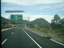
Federal Highway 15, Mexico 15 International Highway or Mexico-Nogales Highway is a primary north-south highway in Mexico. The highway begins in the north at the Mexico–United States border at the Nogales Port of Entry in Nogales, Sonora, and terminates to the south in Mexico City. Many stretches of Federal Highway 15 from Nogales to Mazatlán are split into two routes: a free and a toll road (FH 15D); the portion of this northern stretch from the town of Eldorado southward within the state of Sinaloa is a limited-access highway.[6] North of the U.S.-Mexico border, the highway continues to the north from the Port of Entry, as I-19 Business.
The highway is the southern terminus of the CANAMEX Corridor, a trade corridor that stretches from Mexico north across the United States to the Canadian province of Alberta.
Major cities along the route
- Nogales, Sonora
- Hermosillo, Sonora
- Guaymas, Sonora
- Ciudad Obregón, Sonora
- Navojoa, Sonora
- Los Mochis, Sinaloa
- Guasave, Sinaloa
- Guamúchil, Sinaloa
- Culiacán, Sinaloa
- Mazatlán, Sinaloa
- Tepic, Nayarit
- Guadalajara, Jalisco
- Morelia, Michoacán
- Toluca, State of Mexico
- Mexico City
References
- ↑ "Datos Viales de Jalisco" (PDF) (in Spanish). Dirección General de Servicios Técnicos, Secretaría de Comunicaciones y Transportes. 2011. pp. 7, 10. Retrieved 2012-03-18.
- ↑ "Datos Viales de México" (PDF) (in Spanish). Dirección General de Servicios Técnicos, Secretaría de Comunicaciones y Transportes. 2011. p. 7. Retrieved 2012-03-18.
- ↑ "Datos Viales de Michoacán" (PDF) (in Spanish). Dirección General de Servicios Técnicos, Secretaría de Comunicaciones y Transportes. 2011. pp. 9, 13. Retrieved 2012-03-18.
- ↑ "Datos Viales de Sinaloa" (PDF) (in Spanish). Dirección General de Servicios Técnicos, Secretaría de Comunicaciones y Transportes. 2011. pp. 1, 5, 7. Retrieved 2012-03-18.
- ↑ "Datos Viales de Sonora" (PDF) (in Spanish). Dirección General de Servicios Técnicos, Secretaría de Comunicaciones y Transportes. 2011. pp. 8, 12, 14. Retrieved 2012-03-18.
- ↑ "Rand McNally Road Atlas", Rand McNally & Company, 1998, p. 120
| Highways |
|
|---|---|
| Toll roads | |