Mespaul
| Mespaul Mespaol | |
|---|---|
|
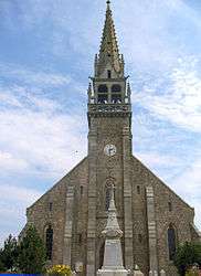
The church in Mespaul | |
 Mespaul | |
|
Location within Brittany region  Mespaul | |
| Coordinates: 48°37′09″N 4°01′25″W / 48.6192°N 4.0236°WCoordinates: 48°37′09″N 4°01′25″W / 48.6192°N 4.0236°W | |
| Country | France |
| Region | Brittany |
| Department | Finistère |
| Arrondissement | Morlaix |
| Canton | Saint-Pol-de-Léon |
| Intercommunality | Pays Léonard |
| Government | |
| • Mayor (2014–2020) | Bernard Floc'h |
| Area1 | 11.48 km2 (4.43 sq mi) |
| Population (2008)2 | 881 |
| • Density | 77/km2 (200/sq mi) |
| Time zone | CET (UTC+1) |
| • Summer (DST) | CEST (UTC+2) |
| INSEE/Postal code | 29148 / 29420 |
| Elevation | 22–93 m (72–305 ft) |
|
1 French Land Register data, which excludes lakes, ponds, glaciers > 1 km² (0.386 sq mi or 247 acres) and river estuaries. 2 Population without double counting: residents of multiple communes (e.g., students and military personnel) only counted once. | |
Mespaul (Breton: Mespaol) is a commune in the Finistère department of Brittany in north-western France.
Population
Inhabitants of Mespaul are called in French Mespaulitains.
| Historical population | ||
|---|---|---|
| Year | Pop. | ±% |
| 1968 | 937 | — |
| 1975 | 814 | −13.1% |
| 1982 | 779 | −4.3% |
| 1990 | 797 | +2.3% |
| 1999 | 739 | −7.3% |
| 2008 | 881 | +19.2% |
See also
References
- Mayors of Finistère Association (French)
External links
| Wikimedia Commons has media related to Mespaul. |
This article is issued from Wikipedia - version of the 2/23/2015. The text is available under the Creative Commons Attribution/Share Alike but additional terms may apply for the media files.