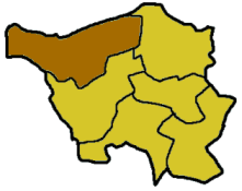
Merzig-Wadern
| Merzig-Wadern | |
|---|---|
| District | |
 | |
| Country |
|
| State | Saarland |
| Capital | Merzig |
| Area | |
| • Total | 555.00 km2 (214.29 sq mi) |
| Population (31 December 2015)[1] | |
| • Total | 103,997 |
| • Density | 190/km2 (490/sq mi) |
| Time zone | CET (UTC+1) |
| • Summer (DST) | CEST (UTC+2) |
| Vehicle registration |
MZG (since 1957) OE 2/ OE 12/ OE 22/ OE 32 (1949–1956); SA 02 (1945–1949) |
| Website | landkreis-merzig-wadern.de |
Merzig-Wadern is a Kreis (district) in the northwest of the Saarland, Germany. Neighboring districts are Trier-Saarburg, Sankt Wendel, Saarlouis, and the French département Moselle, and Luxembourg.
History
The district was created in 1816 when the area became property of Prussia. After World War I the Saar area was under special government of the League of Nations, which split the district into two. The area around Wadern stayed Prussian, while the Merzig area became part of the Saar area. In 1935, the Saar area rejoined Germany; however, it took till after the World War II that the two parts of the district were reunited in 1946.
Geography
The Saar River flows through the district, the Moselle River forms the boundary in the west to Luxembourg.
Coat of arms
 |
The coat of arms show the symbols of those countries which had possessions in the district's area. The top-left show the cross of Trier, the top-right those of Lorraine. The wolf hook in the bottom-left represents Dagstuhl, which owned Wadern; the lion in the bottom-right stands for Luxembourg, which owned the western part of the district. |
Towns and municipalities
| Towns | Municipalities |
|---|---|
References
- ↑ "Fläche und Bevölkerung - Stand: 31.12.2015 (Basis Zensus 2011)" (PDF). Statistisches Amt des Saarlandes (in German). July 2016.
External links
![]() Media related to Landkreis Merzig-Wadern at Wikimedia Commons
Media related to Landkreis Merzig-Wadern at Wikimedia Commons
- Official website (German)
Coordinates: 49°30′N 6°45′E / 49.5°N 6.75°E