Mercersburg, Pennsylvania
| Mercersburg, Pennsylvania | |
|---|---|
| Borough | |
|
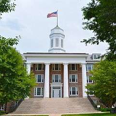
Mercersburg Borough Hall | |
 Mercersburg  Mercersburg | |
| Coordinates: 39°49′46″N 77°54′07″W / 39.82944°N 77.90194°WCoordinates: 39°49′46″N 77°54′07″W / 39.82944°N 77.90194°W | |
| Country | United States |
| State | Pennsylvania |
| County | Franklin |
| Government | |
| • Type | Borough Council |
| • Mayor | James Zeger |
| Area | |
| • Total | 0.9 sq mi (2.3 km2) |
| • Land | 0.9 sq mi (2.3 km2) |
| • Water | 0.0 sq mi (0.0 km2) |
| Elevation | 558 ft (170 m) |
| Population (2010) | |
| • Total | 1,561 |
| • Density | 1,731/sq mi (668.2/km2) |
| Time zone | Eastern (EST) (UTC-5) |
| • Summer (DST) | EDT (UTC-4) |
| ZIP code | 17236 |
| Area code(s) | 717 |
| Website |
www |

Mercersburg is a borough in Franklin County, Pennsylvania, United States. It is 72 miles (116 km) southwest of Harrisburg, the state capital. Originally called "Black Town", it was incorporated in 1831. In 1900, 956 people lived here, and in 1910, 1,410 people lived here. The population was 1,561 at the 2010 census.[1]
History
The borough was named after Hugh Mercer, a general in the American Revolutionary War.[2]
The Mercersburg Historic District, Lane House, and Mercersburg Academy are listed on the National Register of Historic Places.[3]
Geography
Mercersburg is located in southwestern Franklin County at 39°49′46″N 77°54′7″W / 39.82944°N 77.90194°W (39.829388, -77.901952).[4] According to the United States Census Bureau, the borough has a total area of 0.89 square miles (2.3 km2), all of it land.[1]
Mercersburg is located at the eastern foot of Cove Mountain on the west side of the Great Appalachian Valley. The borough is 7.5 miles (12.1 km) north of the Mason–Dixon line, which serves as the state border with Maryland. Whitetail Ski Resort is located 7 miles (11 km) south of the town.
Pennsylvania state highways 16, 75, and 416 all pass through Mercersburg. PA 16 leads east 10 miles (16 km) to Greencastle and 11 miles (18 km) to Interstate 81, and northwest through Cove Gap and over Tuscarora Mountain 10 miles to McConnellsburg. PA 75 leads north 6 miles (10 km) to Fort Loudon and south 7.5 miles (12.1 km) to the Maryland border. PA 416 leads northeast 7 miles (11 km) to U.S. Route 30 near St. Thomas and southeast 10 miles (16 km) to the Maryland border. Hagerstown, Maryland, is 17 miles (27 km) to the southeast via PA 416 and Maryland Route 58, while Chambersburg, the Franklin County seat, is 16 miles (26 km) to the northeast via PA 416 and US 30.
Demographics
| Historical population | |||
|---|---|---|---|
| Census | Pop. | %± | |
| 1840 | 1,143 | — | |
| 1850 | 1,179 | 3.1% | |
| 1860 | 897 | −23.9% | |
| 1870 | 971 | 8.2% | |
| 1880 | 970 | −0.1% | |
| 1890 | 967 | −0.3% | |
| 1900 | 956 | −1.1% | |
| 1910 | 1,410 | 47.5% | |
| 1920 | 1,663 | 17.9% | |
| 1930 | 1,634 | −1.7% | |
| 1940 | 1,763 | 7.9% | |
| 1950 | 1,613 | −8.5% | |
| 1960 | 1,759 | 9.1% | |
| 1970 | 1,727 | −1.8% | |
| 1980 | 1,617 | −6.4% | |
| 1990 | 1,640 | 1.4% | |
| 2000 | 1,540 | −6.1% | |
| 2010 | 1,561 | 1.4% | |
| Est. 2015 | 1,558 | [5] | −0.2% |
| Sources:[6][7][8] | |||
As of the census[7] of 2000, there were 1,540 people, 686 households, and 439 families residing in the borough. The population density was 1,581.0 people per square mile (613.0/km²). There were 770 housing units at an average density of 790.5 per square mile (306.5/km²). The racial makeup of the borough was 92.08% White, 6.49% African American, 0.58% Asian, 0.52% from other races, and 0.32% from two or more races. Hispanic or Latino of any race were 1.36% of the population.
There were 686 households, out of which 30.8% had children under the age of 18 living with them, 48.8% were married couples living together, 11.2% had a female householder with no husband present, and 36.0% were non-families. 32.4% of all households were made up of individuals, and 14.7% had someone living alone who was 65 years of age or older. The average household size was 2.24 and the average family size was 2.80.
In the borough the population was spread out, with 23.6% under the age of 18, 6.5% from 18 to 24, 29.7% from 25 to 44, 22.7% from 45 to 64, and 17.4% who were 65 years of age or older. The median age was 39 years. For every 100 females there were 88.3 males. For every 100 females age 18 and over, there were 88.8 males.
The median income for a household in the borough was $32,619, and the median income for a family was $46,042. Males had a median income of $30,602 versus $23,000 for females. The per capita income for the borough was $18,934. About 7.2% of families and 8.6% of the population were below the poverty line, including 7.5% of those under age 18 and 10.2% of those age 65 or over.
Education
Tuscarora School District
The Tuscarora School District covers an area of 201 square miles (520 km2), stretching north-south from just south of 40 degrees north latitude to the Maryland border and from east of the 78 degree west longitude line to just west of Chambersburg. The district is located within the borders of Franklin County in south-central Pennsylvania and includes the borough of Mercersburg and Montgomery, Peters, St. Thomas and Warren townships. The school district is primarily a rural agricultural area with a total population of approximately 17,000 people. The district consists of four K-5 elementary schools (Saint Thomas, Mountain View, Mercersburg, Montgomery), one grade 6-8 middle school (James Buchanan MS) and one grade 9-12 high school (James Buchanan High School). Tuscarora, the name of the mountain on the western boundary, is derived from the Tuscarora people of the Iroquois Confederation. The Tuscarora came north from the Carolinas about 1713 and settled for a time along the mountains. The name "Tuscarora" comes from the native name Skaruron, or "hemp gatherers". "Conococheague", the name of the creek that flows through the district on its way from the Path Valley south to the Potomac River, is a name from the Delaware people meaning "clear water".
Mercersburg Academy
Mercersburg Academy is an independent college preparatory school that was founded in 1893. It has produced several Rhodes scholars, three Medal of Honor recipients, a Nobel laureate, two Academy Award winners, and 54 Olympians (including 12 gold medalists). Its campus, located east of the square in downtown Mercersburg, spans 300 acres (120 ha) and is home to 430 students (grades 9-12) from 26 states and 40 nations.

Marshall College
Marshall College was a college founded in Mercersburg in 1836. It later merged with Franklin College, in Lancaster County, and produced the so-called Mercersburg Theology.
Notable people

- James Buchanan, the only Pennsylvanian to be elected President of the United States, was born in a log cabin in the village of Cove Gap northwest of Mercersburg and grew up in the town. His log cabin today stands on the Mercersburg Academy campus near the athletics building.
- William Findlay, governor of Pennsylvania from 1817 to 1820 and U.S. senator from Pennsylvania from 1821 to 1827, was born in Mercersburg.
- Harriet Lane (1830–1903), niece of James Buchanan, was born at Mercersburg in the Lane House.
- James S. McCullough (1843-1914), Illinois state auditor, was born in Mercersburg.
- Thomas Bard McFarland (1828–1908), associate justice of the Supreme Court of California
- Blanche Nevin (1841–1925), sculptor and daughter of John Williamson Nevin
- John Williamson Nevin (1803–1886), physician
Academy Award–winning actors Jimmy Stewart and Benicio del Toro each attended Mercersburg Academy, as well as John Hamilton, who played Perry White on Adventures of Superman TV series, and Vanessa Branch, the actress best known for Orbit Gum commercials.
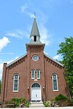 First Methodist Episcopal Church
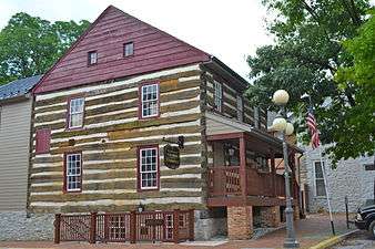 Irwin House on Main and Seminary streets
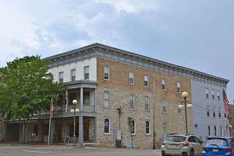 Mansion House
References
- 1 2 "Geographic Identifiers: 2010 Census Summary File 1 (G001), Mercersburg borough, Pennsylvania". American FactFinder. U.S. Census Bureau. Retrieved July 29, 2016.
- ↑ Gannett, Henry (1905). The Origin of Certain Place Names in the United States. U.S. Government Printing Office. p. 205.
- ↑ National Park Service (2010-07-09). "National Register Information System". National Register of Historic Places. National Park Service.
- ↑ "US Gazetteer files: 2010, 2000, and 1990". United States Census Bureau. 2011-02-12. Retrieved 2011-04-23.
- ↑ "Annual Estimates of the Resident Population for Incorporated Places: April 1, 2010 to July 1, 2015". Retrieved July 2, 2016.
- ↑ "Census of Population and Housing". U.S. Census Bureau. Retrieved 11 December 2013.
- 1 2 "American FactFinder". United States Census Bureau. Retrieved 2008-01-31.
- ↑ "Incorporated Places and Minor Civil Divisions Datasets: Subcounty Resident Population Estimates: April 1, 2010 to July 1, 2012". Population Estimates. U.S. Census Bureau. Retrieved 11 December 2013.
External links
- Borough of Mercersburg official website
- Mercersburg Area Chamber of Commerce
- Tuscarora School District
- Mercersburg Academy
Municipalities and communities of Franklin County, Pennsylvania, United States | ||
|---|---|---|
| Boroughs | 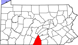 | |
| Townships | ||
| CDPs | ||
| Unincorporated communities | ||
| Footnotes | ‡This populated place also has portions in an adjacent county or counties | |