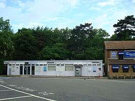
Meopham railway station
| Meopham | |
|---|---|
 | |
| Location | |
| Place | Meopham |
| Local authority | Borough of Gravesham |
| Grid reference | TQ640678 |
| Operations | |
| Station code | MEP |
| Managed by | Southeastern |
| Number of platforms | 2 |
| DfT category | D |
|
Live arrivals/departures, station information and onward connections from National Rail Enquiries | |
| Annual rail passenger usage* | |
| 2008/09 |
|
| 2009/10 |
|
| 2010/11 |
|
| 2011/12 |
|
| 2012/13 |
|
| History | |
| Original company | London, Chatham and Dover Railway |
| Pre-grouping | South Eastern and Chatham Railway |
| Post-grouping | Southern Railway |
| 3 December 1860 | Line opened |
| 6 May 1861 | Station opened |
| National Rail – UK railway stations | |
| * Annual estimated passenger usage based on sales of tickets in stated financial year(s) which end or originate at Meopham from Office of Rail and Road statistics. Methodology may vary year on year. | |
|
| |
Meopham railway station is on the Chatham Main Line, and serves the village of Meopham in north Kent. Train services are provided by Southeastern.
Meopham Station is 25 miles and 1,606 yards (25.9 miles (41.7 km)) from London Victoria, according to the mileage sign on the footbridge. The extant station building is a prefabricated building erected in 1971 to British Rail's CLASP design.[1]
History
The main line of the London, Chatham and Dover Railway was opened in stages. The section between Rochester Bridge (then named Strood) and Bickley was opened on 3 December 1860;[2] but the station at Meopham opened later, on 6 May 1861.[3][4]
Service
The typical Monday to Saturday off-peak service is
- 3 tph to London Victoria
- 2 tph to Dover Priory
- 1 tph to Ramsgate.
The typical Sunday service from the station is
- 1 tph to London Victoria via Bromley South
- 1 tph to Canterbury East.
| Preceding station | |
Following station | ||
|---|---|---|---|---|
| Longfield | Southeastern Chatham Main Line |
Sole Street or Rochester | ||
References
- ↑ "Meopham". Kent Rail website. David Glasspool. 2009. Retrieved 2009-10-24.
- ↑ Dendy Marshall, C.F.; Kidner, R.W. (1963) [1937]. History of the Southern Railway (2nd ed.). Shepperton: Ian Allan. pp. 327, 502. ISBN 0-7110-0059-X.
- ↑ Dendy Marshall & Kidner 1963, p. 524
- ↑ Butt, R.V.J. (1995). The Directory of Railway Stations. Yeovil: Patrick Stephens Ltd. p. 158. ISBN 1-85260-508-1. R508.
External links
- Train times and station information for Meopham railway station from National Rail
Coordinates: 51°23′11.07″N 0°21′25.19″E / 51.3864083°N 0.3569972°E