Menghai County
| Menghai County | |
|---|---|
| County | |
| Chinese transcription(s) | |
| • Characters | 勐海县 |
| • Pinyin | Měnghǎi Xiàn |
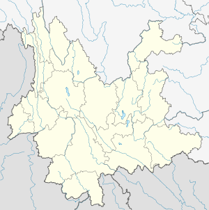
.png) Location of Menghai County (pink) and Xishuangbanna Prefecture (yellow) within Yunnan province of China | |
 Menghai County Location in Yunnan, China | |
| Coordinates: 21°58′N 100°28′E / 21.967°N 100.467°E | |
| Country | China |
| Province | Yunnan |
| Prefecture | Xishuangbanna |
| GB/T 2260 CODE[1] | 532822 |
| Area | |
| • Total | 5,511 km2 (2,128 sq mi) |
| Population | |
| • Total | 292,383 |
| • Density | 53/km2 (140/sq mi) |
| Time zone | China Standard Time (UTC+8) |
| Postal code | 666200[2] |
| Area code(s) | 0691[2] |
| Climate | Cwa |
| Website | http://www.mhfgj.gov.cn/ |
|
1Yunnan Statistics Bureau 2Xishuangbanna Gov. 3Yunnan Portal | |
Menghai County (勐海县; pinyin: Měnghǎi Xiàn) (Thai: เมิ้งฮาย, เมืองฮาย) is a county under the jurisdiction of Xishuangbanna Dai Autonomous Prefecture, Yunnan province, China. Meng is as variation of Mueang.
Ethnic groups
In and around Menghai County, ethnic Hani subgroups include:[3]
- Jiuwei 鸠为 (Dai exonym: Buli 布里; large population): villages include Nanzhong 南中寨 of Mengjing 勐景,[4] Longnapa 笼那帕寨 of Damenglong 大勐笼, and Baiya 拜牙村 Menggun 勐滚, Menghai County 勐海县
- Jizuo 吉坐 (small population): villages include Mengbozhai 勐波寨[5] of Menghan 勐罕村
- Muda 木达 (also locally known as the Nanlin 南林)
Transport
- Nearest airport is Xishuangbanna Gasa
- China National Highway 214
- Asian Highway Network AH3 (alternative route)
Tea
References
- ↑ http://www.stats.gov.cn/tjbz/xzqhdm/index.htm
- 1 2 Area Code and Postal Code in Yunnan Province
- ↑ 中国少数民族社会历史调查资料丛刊》修订编辑委员会. 2009. 哈尼族社会历史调查, p.102-120 Beijing: Minzu Chubanshe.
- ↑ http://www.ynszxc.gov.cn/villagePage/vIndex.aspx?departmentid=226405
- ↑ http://www.ynszxc.gov.cn/villagePage/vIndex.aspx?departmentid=228695
Further reading
- Jacobs, Andrew. EMBARGO: In once-booming tea region, a bitter reality. International Herald Tribune. (2009-01-09)
External links
Coordinates: 21°58′00″N 100°28′00″E / 21.9667°N 100.4667°E
This article is issued from Wikipedia - version of the 6/26/2016. The text is available under the Creative Commons Attribution/Share Alike but additional terms may apply for the media files.