Mendota Heights, Minnesota
| Mendota Heights, Minnesota | |
|---|---|
| City | |
| Motto: "Between St.Paul And Minneapolis The Best Kept Secret" | |
 Location of the city of Mendota Heights within Dakota County, Minnesota | |
| Coordinates: 44°53′13″N 93°8′6″W / 44.88694°N 93.13500°W | |
| Country | United States |
| State | Minnesota |
| County | Dakota |
| Area[1] | |
| • Total | 10.12 sq mi (26.21 km2) |
| • Land | 9.15 sq mi (23.70 km2) |
| • Water | 0.97 sq mi (2.51 km2) |
| Elevation | 912 ft (278 m) |
| Population (2010)[2] | |
| • Total | 11,071 |
| • Estimate (2012[3]) | 11,138 |
| • Density | 1,209.9/sq mi (467.1/km2) |
| Time zone | Central (CST) (UTC−6) |
| • Summer (DST) | CDT (UTC−5) |
| ZIP codes | 55118, 55120 |
| Area code | 651 |
| FIPS code | 27-41696[4] |
| GNIS feature ID | 0647763[5] |
| Website | www.mendota-heights.com |
Mendota Heights is an affluent city in Dakota County, Minnesota, United States. It is a first ring southern suburb of the Twin Cities. The population was 11,071 at the 2010 census.[6] Mendota Heights is listed among the highest-income places in the United States.
Geography
According to the United States Census Bureau, the city has a total area of 10.12 square miles (26.21 km2), of which 9.15 square miles (23.70 km2) is land and 0.97 square miles (2.51 km2) is water.[1]
Interstate Highway 35E, Interstate Highway 494, Minnesota Highways 55 and 110 are four of the main routes near the town.
Demographics
| Historical population | |||
|---|---|---|---|
| Census | Pop. | %± | |
| 1960 | 5,028 | — | |
| 1970 | 6,565 | 30.6% | |
| 1980 | 7,288 | 11.0% | |
| 1990 | 9,431 | 29.4% | |
| 2000 | 11,434 | 21.2% | |
| 2010 | 11,071 | −3.2% | |
| Est. 2015 | 11,223 | [7] | 1.4% |
2010 census
As of the census[2] of 2010, there were 11,071 people, 4,378 households, and 3,204 families residing in the city. The population density was 1,209.9 inhabitants per square mile (467.1/km2). There were 4,620 housing units at an average density of 504.9 per square mile (194.9/km2). The racial makeup of the city was 93.8% White, 1.5% African American, 0.2% Native American, 2.2% Asian, 0.6% from other races, and 1.8% from two or more races. Hispanic or Latino of any race were 2.9% of the population.
There were 4,378 households of which 29.1% had children under the age of 18 living with them, 64.4% were married couples living together, 6.4% had a female householder with no husband present, 2.3% had a male householder with no wife present, and 26.8% were non-families. 22.3% of all households were made up of individuals and 10.8% had someone living alone who was 65 years of age or older. The average household size was 2.51 and the average family size was 2.96.
The median age in the city was 47.5 years. 22.6% of residents were under the age of 18; 6.4% were between the ages of 18 and 24; 16.9% were from 25 to 44; 36.3% were from 45 to 64; and 17.7% were 65 years of age or older. The gender makeup of the city was 48.3% male and 51.7% female.
2000 census
At the 2000 census,[4] there were 11,434 people, 4,178 households and 3,237 families residing in the town. The population density was 1,222.2 per square mile (471.7/km²). There were 4,252 housing units at an average density of 454.5 per square mile (175.4/km²). The racial makeup of the town was 95.66% White, 0.88% African American, 0.17% Native American, 1.78% Asian, 0.46% from other races, and 1.04% from two or more races. Hispanic or Latino of any race were 1.78% of the population.
There were 4,178 households of which 36.3% had children under the age of 18 living with them, 69.5% were married couples living together, 6.1% had a female householder with no husband present, and 22.5% were non-families. 18.9% of all households were made up of individuals and 8.4% had someone living alone who was 65 years of age or older. The average household size was 2.72 and the average family size was 3.14.
Age distribution was 27.6% under the age of 18, 5.8% from 18 to 24, 22.7% from 25 to 44, 29.5% from 45 to 64, and 14.5% who were 65 years of age or older. The median age was 42 years. For every 100 females there were 92.7 males. For every 100 females age 18 and over, there were 89.9 males.
The median income for a household in the town was $97,701 and the median income for a family was $103,204. Males had a median income of $61,095 versus $41,208 for females; the per capita income was $49,589. About 1.3% of families and 1.9% of the population were below the poverty line, including 0.9% of those under age 18 and 2.0% of those age 65 or over.
Local government
The mayor of Mendota Heights is Sandra Krebsbach. Previous mayors include John J. Huber, and Charles E. Mertensotto who was in office for eight consecutive terms, and before that served on the Mendota Heights town council for 14 years. Mertensotto was responsible for the establishment of Mendakota Park and a major percent of the town's growth.
Economy
Patterson Companies, Sun Country Airlines, Bellarcor, Esslinger & co., and Mayflower Distributing, Inc. are headquartered in Mendota Heights.
Education
Henry Sibley High School (Public) Convent of the Visitation (Private, Girls K–12) Saint Thomas Academy (Private, Boys 7–12)
Brown College (Private, post-secondary)
Notable people
- David Hicks (born 1988), basketball player for Ironi Nahariya of the Israeli Basketball Premier League[9]
- Becky Holder, 2008 Summer Olympic Games equestrian[10]
- Justin Morneau, Minnesota Twins First baseman and 2006 American League MVP[11]
- Matt Birk, Minnesota Vikings Baltimore Ravens center.[12]
References
- 1 2 "US Gazetteer files 2010". United States Census Bureau. Retrieved 2012-11-13.
- 1 2 "American FactFinder". United States Census Bureau. Retrieved 2012-11-13.
- ↑ "Population Estimates". United States Census Bureau. Retrieved 2013-05-28.
- 1 2 "American FactFinder". United States Census Bureau. Retrieved 2008-01-31.
- ↑ "US Board on Geographic Names". United States Geological Survey. 2007-10-25. Retrieved 2008-01-31.
- ↑ "2010 Census Redistricting Data (Public Law 94-171) Summary File". American FactFinder. United States Census Bureau. Retrieved 27 April 2011.
- ↑ "Annual Estimates of the Resident Population for Incorporated Places: April 1, 2010 to July 1, 2015". Retrieved July 2, 2016.
- ↑ "Census of Population and Housing". Census.gov. Retrieved June 4, 2015.
- ↑
- ↑ "MOST GOLD MEDALS." Long Beach Press-Telegram. August 12, 2008. Retrieved on May 26, 2009.
- ↑ Thieser, Kelly. "Mauer continues to grow as leader." Major League Baseball. March 16, 2008. Retrieved on May 26, 2009.
- ↑ "http://www.championshipsubdivisionnews.com/log/index.php/2008/07/21/harvard-s-matt-birk-vikings-straight-tal?blog=2"
External links
Municipalities and communities of Dakota County, Minnesota, United States | ||
|---|---|---|
| Cities | 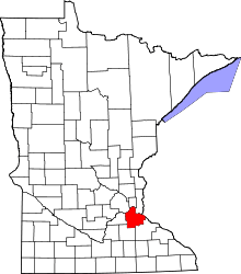 | |
| Townships | ||
| Unincorporated communities | ||
| Ghost towns | ||
| Indian reservation | ||
| Footnotes | ‡This populated place also has portions in an adjacent county or counties | |
Coordinates: 44°53′01″N 93°08′18″W / 44.88361°N 93.13833°W