Melville Island (Australia)
| Native name: <span class="nickname" ">(Tiwi) Yermalner | |
|---|---|
 Tiwi Islands | |
|
Melville | |
| Geography | |
| Location | Timor Sea |
| Coordinates | 11°33′S 130°56′E / 11.550°S 130.933°E |
| Archipelago | Tiwi Islands |
| Major islands | Melville, Irrititu |
| Area | 5,786 km2 (2,234 sq mi) |
| Administration | |
|
Australia | |
| Territory | Northern Territory |
| Largest settlement | Milikapiti (pop. 559) |
| Demographics | |
| Population | ca. 1030 |
| Ethnic groups | Tiwi |
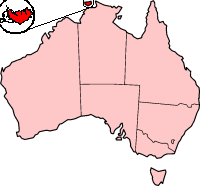
Melville Island known in the Tiwi language as Yermalner lies in the eastern Timor Sea, off the coast of the Northern Territory, Australia. It is west of the Cobourg Peninsula in Arnhem Land and north of Darwin, with a tropical climate.
The largest community/town on the island is Milikapiti, pop. 559. The second village is Pirlangimpi (Pularumpi, formerly Garden Point), pop. 440, 27 km west of Milikapiti, on the west coast of Melville Island. About 30 more people live in five family outstations.
At 5,786 square kilometres (2,234 sq mi) it is just outside the 100 largest islands in the world, but is the second biggest island in Australia, after Tasmania (and excluding the continental landmass). Only 55 metres (180 ft) south of its southern tip is Irrititu Island, with an area of 1.60 square kilometres (0.62 sq mi).[1]
Together, Melville Island and Bathurst Island are known as the Tiwi Islands.
It is said that the first European to sight the island was Abel Tasman in 1644, although this is now disputed. Melville Island's most likely first European sighting was probably made by the Portuguese, as the Aboriginal peoples encountered by the explorer Phillip Parker King (son of governor of New South Wales Philip Gidley King) in 1818, were found to know some Portuguese words.
King named it for Robert Dundas, 2nd Viscount Melville, first lord of the Admiralty, who is also commemorated by the much larger Melville Island in the Canadian Arctic Archipelago. Shortly after this, the British made the first attempt to settle Australia's north coast, at the short-lived Fort Dundas.
References
- ↑ John Woinarski, Brooke Rankmore, Alaric Fisher, Kym Brennan and Damian Milne (December 1997). "The natural occurrence of northern quolls Dasyurus hallucatus on islands of the Northern Territory: assessment of refuges from the threat posed by cane toads Bufo marinus." (PDF). Australian Government and Northern Territory Government. p. 16. Retrieved 30 May 2011.
External links
Coordinates: 11°33′S 130°56′E / 11.550°S 130.933°E