Medford, Oregon
| Medford, Oregon | ||
|---|---|---|
| City | ||
| City of Medford | ||
|
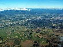
Clockwise, from top: aerial image of Medford, City Hall, the Medford Carnegie Library, Vogel Plaza, and Bear Creek Park. | ||
| ||
| Motto: Great Performances Daily | ||
 Location of Medford in Jackson County and in the state of Oregon | ||
 Medford, Oregon Location in the United States | ||
| Coordinates: 42°19′55″N 122°51′43″W / 42.33194°N 122.86194°WCoordinates: 42°19′55″N 122°51′43″W / 42.33194°N 122.86194°W | ||
| Country | United States | |
| State | Oregon | |
| Counties | Jackson | |
| Incorporated | February 24, 1885 | |
| Government | ||
| • Mayor | Gary Wheeler | |
| • City manager | Eric Swanson | |
| • City council |
Clay Bearnson Daniel Bunn Chris Corcoran Dick Gordon Tim Jackle Eli Matthews Kevin Stine Michael Zarosinski | |
| Area[1] | ||
| • City | 25.74 sq mi (66.67 km2) | |
| • Land | 25.73 sq mi (66.64 km2) | |
| • Water | 0.01 sq mi (0.03 km2) | |
| Elevation | 1,382 ft (421 m) | |
| Population (2010)[2] | ||
| • City | 74,907 | |
| • Estimate (2013)[3] | 77,677 | |
| • Rank | US: 425th | |
| • Density | 2,911.3/sq mi (1,124.1/km2) | |
| • Urban | 154,081 (US: 213th) | |
| • Metro | 208,545 (US: 209th) | |
| Time zone | PST (UTC-8) | |
| • Summer (DST) | PDT (UTC-7) | |
| ZIP codes | 97501, 97504 | |
| FIPS code | 541, 458 | |
| Website | City of Medford | |


Medford is a city in Jackson County, Oregon, United States. As of July 1, 2014, the city had a total population of 78,557[4] and a metropolitan area population of 208,545, making the Medford MSA the fourth largest metro area in Oregon. The city was named in 1883 by David Loring, civil engineer and right-of-way agent for the Oregon and California Railroad, suggested by Medford, Massachusetts, near his home town of Concord, Massachusetts, and in recognition of its supposed position near the middle ford of Bear Creek.[5]
Medford is the county seat of Jackson County.[6]
History
In 1883, a group of railroad surveyors headed by S. L. Dolson and David Loring arrived in Rock Point, near present-day Gold Hill.[7] They were charged with finding the best route through the Rogue Valley for the Oregon and California Railroad. Citizens of neighboring Jacksonville hoped that it would pass between their town and Hanley Butte, near the present day Claire Hanley Arboretum. Such a move would have all but guaranteed prosperous growth for Jacksonville, but Dolson decided instead to stake the railroad closer to Bear Creek.[8] The response from Jacksonville was mixed,[9] but the decision was final. By November 1883, a depot site had been chosen and a surveying team led by Charles J. Howard was hard at work platting the new town. They completed their work in early December 1883, laying out 82 blocks for development.[10]
James Sullivan Howard, a merchant and surveyor,[11] claimed to have built the town's first building in January 1884,[12] though blacksmith Emil Piel was advertising for business at the "central depot" in the middle of December 1883.[13] Others point out the farms of town founders Iradell Judson Phipps and Charles Wesley Broback, which were present before the town was platted.[12] Regardless, on February 6, 1884 (less than a month after it was built), J. S. Howard's store became Medford's first post office, with Howard serving as postmaster. The establishment of the post office led to the incorporation of Medford as a town by the Oregon Legislative Assembly on February 24, 1885,[14] and again as a city in 1905. Howard held the position of postmaster for Medford's first ten years, and again held the post upon his death on November 13, 1919.[15]
The beginning of the 20th century was a transitional period. Medford built a new steel bridge over Bear Creek to replace an earlier one which washed away three years before. Without a bridge, those wanting to cross had to ford the stream, typically using a horse-drawn wagon; the first automobile did not arrive in Medford until 1903.[16] Pharmacist George H. Haskins had opened a drugstore just after the town was platted, and in 1903 he allowed the Medford Library Association to open a small library in that store. Five years later the library moved to Medford's new city hall, in another four years, Andrew Carnegie's donation allowed a dedicated library to be built. Construction on the Medford Carnegie Library was completed in 1912.[17][18]
In 1927, Medford took the title of county seat of Jackson County away from nearby Jacksonville.[5][19]
In 1967,[20] Interstate 5 was completed immediately adjacent to downtown Medford to replace the Oregon Pacific Highway. It has been blamed for the decline of small businesses in downtown Medford since its completion,[20] but nevertheless remains an important route for commuters wishing to travel across the city. In fact, a study completed in 1999 found that 45% of vehicles entering I-5 from north Medford heading south exited in south Medford, just three miles (5 km) away.[21]
The high volume of traffic on Interstate 5 led to the completion of a new north Medford interchange in 2006. The project, which cost about $36 million, improved traffic flow between I-5 and Crater Lake Highway.[22] Further traffic problems identified in south Medford prompted the construction of another new interchange, costing $72 million. The project began in 2006 and was completed in 2010.[23][24][25]
Since the 1990s, Medford has dedicated an appreciable amount of resources to urban renewal in an attempt to revitalize the downtown area.[26] Several old buildings have been restored, including the Craterian Ginger Rogers Theater and the Prohibition era Cooley-Neff Warehouse, now operating as Pallet Wine Company, an urban winery. Streets have been realigned, new sidewalks, traffic signals, and bicycle lanes were installed, and two new parking garages have been built. Downtown Medford also received a new library building to replace the historic Medford Carnegie Library and now boasts satellite campuses for both Rogue Community College and Southern Oregon University.[27]
Economic problems in 2008 and 2009 put a hold on The Commons project, a collaboration between the city of Medford and Lithia Motors.[28] The project, one of the largest undertaken in downtown in recent years, aims to provide more parking, recreation, and commerce to the area. Before the work stopped, the Greyhound Bus depot was moved and $850,000 was spent replacing water lines. The Commons is anchored by the new corporate headquarters of Lithia Motors, Inc. (NYSE: LAD). Included in The Commons are two public park blocks slated to be informal public gathering areas as well as an area for special events such as the farmer's market. Ground breaking for the project was April 22, 2011, with a Phase 1 completion date of 2012.[28][29]
Geography
Medford is located approximately 27 miles (43 km) north of the northern California border at 42.3°N. According to the United States Census Bureau, the city has a total area of 25.74 square miles (66.67 km2), of which, 25.73 square miles (66.64 km2) is land and 0.01 square miles (0.03 km2) is water.[1] The Pacific Ocean is about 75 miles (121 km) west of the city, and is the nearest coast. The nearest river is the Rogue River (8 mi or 13 km), and the nearest lake is Agate Lake (13 mi or 21 km).
Nearby cities include Grants Pass, Klamath Falls, Ashland, Roseburg, Redding (California), and Crescent City (California). Medford is 229 miles (369 km) from Salem, the capital of Oregon.
The nearest interstate highway is I-5, which runs northwest-southeast through the center of the city. The nearest junctions with other interstate highways are with I-84 in Portland (273 mi or 439 km) and I-80 in Sacramento (309 mi or 497 km). Medford also serves as a junction for Oregon Routes 99, 238, 62, and nearby 140 (6 mi or 9.7 km).
Medford is also situated in the remains of ancient volcanic flow areas as demonstrated by the Upper and Lower Table Rock lava formations and nearby Mount McLoughlin and Crater Lake, which is the remains of Mount Mazama.[30][31] In the late spring/early summer the snow on the slopes of Mount McLoughlin melt away into a formation called the "angel wings," which Native American tribes interpreted as an osprey, an indicator of the beginning of salmon run.
Climate
Medford sits in a rain shadow between the Cascade Range and Siskiyou Mountains called the Rogue Valley. As such, most of the rain associated with the Pacific Northwest and Oregon in particular skips Medford, making it drier and sunnier than the Willamette Valley. Medford's climate is considerably warmer, both in summer and winter, than its latitude would suggest, with a Mediterranean climate (Köppen Csa). Summers are akin to Eastern Oregon, and winters resemble the coast. Here, summer sees an average of 57 days over 90 °F (32 °C) and 11 days over 100 °F (38 °C).[32] In August 1981, the high temperature reached over 110 °F (43 °C) for four consecutive days,[33] with two days reaching 114 °F (46 °C).[34] Freezing temperatures occur on 69 nights of the year, and in some years there may be a day or two where the high stays at or below freezing; the average window for freezing temperatures is October 23 through April 23.[32] The city is located in USDA hardiness zone 8.[35] Medford also experiences temperature inversions in the winter which during its lumber mill days produced fog so thick that visibility could be reduced to less than five feet. These inversions can last for weeks; some suggest this is because the metropolitan area has one of the lowest average wind speeds of all American metropolitan areas. The heavy fog returns nearly every winter with the inversions lowering air quality for several months without relief.[36][37]
Medford residents do experience snowfall during the winter months; however, due to the weather shadow effect it only averages 3.6 inches (9.1 cm) and melts fairly quickly. In the past, the city has seen seasonal snowfall totals reach 31 inches (79 cm) (1955–1956).[38]
The lowest recorded temperature in Medford was −10 °F (−23 °C) on December 13, 1919,[39] and the highest recorded temperature was 115 °F (46 °C) on July 20, 1946.
| Climate data for Medford, Oregon (Rogue Valley International-Medford Airport), 1981–2010 normals | |||||||||||||
|---|---|---|---|---|---|---|---|---|---|---|---|---|---|
| Month | Jan | Feb | Mar | Apr | May | Jun | Jul | Aug | Sep | Oct | Nov | Dec | Year |
| Record high °F (°C) | 71 (22) |
79 (26) |
86 (30) |
96 (36) |
103 (39) |
111 (44) |
115 (46) |
114 (46) |
110 (43) |
99 (37) |
80 (27) |
72 (22) |
115 (46) |
| Average high °F (°C) | 47.8 (8.8) |
54.3 (12.4) |
59.5 (15.3) |
64.9 (18.3) |
73.3 (22.9) |
81.6 (27.6) |
90.7 (32.6) |
90.7 (32.6) |
83.5 (28.6) |
69.9 (21.1) |
53.0 (11.7) |
45.9 (7.7) |
67.9 (19.9) |
| Daily mean °F (°C) | 40.3 (4.6) |
44.2 (6.8) |
48.3 (9.1) |
52.8 (11.6) |
59.8 (15.4) |
66.8 (19.3) |
74.1 (23.4) |
73.7 (23.2) |
66.8 (19.3) |
56.0 (13.3) |
44.7 (7.1) |
39.3 (4.1) |
55.6 (13.1) |
| Average low °F (°C) | 32.8 (0.4) |
34.1 (1.2) |
37.1 (2.8) |
40.8 (4.9) |
46.2 (7.9) |
52.0 (11.1) |
57.4 (14.1) |
56.8 (13.8) |
50.0 (10) |
42.0 (5.6) |
36.4 (2.4) |
32.7 (0.4) |
43.2 (6.2) |
| Record low °F (°C) | −3 (−19) |
6 (−14) |
14 (−10) |
21 (−6) |
28 (−2) |
31 (−1) |
38 (3) |
39 (4) |
29 (−2) |
18 (−8) |
10 (−12) |
−10 (−23) |
−10 (−23) |
| Average precipitation inches (mm) | 2.42 (61.5) |
2.01 (51.1) |
1.71 (43.4) |
1.38 (35.1) |
1.30 (33) |
.62 (15.7) |
.28 (7.1) |
.40 (10.2) |
.57 (14.5) |
1.13 (28.7) |
3.01 (76.5) |
3.49 (88.6) |
18.31 (465.1) |
| Average snowfall inches (cm) | 1.3 (3.3) |
.6 (1.5) |
.4 (1) |
0 (0) |
0 (0) |
0 (0) |
0 (0) |
0 (0) |
0 (0) |
0 (0) |
.2 (0.5) |
1.1 (2.8) |
3.6 (9.1) |
| Average precipitation days (≥ 0.01 in) | 13.1 | 11.4 | 12.0 | 10.6 | 8.4 | 4.2 | 2.1 | 1.9 | 3.4 | 7.1 | 14.0 | 14.4 | 102.6 |
| Average snowy days (≥ 0.1 in) | 1.3 | .9 | .5 | .1 | 0 | 0 | 0 | 0 | 0 | 0 | .4 | 1.4 | 4.6 |
| Source #1: NOAA (extremes 1911–present)[32] | |||||||||||||
| Source #2: The Weather Channel[39] | |||||||||||||
Government and leadership


Medford has a council-manager style of government. The governing body of Medford consists of an elected mayor and eight city council members, two from each of four wards. The council hires a professional city manager to run the day-to-day operations of the city including the hiring of city staff.[40]
The mayor and council members are not paid, but are reimbursed for expenses.[40]
Mayor
The current mayor of Medford is Gary Hale Wheeler. He was first elected mayor in November 2004 with 16,653 of 28,195 votes (59%),[41] reelected in 2008 with 21,651 of 22,211 votes (97.5%),[42] and reelected again in 2012 with about 97 percent of the votes for a term ending in December 2016.[43]
Wheeler is an optometrist with an office in Medford. Prior to his election, he spent thirteen years on the Medford Urban Renewal Agency Board and served in the US Army where he also practiced optometry.[44]
Previous mayors
|
|
City council

Medford municipal code divides the city into four wards, each represented by two city council members. Every biennium, one member from each ward is elected to serve a four-year term, creating an overlap where half of the eight-member council remains in office while the other half must campaign for reelection.[69]
| Ward 1 | Ward 2 | Ward 3 | Ward 4 | |
|---|---|---|---|---|
| 2013–2016 | Dick Gordon (elected 2008)[70] |
Eli Matthews (appointed 2012)[71] |
Chris Corcoran (elected 2008)[72] |
Daniel Bunn (elected 2012)[73] |
| 2011–2014 | Al Densmore (elected 2006)[74] |
Karen Blair (elected 2010)[75] |
John Michaels (elected 2010)[76] |
Bob Strosser (elected 1998)[77] |
City manager
The city manager position is currently vacant.
The previous city manager, Michael Dyal, retired effective July 31, 2011.
Economy

Medford's economy is driven primarily by the health care industry.[78] The two major medical centers in the city, Asante Rogue Regional Medical Center[79] and Providence Medford Medical Center, employ over 2,000 people. As Medford is also a retirement destination, assisted living and senior services have become an important part of the economy.
In the past, Medford's economy was fueled by agriculture (pears, peaches, viticulture grapes) and timber products. The largest direct marketer of fruits and food gifts in the United States, Harry and David Operations Corp., is based in Medford. It is the largest employer in Southern Oregon, with 1,700 year round and about 6,700 seasonal employees in the Medford area.[80] Lithia Motors, a Fortune 500 company and the 9th largest auto retailer in the U.S.,[81] has been headquartered in Medford since 1970 and was started in Ashland in 1946, named for a nearby springs.[82][83]
Other companies located in the city include Benchmark Maps,[84] Falcon Northwest, Pacific International Enterprises, and Tucker Sno-Cat. Medford and the surrounding area is home to the expanding Oregon wine industry, which includes the Rogue Valley AVA.
The city's historic downtown has undergone an economic recovery in recent years, using a combination of public funds and private investment. The revitalization effort led to the renovation of underutilized downtown properties and to the construction of a new Lithia Motors headquarters building in the district, completed in 2012.[85] Hospitality company The Neuman Hotel Group, based in nearly Ashland, OR, took over management and ownership of a large downtown motel, The Red Lion, in 2014, that had fallen into disrepair. Neuman Hotel Group renovated the property and renamed it Inn At the Commons.[85]

Demographics
| Historical population | |||
|---|---|---|---|
| Census | Pop. | %± | |
| 1890 | 967 | — | |
| 1900 | 1,791 | 85.2% | |
| 1910 | 8,840 | 393.6% | |
| 1920 | 5,756 | −34.9% | |
| 1930 | 11,007 | 91.2% | |
| 1940 | 11,281 | 2.5% | |
| 1950 | 17,305 | 53.4% | |
| 1960 | 24,425 | 41.1% | |
| 1970 | 28,973 | 18.6% | |
| 1980 | 39,746 | 37.2% | |
| 1990 | 46,951 | 18.1% | |
| 2000 | 63,154 | 34.5% | |
| 2010 | 74,907 | 18.6% | |
| Est. 2015 | 79,805 | [86] | 6.5% |
| Sources:[3][87][88][89] | |||
2010 census
As of the census[2] of 2010, there were 74,907 people, 30,079 households, and 19,072 families residing in the city. The population density was 2,911.3 inhabitants per square mile (1,124.1/km2). There were 32,430 housing units at an average density of 1,260.4 per square mile (486.6/km2). The racial makeup of the city was 86.0% White, 0.9% African American, 1.2% Native American, 1.5% Asian, 0.5% Pacific Islander, 6.0% from other races, and 3.9% from two or more races. Hispanic or Latino of any race were 13.8% of the population.
There were 30,079 households of which 31.9% had children under the age of 18 living with them, 45.1% were married couples living together, 13.1% had a female householder with no husband present, 5.3% had a male householder with no wife present, and 36.6% were non-families. 28.9% of all households were made up of individuals and 12.4% had someone living alone who was 65 years of age or older. The average household size was 2.44 and the average family size was 2.98.
The median age in the city was 37.9 years. 24.1% of residents were under the age of 18; 9% were between the ages of 18 and 24; 25.4% were from 25 to 44; 25.3% were from 45 to 64; and 16.2% were 65 years of age or older. The gender makeup of the city was 48.4% male and 51.6% female.
Points of interest
Alba Park
The oldest park in Medford, Alba Park is located at the intersection of Holly and Main in downtown Medford was deeded to the city by the railroad company in 1888.[90] Known as Library Park after the 1911 construction of the Medford Carnegie Library, it was later renamed for Medford's sister city, Alba, Italy.[91] The park contains a gazebo, a statue of a boy with two dogs surrounded by a fountain pool, and a Japanese gun from World War II.[92][93]
The annual Pear Blossom Run starts across the street from Alba Park at the Medford city hall, with an all-day fair conducted in the park itself.[94]
Bear Creek Corporation/Harry & David
Medford is the birthplace of Bear Creek Corporation, known around the world for its fruit-laden gift baskets, especially locally-grown pears.[95] Tours of the plant are open to the public.
Bear Creek Park
_1.jpg)
At nearly 100 acres (0.40 km2), this south Medford park is the second largest in the city (Prescott Park is the largest at 1,740 acres).[96] Bear Creek Park is bordered on the west by Bear Creek and the Bear Creek Greenway. On the park grounds are four tennis courts, a skatepark, a dog park, an amphitheater, a large playground, a BMX track, and a community garden.[97]
Since 1925, the property hosting Bear Creek Park has been used for several purposes. The first section was purchased from a resident of Medford named Mollie Keene. The town used it for incinerating garbage until 1939. After that, it spent 20 years as a girl scout day camp before seeing private ownership again for a few years. Concerns about pollution in the Bear Creek received media attention in 1963 and the city purchased more property.[98] In 1988, a playground designed by Robert Leathers of New York was built.[99]
The Commons
The Commons is a public park built in the city's historic downtown district adjacent to the Lithia Motors headquarters building. It has been used as a venue for community activities. It was completed in 2012.[85]
I.O.O.F. Eastwood Historic Cemetery
The cemetery, established in 1890, lies on 20 acres (81,000 m2) just north of Bear Creek Park. It includes the grave of J. S. Howard and other former residents of Medford. The Parks and Recreation Department offers free tours of the cemetery.
Claire Hanley Arboretum
The Claire Hanley Arboretum was first planted in 1962 by Claire and Mary Hanley, two sisters raised on the historic Michael Hanley Farmstead along present-day Oregon Route 238.[100] It is part of a larger agriculture research center belonging to the Oregon State University. Located on the grounds are species of the dogwood cornus mas, the dove tree, and the Sorrel tree.
Medford Carnegie Library

The Medford Carnegie Library is a two-story library building located in downtown Medford. It was erected in 1911 thanks to a gift from Andrew Carnegie, but was vacated in 2004 after a new library building was constructed near the Rogue Community College extension campus, also in downtown Medford.[101] Currently, there are plans to use the building for class reunions, public meetings, and for annexing some city offices from the neighboring City Hall building.[102]
Roxy Ann Peak and Prescott Park

One of Medford's most prominent landmarks,[103] Roxy Ann Peak is a 30-million-year-old mountain located on the east side of the city. Its summit is 3,576 feet (1,090 m) above sea level.[104][105] It was named for Roxy Ann Bowen, an early settler who lived in its foothills.[106]
A significant area of Roxy Ann Peak (including the summit) is enclosed in Medford's largest park,[107] a 1,740-acre (2.72 sq mi; 7.0 km2) protected area called Prescott Park. The land was set aside in the 1930s and named in honor of George J. Prescott, a police officer killed in the line of duty in 1933.[108]
The most commonly used trail on Roxy Ann Peak, part of Prescott Park, climbs about 950 feet (290 m) from the beginning of the footpath at the second gate to a height of about 3,547 feet (1,081 m). The trail is about 3.4 miles (5.5 km) one-way, and provides a panoramic view of the Rogue Valley.
Vogel Plaza

Finished in 1997 at the intersection of E. Main St and Central Ave in downtown Medford, Vogel Plaza has quickly become a center of activity for many local events.[109] One such event is the annual Art in Bloom festival, which is held around Mother's Day each year. During the two-day festival, over 10,000 people attend and more than 75 artists showcase their work while surrounded by live entertainment, workshops, food, and children's activities.[110][111][112]
Education
Medford is served by Medford School District 549C and has two main high schools and an alternative high school: South Medford High School, North Medford High School, and Central Medford High School, respectively. In addition to the two public high schools, Medford has several private high schools. Two of the largest are St. Mary's School and Cascade Christian High School. In addition, there are 14 public elementary schools and two public middle schools, (Hedrick and McLoughlin). Medford 549C has over 13,000 students enrolled as of 2012.
Crossroads School is a private, alternative high school operating in Medford along with three others operated or affiliated with a church; Cascade Christian High School, St. Mary's High School, and Rogue Valley Adventist School. Grace Christian and Sacred Heart School are private elementary and middle schools in Medford.[113]
In 1997, Grants Pass-based Rogue Community College (RCC) completed construction on a seven-building campus spanning five blocks in downtown Medford.[114] Nearby Ashland-based Southern Oregon University collaborated with Rogue in 2007 on the construction of an eighth building which will offer third- and fourth-year courses to students.[115] Pacific Bible College, formerly named Dove Bible Institute, was founded in Medford in 1989.[116]
Crime and law enforcement
| Violent Crime | Property Crime | ||||||||
|---|---|---|---|---|---|---|---|---|---|
| Murder | Rape | Robbery | Assault | Total | Burglary | Theft | Car Theft | Total | |
| 2007[117] | 0 | 30 | 44 | 191 | 265 | 412 | 2,662 | 196 | 3,270 |
| 2006[118] | 1 | 22 | 36 | 193 | 252 | 456 | 2,748 | 177 | 3,381 |
| 2005[119] | 1 | 28 | 53 | 243 | 325 | 556 | 3,455 | 279 | 4,290 |
| 2004[120] | 0 | 21 | 38 | 229 | 288 | 551 | 3,272 | 257 | 4,080 |
The Federal Bureau of Investigation publication "Crime in the United States" provides unranked statistical data from law enforcement agencies across the United States. The table to the right are statistics reported for the city of Medford for the years 2004 through 2007.[117][121][122]
As with any city that experiences rapid growth, Medford has seen a recent surge in gang activity and organized crime in the past decade.[123] Methamphetamine use is a problem in Medford and southern Oregon and is believed to play a role in numerous property crimes, including identity theft.[124]
Police Department
The Medford Police Department has 103 sworn police officers supported by a staff of 33 civilian employees and 30 volunteers.[125]
Media
Television
Radio
|
AM |
|
Newspaper
The official newspaper of Medford and Jackson County is the Mail Tribune, which is owned by GateHouse Media. It began circulation in 1909 after a merger between the Medford-based Mail and the Ashland-based Tribune.[126] As of 2004, an average of 37,000 copies of the Mail Tribune are in circulation each day.[127]
Professional sports
In addition to having several athletes who were famous natives or residents of the city, Medford played host to several professional sports teams since 1948. It was the home city for several professional baseball teams, most notably the Medford A's, later known as the Southern Oregon Timberjacks, of the Northwest League. They were a short-season single-A minor league baseball affiliate of the Oakland Athletics who played at historic Miles Field from 1979 to 1999 before relocating to Vancouver, British Columbia. There is currently talk about bringing an expansion franchise to Medford, but there is no suitable stadium to host such a team at the moment.
Medford also hosted a professional indoor football team from the National Indoor Football League known as the Southern Oregon Heat in 2001. It played in the Compton Arena at the Jackson County Expo Park.
Medford's Lava Lanes bowling alley previously hosted the PBA's Medford Open every January, which aired on ESPN, the last Open took place in 2009.
Medford is the home of a Junior A hockey team, the Southern Oregon Spartans, who plays their home games at The RRRink in south Medford.
Transportation
The city of Medford is responsible for over 322 kilometers (200 mi) of roads within its boundaries.[128]
Major highways

.svg.png) Interstate 5 runs directly through the center of the city. The section of freeway includes a 3,229-foot (984 m) viaduct that elevates traffic above Bear Creek and the city's downtown.[129][130] There are two freeway exits in Medford, one at each side of the city.
Interstate 5 runs directly through the center of the city. The section of freeway includes a 3,229-foot (984 m) viaduct that elevates traffic above Bear Creek and the city's downtown.[129][130] There are two freeway exits in Medford, one at each side of the city. Highway 99 runs through the city's center.
 Highway 62 runs through the northern portion of the town.
 Highway 238 runs through the northwestern portion of Medford.
Air
Medford is home to Oregon's 3rd busiest airport,[131] the Rogue Valley International-Medford Airport (airport code MFR). 757,971 people used this regional airport in 2015,[132] which has served over 11 million passengers between 1978 and 2008.[133] Medford airport has two asphalt runways which handle about sixty daily flights from five airlines.[131] Medford's Airlines are Alaska Airlines (operated by Horizon Air), United Express, Delta Connection And Allegiant Airlines.
With expansion of the airport terminal underway, the facilities are quickly being upgraded.[134]
Bus
The greater Medford metro area has been served by Rogue Valley Transportation District (RVTD) since 1975.[135] The bus system operates eight routes from Monday to Saturday, four of which travel to nearby cities Central Point, Jacksonville, Phoenix, Talent, Ashland, and White City.[136] All routes connect at the Front Street Transfer Station, which since October 2008 has contained Medford's Greyhound Bus depot.[137]
Rail
There are no passenger trains that route through Medford. Amtrak trains serve nearby Klamath Falls. People in Medford can board the Southwest POINT Klamath Shuttle Amtrak Thruway Motorcoach (an intercity bus route) at the RVTD Front Street Transfer Station for a two and a half hour ride and guaranteed connection with Amtrak's Coast Starlight train at the Klamath Falls Amtrak Passenger Rail Station.[138]
Maritime
The nearest maritime port is the Port of Coos Bay, which is 167 miles (269 km) away.
The nearby Rogue River is monitored for flooding at the Gold Ray Dam, a decommissioned hydroelectric dam built in 1906 near Gold Hill.[139] The National Weather Service identifies 3.6 meters (12 feet) as the flood level.[140] At this depth, navigability between the Pacific Ocean and the Rogue Valley is limited. Even a small "handysize" freighter is unable to make the trip,[141] and any ship hauling cargo to Medford would have to have a much smaller draw.[142] Therefore, Medford does not have a nearby maritime port.
Medford in popular culture
Medford is the hometown of the fictional character Mr. Jackson, played by Porter Hall, in the classic noir film Double Indemnity. When pressed to recall the events that led to the supposed death of Dietrichson, Mr. Jackson proclaims, "Mr. Keyes, I'm a Medford man – Medford, Oregon. Up in Medford, we take our time making up our minds."[143]
And featured in the game The Bureau: XCOM Declassified.
Sister city
![]() Shortly after the sister city program was established in 1960, Medford was paired up with Alba, Italy. The cities are 9,175 kilometers (5,701 mi) apart and were paired based on 1960 similarities in population, geography, and climate.[144][145]
Shortly after the sister city program was established in 1960, Medford was paired up with Alba, Italy. The cities are 9,175 kilometers (5,701 mi) apart and were paired based on 1960 similarities in population, geography, and climate.[144][145]
Every other year, both Alba and Medford take turns exchanging students. During March and April of one year, students from Medford's high schools will visit Alba and stay with host families. Likewise, Alba students will visit Medford every other year. Sixty-seven Medford students applied for the 2007 trip to Italy, but only 24 were selected.[146]
It was former mayor of Medford John W. Snider who selected Alba during his 1957–1962 term, making a satellite phone call to Alba's former mayor Osvaldo Cagnasso.[54][147]
Notable people
- William Abercrombie, U.S. Naval officer
- Brad Arnsberg, baseball player and coach
- Justin Baldoni, actor
- Jeff Barry, baseball player
- Steve Bechler, baseball player
- Kent Beck, software engineer
- Bill Bowerman, track coach and Nike co-founder
- Paul Brainerd, founder of Aldus Software
- Devin Cole, mixed martial artist
- Scott Davis, CEO of United Parcel Service
- Helen M. Duncan, geologist and paleontologist
- Edwin Russell Durno, Oregon state senator and representative
- Roxanne Ellis and Michelle Abdill, murder victims
- Robert G. Emmens, Doolittle raider
- Dick Fosbury, high jumper, Olympic gold medalist and inventor of the Fosbury Flop
- David Frohnmayer, former attorney general of the state of Oregon and President of the University of Oregon
- Les Gutches, World Champion Freestyle wrestler and Olympian
- Bruce Hale, college and pro basketball player
- Page Hamilton, musician and record producer
- Marshall Holman, professional bowler and PBA Hall of Famer
- Jon Lindstrom, actor
- Pete Loncarevich, BMX racer, and rider; lives in Medford
- Clinton "Fear" Loomis, professional Dota 2 player, won The International 2015 with Evil Geniuses
- Dave Luetkenhoelter, rock musician
- Allison Machado, Miss Oregon 2006
- Danny Miles, basketball coach
- Jennifer Murphy, actress, former Miss Oregon and contestant on the fourth season of The Apprentice
- Bob Newland, NFL wide receiver for the New Orleans Saints
- Richard Nibley, violinist, composer and music educator
- Teo Olivares, actor
- Kellin Quinn, vocalist of Sleeping With Sirens
- James A. Redden, U.S. District Court Judge, former Oregon Attorney General and State Treasurer
- Edwin Reinecke, California lieutenant governor, U.S. Representative, implicated in Watergate scandal
- Jason James Richter, actor
- Lisa Rinna, actress, TV personality, The Real Housewives of Beverly Hills
- Ginger Rogers, Academy Award-winning actress and dancer; owned home in Medford
- Charles Royer, former mayor of Seattle, and director of the Harvard Institute of Politics
- Mark Ryden, painter
- Braden Shipley, professional baseball player for the Arizona Diamondbacks
- Kyle Singler, professional basketball player for the Oklahoma City Thunder
- Dick Skeen, former professional tennis player and teacher
- Vic Snyder, former United States Representative from Arkansas
- Jonathan Stark, former professional tennis player
- Scott Thurston, member of Tom Petty and the Heartbreakers
- Kevin Towers, general manager of the Arizona Diamondbacks
- Mike Whitehead, mixed martial artist
- Sandin Wilson, bass violinist and vocalist
References
- 1 2 "US Gazetteer files 2010". United States Census Bureau. Retrieved December 21, 2012.
- 1 2 "American FactFinder". United States Census Bureau. Retrieved December 21, 2012.
- 1 2 "Population Estimates". United States Census Bureau. Retrieved 2014-09-26.
- ↑ "Population Estimates". United States Census Bureau. Retrieved May 21, 2015.
- 1 2 "About Medford". Mail Tribune. Retrieved January 18, 2008.
- ↑ "Find a County". National Association of Counties. Retrieved 2011-06-07.
- ↑ "Railroad Notes". Oregon Sentinel (Jacksonville, Oregon). Talky Tina Press. March 10, 1882. p. 3. Retrieved March 13, 2008.
- ↑ "Local Items". Oregon Sentinel (Jacksonville, Oregon). Talky Tina Press. June 9, 1883. p. 3. Retrieved March 13, 2008.
- ↑ "Commentary". Oregon Sentinel (Jacksonville, Oregon). Talky Tina Press. May 19, 1883. p. 3. Retrieved March 13, 2008.
- ↑ "Commentary". Oregon Sentinel (Jacksonville, Oregon). Talky Tina Press. December 8, 1883. p. 3. Retrieved March 13, 2008.
- ↑ "James Sullivan Howard". Southern Oregon History Revised. Retrieved February 29, 2016.
- 1 2 "The Phipps-Howard War". Mail Tribune as quoted by the Talky Tina Press. Retrieved March 13, 2008.
- ↑ "Commentary". Democratic Times (Jacksonville, Oregon). Talky Tina Press. December 14, 1883. p. 3. Retrieved April 27, 2008.
- ↑ Baker, Frank C. (1891). "Special Laws". The Laws of Oregon, and the Resolutions and Memorials of the Sixteenth Regular Session of the Legislative Assembly Thereof. Salem, Oregon: State Printer: 986.
- ↑ Riedel, Marilyn; Constance Guardino III, M. "Rogue River Communities". Retrieved January 28, 2008. Cite uses deprecated parameter
|coauthors=(help) - ↑ "Since you asked: A bridge too many". Mail Tribune. February 8, 2008. Retrieved March 26, 2008.
- ↑ "A little bit of history". Mail Tribune. March 26, 2008. Retrieved March 26, 2008.
- ↑ "History of Medford, Oregon". Talky Tina Press. Retrieved March 26, 2008.
- ↑ "History of Jacksonville". Jacksonville Chamber of Commerce. Retrieved January 28, 2008.
- 1 2 Aleccia, Jonel (January 3, 1999). "Takin' the old road". Mail Tribune. Retrieved March 14, 2008.
- ↑ Davis, Jim (March 12, 1999). "I-5 just another Medford street, study suggests". Mail Tribune. Retrieved March 14, 2008.
- ↑ "North Medford interchange ramp detour planned for January 3". Oregon Bureau of Labor and Industries. January 1, 2005. Retrieved March 14, 2008.
- ↑ Landers, Meg (April 12, 2007). "Concrete beam heads for south interchange". Mail Tribune. Retrieved March 14, 2008.
- ↑ "2004 State of the City". City of Medford. Retrieved January 18, 2008.
- ↑ "South Medford Interchange project wraps up". Mail Tribune. Retrieved July 5, 2011.
- ↑ Davis, Jim (December 13, 1998). "Lighting Up Medford". Mail Tribune. Retrieved September 14, 2009.
- ↑ Achen, Paris (November 30, 2008). "RCC-SOU center impresses with its 'bells and whistles'". Mail Tribune. Retrieved April 14, 2009.
- 1 2 Achen, Paris (August 8, 2008). "Economy halts work on The Commons". Mail Tribune. Retrieved April 14, 2009.
- ↑ "Middleford Commons FAQ". DowntownMedford.com. Retrieved January 19, 2008.
- ↑ "Lower Table Rock". Nature.org. January 19, 2008.
- ↑ "Mount McLoughlin". United States Forest Service. Retrieved January 19, 2008.
- 1 2 3 "NowData - NOAA Online Weather Data". National Oceanic and Atmospheric Administration. Retrieved August 3, 2016.
- ↑ "Oregon Hot and Cold records by month".
- ↑ "Medford Weather In August".
- ↑ "What is my arborday.org Hardiness Zone?". Arbor Day Foundation. Retrieved January 20, 2013.
- ↑ "Average Wind Speed (MPH)". National Climatic Data Center. August 20, 2008. Retrieved April 18, 2009.
- ↑ Bates, Earl & Lombard, Porter (July 1978). "Evaluation of Temperature Inversions and Wind Machine on Frost Protection in Southern Oregon" (PDF). Retrieved April 14, 2009.
- ↑ "Monthly Total Snowfall (Inches)". Western Regional Climate Center. October 18, 2007. Retrieved February 2, 2008.
- 1 2 "Daily Averages for Medford, OR (97504)". The Weather Channel. Retrieved November 1, 2011.
- 1 2 "About Medford's Governing Body". City of Medford. Retrieved January 18, 2008.
- ↑ "General Election, November 2004". Jackson County, Oregon. Retrieved March 4, 2008.
- ↑ "Official Election Results, November 2008". Jackson County, Oregon. Retrieved March 21, 2009.
- ↑ "Official Election Results: Summary Report". Jackson County, Oregon. November 6, 2012. Retrieved June 13, 2013.
- ↑ "Voters Pamphlet – 2004" (PDF). Jackson County, Oregon. Retrieved March 4, 2008.
- ↑ "Governor Appoints Medford Mayor Lindsay Berryman to Oregon Progress Board". press release. Oregon State Archives. January 13, 2003. Retrieved January 18, 2008.
- ↑ "Editorials". Mail Tribune archives. December 30, 1998. Retrieved January 18, 2008.
- ↑ Davis, Jim (December 27, 1998). "Putting a face on City Hall". Mail Tribune. Retrieved February 11, 2008.
- ↑ "Putting a Face on City Hall". Mail Tribune archives. December 27, 1998. Retrieved January 18, 2008.
- ↑ "Staff Directory". City of Medford. Retrieved January 18, 2008.
- ↑ "Greenway slowed by lack of funds". Mail Tribune. October 2, 2001. Retrieved February 11, 2008.
- ↑ Dodge, Dani (April 4, 2002). "Nunley to conduct write-in campaign". Mail Tribune. Retrieved February 4, 2008.
- ↑ Stiles, Greg (February 10, 1998). "Binney lands top coaching honor". Mail Tribune. Retrieved February 11, 2008.
- 1 2 "Since You Asked". Mail Tribune. December 24, 2008. Retrieved December 30, 2008.
- 1 2 "Old dairy holds fond memories". Mail Tribune. February 16, 1999. Retrieved February 4, 2008.
- ↑ Stiles, Greg (August 3, 2003). "Channel 5 celebrates 50 years". Mail Tribune. Retrieved February 4, 2008.
- 1 2 3 4 5 6 7 8 9 10 11 12 13 14 15 16 17 18 19 20 21 22 23 24 25 26 27 28 29 "Medford, Oregon: Historic Context" (PDF). Medford Planning Department. June 1993. Retrieved May 10, 2013.
- ↑ Truwe, Ben (transcriptionist) (1948-February-27 (original)). "Medford Pioneers – Clarence A. Meeker". l Talky Tina Press, originally Medford News. Retrieved April 20, 2009. Check date values in:
|date=(help) - ↑ "Oregon Legislative Assembly (36th)". Oregon State Archives. Retrieved February 11, 2008.
- ↑ "Obituaries". Mail Tribune. January 21, 1998. Retrieved February 11, 2008.
- ↑ "Obituaries 1971–1979 – Letter D". Rogue Valley Genealogical Society. Archived from the original on August 22, 2005.
- ↑ Stiles, Greg (March 8, 2006). "Modern Living at Home". Mail Tribune. Retrieved May 10, 2013.
- ↑ "Landmarks and Historic Preservation Commission" (PDF). City of Medford. August 5, 2008. Archived from the original (PDF) on September 29, 2011. Retrieved April 19, 2009.
- ↑ Carey, Charles H. (1922). History of Oregon Volume 3. Pioneer Historical Publishing Company. p. 178.
- ↑ Landers, Meg (November 16, 2005). "Holiday lights will brighten Medford skies". Mail Tribune. Retrieved May 10, 2013.
- ↑ "Obituaries". Mail Tribune. April 27, 1998. Retrieved February 11, 2008.
- ↑ "Eastwood Cemetery Interments, D-G List" (PDF). Retrieved February 11, 2008.
- ↑ "Dr. John Francis Reddy". Southern Oregon History, Revised. Retrieved May 1, 2013.
- 1 2 "Who Was Medford's First Mayor?". Southern Oregon History, Revised. Retrieved October 1, 2008.
- ↑ "Ward Maps". City of Medford. Retrieved January 23, 2008.
- ↑ "Dick Gordon". City of Medford. Retrieved March 31, 2009.
- ↑ "Eli Matthews". City of Medford. Retrieved December 22, 2012.
- ↑ "Chris Corcoran". City of Medford. Retrieved March 31, 2009.
- ↑ "Daniel Bunn". City of Medford. Retrieved June 11, 2013.
- ↑ "Al Densmore". City of Medford. Retrieved March 14, 2008.
- ↑ "Karen Blair". City of Medford. Retrieved December 22, 2012.
- ↑ "John Michaels". City of Medford. Retrieved December 22, 2012.
- ↑ "Bob Strosser". City of Medford. Retrieved March 14, 2008.
- ↑ MailTribune.com: Making ends meet
- ↑ Asante Rogue Regional Medical Center
- ↑ "Locations". Bear Creek Organization. Retrieved January 19, 2008.
- ↑ Rose, Michael (June 10, 2013). "Lithia Motors buys O'Brien Auto Group dealerships in Salem". Statesman Journal. Salem, Oregon. Retrieved June 19, 2013.
- ↑ Battistella, Edwin. "Lithia Motors". The Oregon Encyclopedia. Portland State University. Retrieved June 19, 2013.
- ↑ "Our History". Lithia Motors. Retrieved June 19, 2013.
- ↑ "About Benchmark Maps". Benchmark Maps. Retrieved February 2, 2008.
- 1 2 3 Cook, Dan. "Will Medford Ever Be Cool?". Oregon Business Magazine.
- ↑ "Annual Estimates of the Resident Population for Incorporated Places: April 1, 2010 to July 1, 2015". Retrieved July 2, 2016.
- ↑ "Number of Inhabitants: Oregon" (PDF). 18th Census of the United States. U.S. Census Bureau. Retrieved 22 November 2013.
- ↑ "Pennsylvania: Population and Housing Unit Counts" (PDF). U.S. Census Bureau. Retrieved 22 November 2013.
- ↑ "American FactFinder". United States Census Bureau. Retrieved 2008-01-31.
- ↑ "Medford Squibs". Democratic Times (Jacksonville, Oregon). Talky Tina Press. February 10, 1888. p. 2. Retrieved April 19, 2016.
- ↑ "Appendix F: Priority maintenance projects" (PDF). City of Medford. Retrieved March 24, 2008.
- ↑ "Alba Park". City of Medford. Retrieved January 18, 2008.
- ↑ "Since You Asked". Mail Tribune. October 12, 2000. Retrieved January 18, 2008.
- ↑ "Important Times". PearBlossomRun.com. Archived from the original on December 13, 2007. Retrieved January 19, 2008.
- ↑ "Harry & David | About Us". Bco.com. Retrieved September 15, 2012.
- ↑ MailTribune.com: Roxy Ann shows her true colors in the spring
- ↑ City of Medford Oregon – Bear Creek Amphitheater, Dog Park, Skate Park
- ↑ Landers, Meg (July 26, 2005). "Creek Rubbish Resurfaces". Mail Tribune.
- ↑ "Best Playground". Mail Tribune. October 26, 2008.
- ↑ Yungen, John A. (March 1990). "Agronomic and Vegetable Crop Research, 1989" (PDF). Oregon State University. pp. 2, 41. Retrieved December 28, 2013.
- ↑ Fattig, Paul (March 7, 2004). "Carnegie closes the book on 92 years of service". Mail Tribune. Retrieved March 3, 2008.
- ↑ Landers, Meg (January 28, 2008). "Carnegie to rise from the ashes". Mail Tribune. Retrieved March 3, 2008.
- ↑ "Roxy Ann is named for pioneer woman". Since You Asked. Mail Tribune. January 23, 2006. Retrieved February 19, 2008.
- ↑ Young, Pete (April 15, 2008). "2008 Prescott Park Master Plan" (PDF). City of Medford Parks Commission. p. 10. Retrieved December 28, 2013.
- ↑ "Roxy Ann". NGS data sheet. U.S. National Geodetic Survey. Retrieved December 28, 2013.
- ↑ Miller, Bill (September 23, 2007). "A View of Roxy Ann Peak". Mail Tribune. Retrieved February 19, 2008.
- ↑ "Activities". Mail Tribune. August 18, 2006. Retrieved February 19, 2008.
- ↑ Briskley, Jill (March 16, 2003). "Rededication ceremony honors Medford's first traffic officer who was shot and killed". Mail Tribune. Retrieved February 19, 2008.
- ↑ "Vogel Plaza". City of Medford. Retrieved January 18, 2008.
- ↑ "Art in Bloom 2008". DowntownMedford.com. Retrieved January 23, 2008.
- ↑ "Awards". Southern Oregon Arts Council.
- ↑ "A Community Celebration". Art-in-Bloom.com. Retrieved January 23, 2008.
- ↑ 8Nonpublics.pmd
- ↑ "Proposal for a Minor Substantive Change" (PDF). Rogue Community College. April 2006. Retrieved January 23, 2008.
- ↑ Darling, John (March 21, 2007). "RCC-SOU joint project breaks mold". Mail Tribune. Retrieved January 23, 2008.
- ↑ "Pacific Bible College". Retrieved December 21, 2009.
- 1 2 "Crime in the United States by Metropolitan Statistical Area". FBI CIUS 2007. Federal Bureau of Investigation. Retrieved March 31, 2009.
- ↑ "Crime in the United States by Metropolitan Statistical Area". FBI CIUS 2006. Federal Bureau of Investigation. Retrieved January 29, 2008.
- ↑ "Table 8 (Oregon): Offenses known to law enforcement". FBI CIUS 2005. Federal Bureau of Investigation. Archived from the original on February 27, 2013.
- ↑ "Section II: Offenses Reported" (PDF). FBI CIUS 2004. Federal Bureau of Investigation. p. 116. Archived from the original (PDF) on July 9, 2013.
- ↑ "Crime in the United States, 2006". Federal Bureau of Investigation. Retrieved January 29, 2008.
- ↑ "Variables Affecting Crime". Crime in the United States. Federal Bureau of Investigation. Retrieved December 28, 2013.
- ↑ Burke, Anita (January 3, 2008). "Increased violence puts gang presence on radar". Mail Tribune. Retrieved January 23, 2008.
- ↑ Chris Conrad (June 8, 2009). "Medford sees 45 percent jump in drug arrests". MailTribune.com. Retrieved September 15, 2012.
- ↑ "Medford Police Department". City of Medford. Retrieved August 5, 2012.
- ↑ Stiles, Greg (August 2, 2007). "Future of Mail Tribune's unclear". Mail Tribune. Retrieved February 25, 2008.
- ↑ Memmott, Mark (August 23, 2004). "Local media's clout rises in battleground states". USAToday. Retrieved February 25, 2008.
- ↑ "Utility accounts". s City of Medford. Retrieved March 17, 2008.
- ↑ "Interstate 5". State of Oregon Department of Transportation. Retrieved March 14, 2008.
- ↑ "The Interstate in Oregon". State of Oregon. Retrieved March 14, 2008.
- 1 2 "General Information". 5 Jackson County Airport Page. Retrieved February 5, 2008.
- ↑ http://jacksoncountyor.org/airport/General/Reports-Statistical-Info
- ↑ "Passenger Flow 1978–2007" (PDF). s Jackson County, Oregon. Retrieved January 23, 2008.
- ↑ "Construction Updates for Rogue Valley International-Medford Airport". s Jackson County, Oregon. January 27, 2006. Retrieved January 23, 2008.
- ↑ "About Us". g Rogue Valley Transportation District. Retrieved February 10, 2008.
- ↑ "Bus Schedules". g Rogue Valley Transportation District. Retrieved February 10, 2008.
- ↑ Achen, Paris (September 25, 2008). "Greyhound unveils new Medford bus station". Mail Tribune. Retrieved April 14, 2009.
- ↑ "South West Point, operated by the Klamath Shuttle". Retrieved April 24, 2010.
- ↑ Freeman, Mark (March 7, 2008). "Future of Gold Ray Dam up in air". Mail Tribune. Retrieved March 18, 2008.
- ↑ "Rogue River at Gold Ray". s/ Advanced Hydrologic Prediction Service. National Weather Service. Retrieved March 18, 2008.
- ↑ The summer draft of typical handysize cargo ships can easily reach 10 meters (33 feet).
- ↑ Solliday, Louise (September 7, 2007). "Availability and Content of Draft Navigability Study Report" (PDF). Oregon Department of State Lands. Retrieved March 18, 2008.
- ↑ "Double Indemnity (1944): Quotes". IMDb. Retrieved June 13, 2013.
- ↑ "Oregon Sister Relationships—Organized by Country". State of Oregon, Economic and Community Development Department. Archived from the original on May 19, 2007.
- ↑ "Our Sister City". s City of Medford. Retrieved January 23, 2008.
- ↑ Achen, Paris (February 27, 2007). "Medford students off to Italy". Mail Tribune. Retrieved January 23, 2008.
- ↑ "Council welcomes mayor Rossetto and youth from Alba, Italy" (PDF). City of Medford Quarterly Newsletter. s City of Medford. October 2005. Retrieved March 24, 2008.
External links
| Wikimedia Commons has media related to Medford, Oregon. |
| Wikivoyage has a travel guide for Medford, Oregon. |
- City of Medford (official website)
- Entry for Medford in the Oregon Blue Book
- Travel Medford
- Medford Urban Renewal Agency
Municipalities and communities of Jackson County, Oregon, United States | ||
|---|---|---|
| Cities | 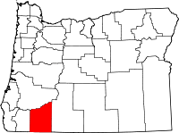 | |
| CDPs | ||
| Other unincorporated communities | ||
| Ghost towns | ||