McLaughlin, South Dakota
| McLaughlin, South Dakota Matȟó Akicita | |
|---|---|
| City | |
|
Main Street in McLaughlin | |
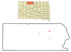 Location in Corson County and the state of South Dakota | |
| Coordinates: 45°48′47″N 100°48′41″W / 45.81306°N 100.81139°WCoordinates: 45°48′47″N 100°48′41″W / 45.81306°N 100.81139°W | |
| Country | United States |
| State | South Dakota |
| County | Corson |
| Incorporated | 1909[1] |
| Area[2] | |
| • Total | 0.40 sq mi (1.04 km2) |
| • Land | 0.40 sq mi (1.04 km2) |
| • Water | 0 sq mi (0 km2) |
| Elevation | 2,001 ft (610 m) |
| Population (2010)[3] | |
| • Total | 663 |
| • Estimate (2015)[4] | 679 |
| • Density | 1,657.5/sq mi (640.0/km2) |
| Time zone | Mountain (MST) (UTC-7) |
| • Summer (DST) | MDT (UTC-6) |
| ZIP code | 57642 |
| Area code(s) | 605 |
| FIPS code | 46-40020[5] |
| GNIS feature ID | 1256396[6] |

McLaughlin (Lakota: matȟó wakpá;[7] "Bear Soldier" or "Blue Soldier") is a city in Corson County, South Dakota, United States. The population was 663 at the 2010 census. It is the largest city on the Standing Rock Indian Reservation.
History
The town is named after US Indian Service Agent James McLaughlin,[8] who supervised the Standing Rock Indian Agency from 1881 to 1895. He moved to Washington, DC, where he was Inspector of the Bureau of Indian Affairs and Department of the Interior. After his death in 1923, his body was returned here for burial.
Geography
McLaughlin is located at 45°48′47″N 100°48′41″W / 45.81306°N 100.81139°W (45.813029, -100.811447).[9]
According to the United States Census Bureau, the city has a total area of 0.40 square miles (1.04 km2), all of it land.[2]
McLaughlin has been assigned the ZIP code 57642 and the FIPS place code 40020.
Demographics
| Historical population | |||
|---|---|---|---|
| Census | Pop. | %± | |
| 1920 | 555 | — | |
| 1930 | 678 | 22.2% | |
| 1940 | 660 | −2.7% | |
| 1950 | 713 | 8.0% | |
| 1960 | 983 | 37.9% | |
| 1970 | 863 | −12.2% | |
| 1980 | 754 | −12.6% | |
| 1990 | 780 | 3.4% | |
| 2000 | 775 | −0.6% | |
| 2010 | 663 | −14.5% | |
| Est. 2015 | 679 | [10] | 2.4% |
| U.S. Decennial Census[11] 2015 Estimate[4] | |||
2010 census
As of the census[3] of 2010, there were 663 people, 233 households, and 154 families residing in the city. The population density was 1,657.5 inhabitants per square mile (640.0/km2). There were 270 housing units at an average density of 675.0 per square mile (260.6/km2). The racial makeup of the city was 28.1% White, 65.3% Native American, 0.9% Asian, 0.2% Pacific Islander, 1.1% from other races, and 4.5% from two or more races. Hispanic or Latino of any race were 3.8% of the population.
There were 233 households of which 43.8% had children under the age of 18 living with them, 33.9% were married couples living together, 21.9% had a female householder with no husband present, 10.3% had a male householder with no wife present, and 33.9% were non-families. 29.2% of all households were made up of individuals and 9% had someone living alone who was 65 years of age or older. The average household size was 2.84 and the average family size was 3.54.
The median age in the city was 31 years. 31.8% of residents were under the age of 18; 10.7% were between the ages of 18 and 24; 21.6% were from 25 to 44; 24.2% were from 45 to 64; and 11.8% were 65 years of age or older. The gender makeup of the city was 49.2% male and 50.8% female.
2000 census
As of the census[5] of 2000, there were 775 people, 268 households, and 181 families residing in the city. The population density was 1,835.1 people per square mile (712.5/km²). There were 291 housing units at an average density of 689.1 per square mile (267.5/km²). The racial makeup of the city was 41.29% White, 0.13% African American, 55.74% Native American, 0.13% from other races, and 2.71% from two or more races. Hispanic or Latino of any race were 4.77% of the population.
There were 268 households out of which 33.6% had children under the age of 18 living with them, 40.7% were married couples living together, 20.9% had a female householder with no husband present, and 32.1% were non-families. 27.6% of all households were made up of individuals and 11.9% had someone living alone who was 65 years of age or older. The average household size was 2.89 and the average family size was 3.48.
In the city the population was spread out with 33.3% under the age of 18, 9.7% from 18 to 24, 25.9% from 25 to 44, 18.5% from 45 to 64, and 12.6% who were 65 years of age or older. The median age was 30 years. For every 100 females there were 93.3 males. For every 100 females age 18 and over, there were 86.0 males.
The median income for a household in the city was $22,500, and the median income for a family was $31,111. Males had a median income of $22,500 versus $18,229 for females. The per capita income for the city was $10,682. About 15.8% of families and 25.8% of the population were below the poverty line, including 34.8% of those under age 18 and 30.0% of those age 65 or over.
References
- ↑ "SD Towns" (PDF). South Dakota State Historical Society. Retrieved 2010-02-14.
- 1 2 "US Gazetteer files 2010". United States Census Bureau. Archived from the original on January 24, 2012. Retrieved 2012-06-21.
- 1 2 "American FactFinder". United States Census Bureau. Retrieved 2012-06-21.
- 1 2 "Population Estimates". United States Census Bureau. Retrieved June 12, 2016.
- 1 2 "American FactFinder". United States Census Bureau. Archived from the original on September 11, 2013. Retrieved 2008-01-31.
- ↑ "US Board on Geographic Names". United States Geological Survey. 2007-10-25. Retrieved 2008-01-31.
- ↑ Ullrich, Jan F. (2014). New Lakota Dictionary (2nd ed.). Bloomington, IN: Lakota Language Consortium. ISBN 978-0-9761082-9-0.
- ↑ Federal Writers' Project (1940). South Dakota place-names, v.1-3. University of South Dakota. p. 49.
- ↑ "US Gazetteer files: 2010, 2000, and 1990". United States Census Bureau. 2011-02-12. Retrieved 2011-04-23.
- ↑ "Annual Estimates of the Resident Population for Incorporated Places: April 1, 2010 to July 1, 2015". Retrieved July 2, 2016.
- ↑ United States Census Bureau. "Census of Population and Housing". Archived from the original on May 11, 2015. Retrieved June 12, 2016.
Municipalities and communities of Corson County, South Dakota, United States | ||
|---|---|---|
| Cities |  | |
| Town | ||
| CDPs | ||
| Unincorporated communities | ||
| Indian reservation | ||
| Ghost town | ||
| Footnotes | ‡This populated place also has portions in an adjacent county or counties | |