McIlwraith Range
| McIlwraith | |
|---|---|
 The range is an important area for Southern Cassowaries | |
| Highest point | |
| Peak | unnamed peak (northeast of Coen) |
| Elevation | 824 m (2,703 ft) [1] AHD |
| Coordinates | 13°54′26″S 143°18′40″E / 13.90722°S 143.31111°E |
| Dimensions | |
| Area | 3,000 km2 (1,200 sq mi) |
| Geography | |
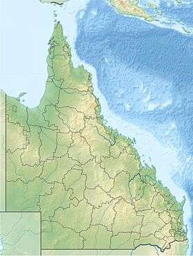 Location of the McIlwraith Range in Queensland | |
| Country | Australia |
| State | Queensland |
| Range coordinates | 13°45′S 143°20′E / 13.75°S 143.33°ECoordinates: 13°45′S 143°20′E / 13.75°S 143.33°E |
| Parent range | Great Dividing Range |
| Geology | |
| Formed by | Volcanic plug |
| Age of rock | Cretaceous and Permian |
| Type of rock | Granite plateau |
The McIlwraith Range is a rugged, dissected granite plateau on the Cape York Peninsula of Far North Queensland, Australia. Part of the Great Dividing Range, the McIlwraith Range covers about 3,000 square kilometres (1,200 sq mi) and lies about 15 kilometres (9.3 mi) east of the town of Coen, and 550 kilometres (340 mi) north of Cairns. The Archer and Stewart Rivers rise in the range, with the Archer draining the range's western slopes into the Gulf of Carpentaria and the Stewart draining east into the Coral Sea. The range receives an annual rainfall of about 1,500 millimetres (59 in).
Environment
The McIlwraith Range has been protected since its gazettal as the Kulla (McIlwraith Range) National Park. It is also listed on Australia's Register of the National Estate. It was named after Sir Thomas McIlwraith (1835–1900), three time Premier of Queensland 1879–1883, 1888, and 1893.
With most of the range being about 450 metres (1,480 ft) AHD , and with a high point of 824 metres (2,703 ft), just north-east of Coen. The major peaks are Mount Carter, Mount White, Mount Newberry, and Mount Walsh.[2] The range is largely vegetated with a variety of rainforest types, forming the southernmost limit of the ranges of many plants and animals characteristic of New Guinea. These include the spotted cuscus, green tree python and palm cockatoo.[1][3] An endemic species is the McIlwraith leaf-tailed gecko (Orraya occultus).
Birds
The range is part of the 6,205 square kilometres (2,396 sq mi) McIlwraith and Iron Ranges Important Bird Area (IBA), identified as such by BirdLife International because it is one of the few known sites for the endangered buff-breasted buttonquail. The IBA also supports an isolated population of southern cassowaries as well as populations of lovely fairywrens, silver-crowned friarbirds, yellow, yellow-spotted, white-streaked and banded honeyeaters, and white-browed robins.[4]
References
- 1 2 "McIlwraith Range (Place ID 18047)". Australian Heritage Database. Department of the Environment.
- ↑ "Mountain Systems (Orography) of Australia". 1301.0 – Year Book Australia, 1910. Bureau of Statistics, Australian Government. 25 January 1909. Retrieved 31 October 2015.
- ↑ KULLA (McIlwraith Range) National Park: Nature, culture and history. Department of Environment and Resource Management. Retrieved on 20 October 2011.
- ↑ "IBA: McIlwraith and Iron Ranges". Birdata. Birds Australia. Archived from the original on 6 July 2011. Retrieved 12 July 2011.
Further reading
- Willmott, Warwick (30 August 2009). "Cape York Peninsula Areas of International Conservation Significance: The Geological Story of Cape York Peninsula" (PDF). Department of Environment and Resource Management. Queensland Government. pp. 19–20.