McEwen, Oregon
| McEwen, Oregon | |
|---|---|
| Unincorporated community | |
|
Community church in McEwen | |
 McEwen, Oregon  McEwen, Oregon | |
| Coordinates: 44°42′03″N 118°06′17″W / 44.70083°N 118.10472°WCoordinates: 44°42′03″N 118°06′17″W / 44.70083°N 118.10472°W | |
| Country | United States |
| State | Oregon |
| County | Baker |
| Elevation | 4,150 ft (1,260 m) |
| Time zone | Pacific (PST) (UTC-8) |
| • Summer (DST) | PDT (UTC-7) |
| Area code(s) | 458 and 541 |
| GNIS feature ID | 1136524[1] |

McEwen is an unincorporated community in Baker County, Oregon, United States.[1] McEwen lies on Oregon Route 7 east of its interchange with Oregon Route 410.[2] McEwen is about 6 miles (10 km) southeast of Sumpter along the Powder River.[2]
McEwen was founded as a logging town, platted in 1891, and then was a rail stop on the Sumpter Valley Railway.[3] It was named after a Mormon missionary who converted Charles W. Nibley's parents to the LDS Church.[4]
Oregon Geographic Names links the community name to Thomas McEwen, a settler who filed a land claim here in 1888. The McEwen post office opened in 1893 and closed in 1943.[5]
References
- 1 2 "McEwen". Geographic Names Information System. United States Geological Survey. November 28, 1980. Retrieved November 11, 2016.
- 1 2 Oregon Atlas & Gazetteer (7th ed.). Yarmouth, Maine: DeLorme. 2008. p. 78. ISBN 0-89933-347-8.
- ↑ Bailey, Barbara Ruth (1982). Main Street: Northeastern Oregon. Oregon Historical Society. pp. 21, 51. ISBN 0-87595-073-6.
- ↑ Deumling, Dietrich (May 1972). The Roles of the Railroad in the Development of the Grande Ronde Valley (masters thesis). Flagstaff, Arizona: Northern Arizona University. OCLC 4383986.
- ↑ McArthur, Lewis A.; McArthur, Lewis L. (2003) [1928]. Oregon Geographic Names (7th ed.). Portland, Oregon: Oregon Historical Society Press. p. 625. ISBN 978-0875952772.
External links
- Photos of McEwen by Chris and Tina Pfeiffer and Pwaully73
Municipalities and communities of Baker County, Oregon, United States | ||
|---|---|---|
| Cities | 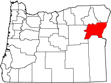 | |
| Unincorporated communities | ||
| Ghost towns | ||
This article is issued from Wikipedia - version of the 11/11/2016. The text is available under the Creative Commons Attribution/Share Alike but additional terms may apply for the media files.