McDonough, Georgia
| McDonough, Georgia | |
|---|---|
| City | |
|
Henry County Courthouse | |
| Nickname(s): The Geranium City | |
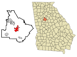 Location in Henry County and the state of Georgia | |
 McDonough Location of McDonough in Metro Atlanta | |
| Coordinates: 33°26′42″N 84°8′57″W / 33.44500°N 84.14917°WCoordinates: 33°26′42″N 84°8′57″W / 33.44500°N 84.14917°W | |
| Country | United States |
| State | Georgia |
| County | Henry |
| Area | |
| • Total | 12.9 sq mi (33.4 km2) |
| • Land | 12.7 sq mi (32.9 km2) |
| • Water | 0.2 sq mi (0.5 km2) |
| Elevation | 863 ft (263 m) |
| Population (2010) | |
| • Total | 22,084 |
| • Density | 1,737.4/sq mi (670.6/km2) |
| Time zone | Eastern (EST) (UTC-5) |
| • Summer (DST) | EDT (UTC-4) |
| ZIP codes | 30252-30253 |
| Area code(s) | 770/678/470 |
| FIPS code | 13-48624[1] |
| GNIS feature ID | 0317901[2] |
| Website | www.mcdonoughga.org |

McDonough is a city in Henry County, Georgia, United States. It is part of the Atlanta metropolitan area. Its population was 22,084 at the 2010 census. Inclusion of the unincorporated neighborhoods surrounding McDonough, which are not part of a town/city, raises the population to approximately 30,000 from an estimate in 2008. The city is the county seat of Henry County.[3] It is the home of AM radio station Classic Country 1410 WKKP and SCB-TV cable Channel 15 television station.
The census-designated place of Blacksville and the unincorporated communities of Flippen, Kelleytown, and Ola are located near McDonough, and addresses in those communities have McDonough postal addresses.
History
The town was named for naval officer Commodore Thomas MacDonough[4] and founded in 1823 around a traditional town square design. The buildings surrounding the square are intact, although there are some vacancies. The county courthouse and historic jail building are on the north side near the Welcome Center in a historically maintained Standard Oil service station, built in 1920. The station also houses the Main Street Program Office and Hospitality and Tourism Office. In the center of the square is a monument to Henry County's Confederate dead.
One block east of the square, the town's original cotton warehouse has been replaced with the Henry County Judicial Center. In the same area the Henry County Courthouse Annex has an original oil on canvas "Cotton Gin" (4½ by 11 feet) by artist Jean Charlot. He painted this oil in 1942 for the town post office. His works can be found all over the world in everything from children's books to large murals.
The town was a relay station on the New York to New Orleans stagecoach line and was connected by other stage lines with Fayetteville and Decatur, and with Macon by way of Jackson.[5]
On June 24, 1900, a washout during a thunderstorm caused a train wreck about 1½ miles (2.4 km) north of town. The runoff undermined about 100 feet (30 m) of the Southern Railway (Macon division) prior to the accident, and the passenger train subsequently caught fire, killing 39.[6]
Geography
According to the United States Census Bureau, the city has a total area of 12.9 square miles (33 km2), of which 12.7 square miles (33 km2) is land and 0.2 square miles (0.52 km2) (1.6%) is water.
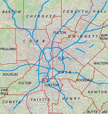
Transportation
- Xpress GA provides local bus service.
McDonough is served by the following highways:
 Interstate 75
 U.S. Highway 23
 Georgia State Route 20
 Georgia State Route 42
 Georgia State Route 81
 Georgia State Route 155
 Georgia State Route 351
 Georgia State Route 401
Demographics
| Historical population | |||
|---|---|---|---|
| Census | Pop. | %± | |
| 1870 | 320 | — | |
| 1880 | 320 | 0.0% | |
| 1890 | 515 | 60.9% | |
| 1900 | 683 | 32.6% | |
| 1910 | 882 | 29.1% | |
| 1920 | 1,263 | 43.2% | |
| 1930 | 1,068 | −15.4% | |
| 1940 | 1,232 | 15.4% | |
| 1950 | 1,635 | 32.7% | |
| 1960 | 2,224 | 36.0% | |
| 1970 | 2,675 | 20.3% | |
| 1980 | 2,778 | 3.9% | |
| 1990 | 2,929 | 5.4% | |
| 2000 | 8,493 | 190.0% | |
| 2010 | 22,084 | 160.0% | |
| Est. 2015 | 23,417 | [7] | 6.0% |
2000 census
At the 2000 census,[1] there were 8,493 people, 3,069 households and 2,102 families residing in the city. The population density was 1,093.8 per square mile (422.6/km²). There were 3,234 housing units at an average density of 416.5 per square mile (160.9/km²). The racial makeup of the city was 61.4% white, 34.3% African American, 0.2% Native American, 1.4% Asian, 1.8% from other races, and 1% from two or more races. Hispanic or Latino of any race were 3.7% of the population.
There were 3,069 households of which 35.7% had children under the age of 18 living with them, 45.2% were married couples living together, 18.8% had a female householder with no husband present, and 31.5% were non-families. 25.4% of all households were made up of individuals and 8.0% had someone living alone who was 65 years of age or older. The average household size was 2.61 and the average family size was 3.14.
26.4% of the population were under the age of 18, 10.6% from 18 to 24, 34.1% from 25 to 44, 16.8% from 45 to 64, and 12.1% who were 65 years of age or older. The median age was 31 years. For every 100 females there were 90.3 males. For every 100 females age 18 and over, there were 86.1 males.
The median household income was $40,482 and the median family income was $46,818. Males had a median income of $34,669 versus $28,318 for females. The per capita income for the city was $19,029. About 9.6% of families and 12.8% of the population were below the poverty line, including 13.3% of those under age 18 and 18.3% of those age 65 or over.
Although it is considered to be located in Stockbridge many of the Eagle's Landing Country Club's homes are within McDonough's 30253 zip code.
2010 census
As of the 2010 United States Census, there were 22,084 people, 8,053 households, and 5,404 families residing in the city.[9] The population density was 1,737.4 inhabitants per square mile (670.8/km2). There were 9,063 housing units at an average density of 713.6 per square mile (275.5/km2).[10] The racial makeup of the city was 34.8% white, 58.2% black or African American, 1.8% Asian, 0.3% American Indian, 0.1% Pacific islander, 2.2% from other races, and 2.6% from two or more races. Those of Hispanic or Latino origin made up 6.1% of the population.[9]
Of the 8,053 households, 38.8% had children under the age of 18 living with them, 38.3% were married couples living together, 23.3% had a female householder with no husband present, 32.9% were non-families, and 28.1% of all households were made up of individuals. The average household size was 2.64 and the average family size was 3.25. The median age was 33.1 years.[9]
Media
WKKP is the local radio media outlet. It broadcasts 24 hours a day on 100.9 FM and 1410 AM, and has a classic country format. It also broadcasts AP network news at the top of each hour.
The Henry Herald and the Henry County Times are the local county news print media.
Industry
Snapper Inc. manufacturing residential and professional lawn care and snow removal equipment, was based in McDonough. The company began in 1894 as Southern Saw Works, and claims to have invented the first self-propelled rotary lawn mower. The company was sold to Briggs and Stratton, which operated the plant until its closure in 2015.
Goya Foods has its Atlanta offices in an unincorporated area near McDonough.[11][12]
Events and festivals
- Geranium Festival
The city hosts a Geranium Festival each springtime on the third Saturday in May, celebrating the locally grown flowers and community. The one-day festival serves as a showcase of local artistry and talent through the open-air craft markets and live musical performances. The festival is sponsored by the McDonough Lions Club, and held on the McDonough Square. 2009 marks the 32nd anniversary of the festival.
Film
- The film A Madea Christmas by Tyler Perry was filmed in the town square and all around McDonough.
- The television show, Resurrection was filmed in the town square and all around McDonough and was aired March 2014.[13]
- Scenes for the 1977 movie Pickle Strikes Back III were filmed in the town.
- Scenes for the 1989 Oscar-winning Civil War epic, Glory were filmed in the town.
- A pilot episode for the WB show Roswell was filmed on the city square at the old Phillips 66 service station.
- A scene from the movie We Are Marshall was filmed on Hwy. 155 near Miller's Mill.
- "The McDonough Road" is mentioned by Rhett Butler in the 1939 classic, Gone with the Wind.
- The 1977 film Smokey and the Bandit was filmed primarily in Georgia in the cities of McDonough, Jonesboro, and Lithonia.
Education
Henry County School District
The Henry County School District holds grades pre-school to grade twelve. The district has twenty eight elementary schools, nine middle schools, and ten high schools.[14] The district has 1,543 full-time teachers and over 40,000 students.[15]
Elementary schools
- Cotton Indian Elementary School
- Dutchtown Elementary School
- East Lake Elementary School
- Flippen Elementary School
- Hickory Flat Charter Elementary School
- McDonough Elementary School
- New Hope Elementary School
- Oakland Elementary School
- Ola Elementary School
- Pleasant Grove Elementary School
- Rock Spring Elementary School
- Union Grove Elementary School
- Timber Ridge Elementary School
- Tussahaw Elementary School
- Unity Grove Elementary School
- Walnut Creek Elementary School
- Wesley Lakes Elementary School
Middle schools
- Eagle's Landing Middle School
- Henry County Middle School
- Ola Middle School
- Woodland Middle School
- Union Grove Middle School
High schools
- Academy for Advanced Studies McDonough, GA
- Dutchtown High School
- Eagle's Landing High School
- Hampton High School
- Henry County Evening Academy
- Henry County High School
- Ola High School
- Union Grove High School
- Stockbridge High School
- Woodland High School
Private schools
- Eagle's Landing Christian Academy[16]
- Community Christian School[17]
- Strong Rock Christian School
- New Creation Christian Academy[18]
- Creekside Christian Academy[19]
- Lake Dow Christian Academy
- Living Word Christian
- McDonough Christian Academy
- Sunbrook Academy at Luella [20]
- The Sharon School
- Peoples Baptist AcademyPBA
Online schools
Higher education
- Gordon State College has a satellite center in McDonough and has been a partner with the Academy for Advanced Studies since 2009. Gordon State @ McDonough offers day and evening classes and has a weekend college program dedicated to Human Services baccalaureate degree.[21]
- Mercer University has a Regional Academic Center in McDonough. The center, opened in 2003, offers Teacher Education programs through the university's Tift College of Education as well as programs in Criminal Justice and General Studies in[22] the College of Continuing and Professional Studies. Additionally, Atlanta Bible College is located in McDonough.
Notable people
- Darrell Armstrong, former NBA player; lives in McDonough
- Erasmus W. Beck, United States Congressman; born in McDonough in 1833.
- Herman Cain, businessman and candidate for the 2012 Republican presidential nomination; lives in McDonough[23]
- Jason Heyward, Former Atlanta Braves All-Star outfielder and first-round selection in the 2007 Major League Baseball Draft. Current starting outfielder for the Chicago Cubs
- James T. Holtzclaw, Confederate general in the American Civil War; born in McDonough in 1833.
- Kristal Marshall, former WWE Diva.
- Matt Murton, Hanshin Tigers outfielder; former MLB player with the Chicago Cubs, Oakland Athletics, and Colorado Rockies; went to high school in McDonough.
- J.R. Pinnock, George Washington Colonials guard; went to high school in McDonough.
- Renford Reese, Ph.D., son of pioneer sports writer Earnest Reese (Atlanta Journal-Constitution); professor, author, founder, Colorful Flags program at Cal Poly Pomona University; grew up/went to high school in McDonough (graduated 1985). .
- Andrew Sloan, United States Congressman; born in McDonough in 1845.
- James W. Wise, United States Congressman; born in McDonough in 1868.
- D.J. White, Professional football cornerback for the Kansas City Chiefs
- The Emotron (b. Jason Kyle Knight); one man punk and electronic band; from McDonough and played many shows at the McDonough American Legion.
- Casting Crowns Contemporary Christian band including frontman Mark Hall; their ministry is based at Eagle's Landing First Baptist Church in McDonough.
References
- 1 2 "American FactFinder". United States Census Bureau. Retrieved 2008-01-31.
- ↑ "US Board on Geographic Names". United States Geological Survey. 2007-10-25. Retrieved 2008-01-31.
- ↑ "Find a County". National Association of Counties. Archived from the original on May 31, 2011. Retrieved 2011-06-07.
- ↑ Gannett, Henry (1905). The Origin of Certain Place Names in the United States. U.S. Government Printing Office. p. 193.
- ↑ , Accessed 24 April 2009
- ↑ http://www3.gendisasters.com/georgia/7634/mcdonough-ga-train-wreck-jun-1900
- ↑ "Annual Estimates of the Resident Population for Incorporated Places: April 1, 2010 to July 1, 2015". Retrieved July 2, 2016.
- ↑ "Census of Population and Housing". Census.gov. Archived from the original on May 11, 2015. Retrieved June 4, 2015.
- 1 2 3 "DP-1 Profile of General Population and Housing Characteristics: 2010 Demographic Profile Data". United States Census Bureau. Retrieved 2016-11-28.
- ↑ "Population, Housing Units, Area, and Density: 2010 - County". United States Census Bureau. Retrieved 2016-11-28.
- ↑ "Contact Us." Goya Foods. Retrieved on March 26, 2016. "Goya Atlanta 4005 Haworth Parkway McDonough, GA 30253"
- ↑ Maps of McDonough." U.S. Census Bureau. Retrieved on April 19, 2016.
- ↑ Resurrection (U.S. TV series)
- ↑ Georgia Board of Education, Retrieved June 19, 2010.
- ↑ School Stats, Retrieved June 19, 2010.
- ↑ Eagle's Landing Christian Academy, Retrieved June 19, 2010.
- ↑ Community Christian School, Retrieved June 19, 2010.
- ↑ New Creation Center, Retrieved June 19, 2010.
- ↑ Creekside Christian Academy, Retrieved August 8, 2010.
- ↑ Sunbrook Academy at Luella
- ↑ http://www.gordonstate.edu
- ↑ http://www.mercer.edu
- ↑ Reinhard, Beth (2011-05-20). "Home is Where the Votes Are". National Journal. Retrieved 21 May 2011.
External links
- City of McDonough
- Henry Herald
- Henry County School System
- Henry Neighbor Newspaper
- The Henry County Times Newspaper
- Henry County Chamber of Commerce
- Geranium Festival
- Taste of Henry
- Kelleytown, GA
- A Friend's House
- Community Gardens of Henry County
- Shingleroof Campground historical marker
|  | |||||||
|
| ||||||||
| ||||||||
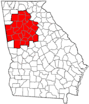
Municipalities and communities of Henry County, Georgia, United States | ||
|---|---|---|
| Cities | 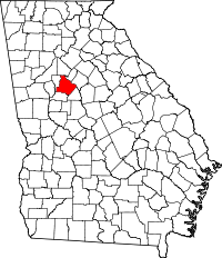 | |
| CDP | ||
| Unincorporated communities | ||
| Footnotes | ‡This populated place also has portions in an adjacent county or counties | |
Template:Georgia