McArthur, Arkansas
| McArthur, Arkansas | |
|---|---|
| Unincorporated community | |
 McArthur, Arkansas McArthur's position in Arkansas | |
| Coordinates: 33°41′22.4″N 91°20′5.4″W / 33.689556°N 91.334833°WCoordinates: 33°41′22.4″N 91°20′5.4″W / 33.689556°N 91.334833°W | |
| Country |
|
| State |
|
| County | Desha |
| Township | Clayton |
| Elevation[1] | 45 m (148 ft) |
| Time zone | Central (CST) (UTC-6) |
| • Summer (DST) | CDT (UTC-5) |
| ZIP code | 71654 |
| Area code(s) | 870 |
| GNIS feature ID | 58138 |
| U.S. Geological Survey Geographic Names Information System: McArthur, Arkansas | |
McArthur is an unincorporated community in Clayton Township, Desha County, Arkansas.[1] It is located on Arkansas Highway 1 northeast of McGehee.[2]
McArthur is one of two possible sites of the death of Hernando de Soto. The Natives of the region called the Mississippi River "Tamaliseu", while De Soto christened it "Río del Espíritu Santo". Afraid of revealing to the Native Americans that he was a mortal and not a deity, he opted for a watery burial under the Mississippi.[3]
References
- 1 2 "McArthur, Arkansas". Geographic Names Information System. United States Geological Survey. Retrieved January 20, 2012.
- ↑ Arkansas Atlas and Gazetteer (Map) (Second ed.). DeLorme. § 22.
- ↑ Davidson, James West. After the Fact: The Art of Historical Detection Volume 1. Mc Graw Hill, New York 2010, Chapter 1, p. 1
Municipalities and communities of Desha County, Arkansas, United States | ||
|---|---|---|
| Cities | 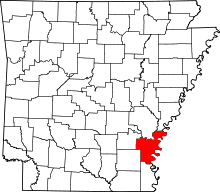 | |
| Towns | ||
| Unincorporated communities | ||
| Ghost town | ||
| Footnotes | ‡This populated place also has portions in an adjacent county or counties | |
This article is issued from Wikipedia - version of the 7/7/2015. The text is available under the Creative Commons Attribution/Share Alike but additional terms may apply for the media files.