Maybrook, New York
| Maybrook | |
| Village | |
 Village hall, 2015 | |
| Country | United States |
|---|---|
| State | New York |
| Region | Hudson Valley |
| County | Orange |
| Towns | Montgomery, Hamptonburgh |
| Elevation | 420 ft (128 m) |
| Coordinates | 41°29′21″N 74°12′48″W / 41.48917°N 74.21333°WCoordinates: 41°29′21″N 74°12′48″W / 41.48917°N 74.21333°W |
| Highest point | Unnamed hill near west village line |
| - elevation | 520 ft (158 m) |
| - coordinates | 41°29′17″N 74°13′12″W / 41.48806°N 74.22000°W |
| Lowest point | Swampy area in northeast corner |
| - elevation | 360 ft (110 m) |
| - coordinates | 41°29′48″N 74°12′09″W / 41.49667°N 74.20250°W |
| Area | 1.3 sq mi (3 km2) |
| - land | 1.3 sq mi (3 km2) |
| Population | 2,958 (2010) |
| Founded | 1926 |
| Mayor | Dennis K. Leahy |
| Timezone | Eastern (EST) (UTC-5) |
| - summer (DST) | EDT (UTC-4) |
| ZIP Code | 12543 |
| Area code | 845 |
| Exchange | 427 |
| FIPS code | 36-46162 |
| GNIS feature ID | 0956701 |
 Location in Orange County and the state of New York. | |
| Wikimedia Commons: Maybrook, New York | |
Maybrook is a village in Orange County, New York, United States. The population was 2,958 at the 2010 census. It is part of the Poughkeepsie–Newburgh–Middletown, NY Metropolitan Statistical Area as well as the larger New York–Newark–Bridgeport, NY-NJ-CT-PA Combined Statistical Area.
It is located mostly in the Town of Montgomery, but a small portion is in the Town of Hamptonburgh. It is also defined by the 427 telephone exchange in the 845 area code and the 12543 ZIP code, as well as its own eponymous fire district.
Geography
Maybrook is located at 41°29′12″N 74°12′52″W / 41.48667°N 74.21444°W (41.486660, -74.214463).[1]
According to the United States Census Bureau, the village has a total area of 1.3 square miles (3.4 km2), all of it land. The village is centered on NY 208 which runs through it for the village's two-mile (3.2 km) length in a northeast-southwest orientation, from the small extension in the Town of Hamptonburgh to its northern boundary. By contrast, it is only a mile wide at its widest point, near its south end, and even narrower to the north.
The village is mostly flat, rising up to hills on its west side. The summit of one is its highest elevation, at 520 feet (160 m) above sea level. Maybrook's lowest point is a swampy, undeveloped area in its northeast corner, 360 feet (110 m) in elevation.
Demographics
| Historical population | |||
|---|---|---|---|
| Census | Pop. | %± | |
| 1930 | 1,159 | — | |
| 1940 | 1,189 | 2.6% | |
| 1950 | 1,316 | 10.7% | |
| 1960 | 1,348 | 2.4% | |
| 1970 | 1,536 | 13.9% | |
| 1980 | 2,007 | 30.7% | |
| 1990 | 2,802 | 39.6% | |
| 2000 | 3,084 | 10.1% | |
| 2010 | 2,958 | −4.1% | |
| Est. 2015 | 3,286 | [2] | 11.1% |
As of the census[4] of 2000, there were 3,084 people, 1,043 households, and 780 families residing in the village. The population density was 2,306.3 people per square mile (888.6/km²). There were 1,077 housing units at an average density of 805.4 per square mile (310.3/km²). The racial makeup of the village was 82.81% White, 8.98% African American, 0.29% Native American, 1.20% Asian, 3.99% from other races, and 2.72% from two or more races. Hispanic or Latino of any race were 12.74% of the population.

There were 1,043 households out of which 46.3% had children under the age of 18 living with them, 54.3% were married couples living together, 14.7% had a female householder with no husband present, and 25.2% were non-families. 19.9% of all households were made up of individuals and 7.1% had someone living alone who was 65 years of age or older. The average household size was 2.95 and the average family size was 3.41.
In the village the population was spread out with 32.7% under the age of 18, 8.2% from 18 to 24, 32.8% from 25 to 44, 19.0% from 45 to 64, and 7.4% who were 65 years of age or older. The median age was 32 years. For every 100 females there were 95.2 males. For every 100 females age 18 and over, there were 92.7 males.
The median income for a household in the village was $52,872, and the median income for a family was $56,912. Males had a median income of $40,165 versus $30,385 for females. The per capita income for the village was $19,194. About 3.6% of families and 6.1% of the population were below the poverty line, including 6.9% of those under age 18 and 11.2% of those age 65 or over.
History
The hamlet did not incorporate as a village until 1926, making it the last of the Town of Montgomery's three villages to do so. Its growth was spurred by the development of Maybrook Yard, an important railroad switching terminal where eastbound traffic from several railroads was funneled across the Poughkeepsie Bridge.[5] At its peak, the yard employed over 1,500 workers. All yards, terminals and roundhouses have since been removed following the closing of the Poughkeepsie Bridge in 1974. The Middletown and New Jersey Railroad currently operates trains to Maybrook.
Maybrook is accessible by Interstate 84, the New York State Thruway and Stewart International Airport. Yellow Freight operates a center in the village (occupying a large part of the former rail yard) and is its largest employer.
Popular culture
Maybrook is referenced in the seventh volume of The Dark Tower by popular horror novelist Stephen King as the home of minor character Justine Anderson, who is present when the fictionalized version of King is struck by Bryan Smith's van.
See also
References
- ↑ "US Gazetteer files: 2010, 2000, and 1990". United States Census Bureau. 2011-02-12. Retrieved 2011-04-23.
- ↑ "Annual Estimates of the Resident Population for Incorporated Places: April 1, 2010 to July 1, 2015". Retrieved July 2, 2016.
- ↑ "Census of Population and Housing". Census.gov. Retrieved June 4, 2015.
- ↑ "American FactFinder". United States Census Bureau. Retrieved 2008-01-31.
- ↑ abandonedrails.com
External links
| Wikimedia Commons has media related to Maybrook, New York. |
Municipalities and communities of Orange County, New York, United States | ||
|---|---|---|
| Cities | 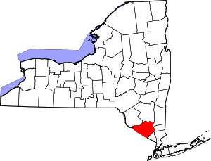 | |
| Towns | ||
| Villages | ||
| CDPs | ||
| Other hamlets | ||