Max, North Dakota
| Max, North Dakota | |
|---|---|
| City | |
| Motto: Live life to the Max! | |
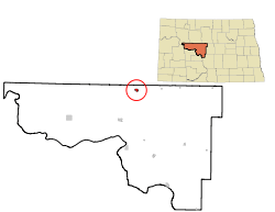 Location of Max, North Dakota | |
| Coordinates: 47°49′20″N 101°17′44″W / 47.82222°N 101.29556°WCoordinates: 47°49′20″N 101°17′44″W / 47.82222°N 101.29556°W | |
| Country | United States |
| State | North Dakota |
| County | McLean |
| Established | 1906 |
| Government | |
| • Type | City Council of Four Aldermen |
| • Mayor | Joel Hauf |
| • Aldermen |
Dick Gray (Council President – law enforcement) Randy Swanson (Vice President – water) Jon Hauf (streets) Chad Talbott |
| • City Auditor | Tonya Balaban |
| • Municipal Judge | Don Krebsbach |
| Area[1] | |
| • Total | 0.78 sq mi (2.02 km2) |
| • Land | 0.78 sq mi (2.02 km2) |
| • Water | 0 sq mi (0 km2) |
| Elevation | 2,093 ft (638 m) |
| Population (2010)[2] | |
| • Total | 334 |
| • Estimate (2015)[3] | 342 |
| • Density | 428.2/sq mi (165.3/km2) |
| Time zone | Central (CST) (UTC-6) |
| • Summer (DST) | CDT (UTC-5) |
| ZIP code | 58759 |
| Area code(s) | 701 |
| FIPS code | 38-51380 |
| GNIS feature ID | 1030122[4] |
| Website | http://www.maxnd.com/ |
Max is a town in McLean County, North Dakota, United States. The population was 334 at the 2010 census.[5] Max was founded in 1906.
History
Before 1906, rumors were circulating that the Soo Line would lay track close to Elbow Lake, north of Garrison, to obtain water for their steam engines. On this prospect, enterprising businessmen swiftly began staking claims in anticipation of purchasing prime real estate in a new town. A haphazard shack-building boom ensued on the surrounding ambling prairies. On August 8, 1906, a surveyor named J.G. Sheldrick filed a certificate to plat what would become the Max townsite on a grid.[6]
The Soo Line came from the south and would have east and west branches at a junction to be named "Junction" or "Junction City". However, people started calling it Max's Post Office, after Max Freitag, eldest son of Paul Freitag. Paul Freitag was a local farmer and the first postmaster. Max asked people he met at the junction if they were coming to "his" post office to pick up their mail. The name, truncated to simply Max, stuck (in habit, if not officially). When the town was later moved two miles west to the present townsite, the name was changed officially to Max.[6]
The Central Light and Power Company installed street lights in January 1918.[6]
In 1947, Max decided to fully incorporate, with affairs managed by an elected mayor, and aldermanic council of four.[6]
In the early 1950s, the town obtained a new telephone system, updated fire equipment, waterworks, water mains and a sewerage system.[6]
Geography
Max is located at 47°49′20″N 101°17′44″W / 47.822171°N 101.295529°W.[7]
According to the United States Census Bureau, the city has a total area of 0.78 square miles (2.02 km2), all of it land.[1]
Demographics
| Historical population | |||
|---|---|---|---|
| Census | Pop. | %± | |
| 1910 | 285 | — | |
| 1920 | 473 | 66.0% | |
| 1930 | 500 | 5.7% | |
| 1940 | 423 | −15.4% | |
| 1950 | 465 | 9.9% | |
| 1960 | 410 | −11.8% | |
| 1970 | 301 | −26.6% | |
| 1980 | 330 | 9.6% | |
| 1990 | 301 | −8.8% | |
| 2000 | 278 | −7.6% | |
| 2010 | 334 | 20.1% | |
| Est. 2015 | 342 | [8] | 2.4% |
| U.S. Decennial Census[9] 2015 Estimate[3] | |||
2010 census
As of the census[2] of 2010, there were 334 people, 141 households, and 90 families residing in the city. The population density was 428.2 inhabitants per square mile (165.3/km2). There were 164 housing units at an average density of 210.3 per square mile (81.2/km2). The racial makeup of the city was 94.3% White, 2.7% Native American, and 3.0% from two or more races. Hispanic or Latino of any race were 0.3% of the population.
There were 141 households of which 29.1% had children under the age of 18 living with them, 53.2% were married couples living together, 5.7% had a female householder with no husband present, 5.0% had a male householder with no wife present, and 36.2% were non-families. 30.5% of all households were made up of individuals and 12.7% had someone living alone who was 65 years of age or older. The average household size was 2.37 and the average family size was 2.89.
The median age in the city was 37.7 years. 24.6% of residents were under the age of 18; 8.7% were between the ages of 18 and 24; 25.5% were from 25 to 44; 27.6% were from 45 to 64; and 13.8% were 65 years of age or older. The gender makeup of the city was 50.6% male and 49.4% female.
2000 census
As of the census of 2000, there were 278 people, 129 households, and 74 families residing in the city. The population density was 362.3 people per square mile (139.4/km2). There were 150 housing units at an average density of 195.5 per square mile (75.2/km2). The racial makeup of the city was 95.68% White, 1.44% Native American, 1.44% Asian, and 1.44% from two or more races.
There were 129 households out of which 28.7% had children under the age of 18 living with them, 48.8% were married couples living together, 7.8% had a female householder with no husband present, and 42.6% were non-families. 40.3% of all households were made up of individuals and 27.9% had someone living alone who was 65 years of age or older. The average household size was 2.16 and the average family size was 2.92.
In the city the population was spread out with 25.9% under the age of 18, 5.8% from 18 to 24, 21.9% from 25 to 44, 25.2% from 45 to 64, and 21.2% who were 65 years of age or older. The median age was 42 years. For every 100 females there were 87.8 males. For every 100 females age 18 and over, there were 80.7 males.
The median income for a household in the city was $27,321, and the median income for a family was $31,375. Males had a median income of $26,250 versus $16,563 for females. The per capita income for the city was $13,640. About 10.8% of families and 17.9% of the population were below the poverty line, including 28.8% of those under the age of eighteen and 21.0% of those sixty five or over.
Local politics
Jodi Gullickson, the mayor of Max preceding current mayor Richard Seklecki, faced an unsuccessful effort to recall her in a special election held in April 2007.[10] The recall election followed several resignations in Max's government in late 2006.[11]
Notes and references
- 1 2 "US Gazetteer files 2010". United States Census Bureau. Retrieved 2012-06-14.
- 1 2 "American FactFinder". United States Census Bureau. Retrieved 2012-06-14.
- 1 2 "Population Estimates". United States Census Bureau. Retrieved July 13, 2016.
- ↑ "US Board on Geographic Names". United States Geological Survey. 2007-10-25. Retrieved 2008-01-31.
- ↑ "2010 Census Redistricting Data (Public Law 94-171) Summary File". American FactFinder. United States Census Bureau. Retrieved 2 May 2011.
- 1 2 3 4 5 Margaret Zaderaka; Ethel Boettcher, contributor (June 1, 2009). "Max History". Retrieved July 20, 2009. Cite uses deprecated parameter
|coauthors=(help) - ↑ "US Gazetteer files: 2010, 2000, and 1990". United States Census Bureau. 2011-02-12. Retrieved 2011-04-23.
- ↑ "Annual Estimates of the Resident Population for Incorporated Places: April 1, 2010 to July 1, 2015". Retrieved July 2, 2016.
- ↑ United States Census Bureau. "Census of Population and Housing". Retrieved July 19, 2013.
- ↑ Staff (April 28, 2007). "The Weeklies". Originally printed in The Mclean County Independent. Bismarck Tribune . Retrieved August 8, 2010.
- ↑ Lauren Donovan, Compl. (October 14, 2006). "The Weeklies: Then there were three". Originally printed in The Mclean County Independent. Bismarck Tribune . Retrieved August 8, 2010.
External links
Municipalities and communities of McLean County, North Dakota, United States | ||
|---|---|---|
| Cities | 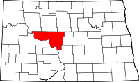 | |
| Townships |
| |
| CDP | ||
| Unorganized territories |
| |
| Unincorporated communities | ||
| Footnotes | ‡This populated place also has portions in an adjacent county or counties | |