Maumelle, Arkansas
| Maumelle, Arkansas | |
|---|---|
| City | |
 Location within Pulaski County (left) and Arkansas | |
 Maumelle, Arkansas Location in the United States | |
| Coordinates: 34°51′13″N 92°24′24″W / 34.85361°N 92.40667°WCoordinates: 34°51′13″N 92°24′24″W / 34.85361°N 92.40667°W | |
| Country | United States |
| State | Arkansas |
| County | Pulaski |
| Founded | 1974 |
| Incorporated | 1985 |
| Government | |
| • Mayor | Mike Watson |
| Area | |
| • City | 9.3 sq mi (24 km2) |
| • Land | 8.8 sq mi (22.8 km2) |
| • Water | 0.5 sq mi (1.2 km2) |
| Elevation | 341 ft (104 m) |
| Population (2010) | |
| • City | 17,163 |
| • Density | 1,199.3/sq mi (463.2/km2) |
| • Metro | 729,135 ('14) (Little Rock) |
| Time zone | CST (UTC-6) |
| • Summer (DST) | CDT (UTC-5) |
| ZIP codes | 72113, 72118 |
| Area code(s) | 501 |
| FIPS code | 05-44600 |
| GNIS feature ID | 0067577 |
| Website | City Website |
Maumelle is a city in Pulaski County, Arkansas, United States. As of the 2010 census, the city population was 17,163. The city is located northwest of Little Rock, bordering the opposite shore of the Arkansas River and is part of the Little Rock metropolitan area.
History
Maumelle was founded by Jess Odom with federal assistance from the Urban Growth and New Community Development Act.
Geography
Maumelle is located at 34°51′13″N 92°24′24″W / 34.85361°N 92.40667°W (34.853745, -92.406551).[1] According to the United States Census Bureau, the city has a total area of 12.05 square miles (31.2 km2), of which 8.8 square miles (23 km2) is land and 0.5 square miles (1.3 km2) (5.07%) is water.
Demographics
| Historical population | |||
|---|---|---|---|
| Census | Pop. | %± | |
| 1990 | 6,714 | — | |
| 2000 | 10,557 | 57.2% | |
| 2010 | 17,163 | 62.6% | |
| Est. 2015 | 17,931 | [2] | 4.5% |
Maumelle belongs to the Little Rock–North Little Rock–Conway Metropolitan Statistical Area.
As of the census[4] of 2010, there are 17,163 people, 6,531 households, and 3,174 families residing in the city. The population density is 463.2/km² (1,199.3/mi²). There are 4,294 housing units at an average density of 188.4/km² (487.8/mi²). The racial makeup of the city is 82.9% White, 12.1% Black or African American, 0.40% Native American, 2.3% Asian, 0.01% Pacific Islander, 0.41% from other races, and 0.97% from two or more races. 1.77% of the population are Hispanic or Latino of any race.
There are 6,531 households out of which 39.4% have children under the age of 18 living with them, 66.8% are married couples living together, 8.0% have a female householder with no husband present, and 23.1% are non-families. 19.8% of all households are made up of individuals and 6.0% have someone living alone who is 65 years of age or older. The average household size is 2.59 and the average family size is 2.94.
In the city the population is spread out with 25.8% under the age of 18, 5.6% from 18 to 24, 35.2% from 25 to 44, 25.5% from 45 to 64, and 10.2% who are 65 years of age or older. The median age is 36 years. For every 100 females there are 93.2 males. For every 100 females age 18 and over, there are 88.9 males.
The median income for a household in the city is $82,122, and the median income for a family is $71,826. Males have a median income of $50,220 versus $35,461 for females. The per capita income for the city is $37,453. 5.3% of the population and 1.3% of families are below the poverty line. Out of the total population, 2.7% of those under the age of 18 and 15.2% of those 65 and older are living below the poverty line.
Attractions
Maumelle has two recreational lakes, Lake Willastein and Lake Valencia, both surrounded by parkland, bicycle trails, and wooden bridges. Picnicking and fishing are available at both lakes. The Maumelle Veterans Memorial was formally dedicated on April 8, 2006, and is located on the shores of Lake Willastein.
The city has one of the most extensive municipal bicycle trail systems in Arkansas (13 miles) that offers access to wooded greenbelts.
The 4,226-foot-long (1,288 m) Big Dam Bridge, the second-longest pedestrian bridge in the United States, is located three miles east of Maumelle along Highway 100 (Maumelle Boulevard). The 14-foot-wide (4.3 m) bridge was designed by the United States Army Corps of Engineers and rises 65 feet (20 m) above the Arkansas River and Murray Lock and Dam. It is the longest pedestrian bridge in North America originally designed and built for that purpose. Pulaski County Judge "Buddy" Villines formally opened the bridge to the public on September 30, 2006.
Education
Public education is provided by the Pulaski County Special School District and the city is home to Pine Forest Elementary School (prekindergarten through grade 5), Maumelle Middle School (grades 6 through 8), and Maumelle High School (grades 9 through 12). Maumelle is also served by Academics Plus Charter School (K-12) inside the city limits. Central Arkansas Christian, a private middle school and high school, is located two miles east of the city limits.
Public libraries
The Maumelle Public Library, located at 10 Lakepoint Drive, is part of the Central Arkansas Library System.
Infrastructure
Water supply
Maumelle Suburban Improvement District No. 500, popularly known as Maumelle Water Management, provides all water and sewer service to the city. The District traces its formation back to 1970 and operates independently of the City Council. It is governed by a three-member Board of Commissioners. The District treats ground water from the Alluvial Aquifer and is the only water utility in Pulaski County that relies on ground water. All other utilities in the county use surface water from two reservoirs tapped by Central Arkansas Water.
Notable people
- Rick Beck, Republican member of the Arkansas House of Representatives for Conway and Perry counties since 2015, is an electrical engineer for Kimberly-Clark in Maumelle.[5]
- Mark Lowery, Republican member of the Arkansas House of Representatives from Maumelle since 2013
References
- ↑ "US Gazetteer files: 2010, 2000, and 1990". United States Census Bureau. 2011-02-12. Retrieved 2011-04-23.
- ↑ "Annual Estimates of the Resident Population for Incorporated Places: April 1, 2010 to July 1, 2015". Retrieved July 2, 2016.
- ↑ "Census of Population and Housing". Census.gov. Retrieved June 4, 2015.
- ↑ "American FactFinder". United States Census Bureau. Retrieved 2008-01-31.
- ↑ "Rick Beck". Project Vote Smart. Retrieved April 8, 2015.
External links
Municipalities and communities of Pulaski County, Arkansas, United States | ||
|---|---|---|
| Cities | 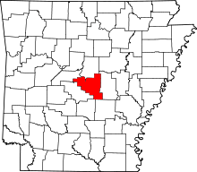 | |
| CDPs | ||
| Unincorporated communities | ||
| Footnotes | ‡This populated place also has portions in an adjacent county or counties | |