Matsusaka, Mie
| Matsusaka 松阪市 | |||
|---|---|---|---|
| City | |||
|
Traditional street in central Matsusaka | |||
| |||
 Location of Matsusaka in Mie Prefecture | |||
 Matsusaka
| |||
| Coordinates: 34°34′40.6″N 136°31′39.3″E / 34.577944°N 136.527583°ECoordinates: 34°34′40.6″N 136°31′39.3″E / 34.577944°N 136.527583°E | |||
| Country | Japan | ||
| Region | Kansai, Tōkai | ||
| Prefecture | Mie Prefecture | ||
| Government | |||
| • Mayor | Mitsushige Yamanaka | ||
| Area | |||
| • Total | 623.64 km2 (240.79 sq mi) | ||
| Population (August 2015) | |||
| • Total | 165,166 | ||
| • Density | 265/km2 (690/sq mi) | ||
| Time zone | Japan Standard Time (UTC+9) | ||
| Symbols | |||
| • Tree | Pine | ||
| • Flower | Lilium auratum | ||
| • Bird | Japanese bush-warbler | ||
| Phone number | 0598-53-4311 | ||
| Address | 1340-1 Tonomachi, Matsusaka-shi, Mie-ken 515-8515 | ||
| Website |
www | ||


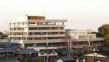
Matsusaka (松阪市 Matsusaka-shi) is a city located in Mie Prefecture, Japan.
As of August 2015, the city had an estimated population of 165,166 and a population density of 265 persons per km2. The total area was 623.64 square kilometres (240.79 sq mi). The city is famous for Matsusaka beef.
Geography
Matsusaka is located in east-central Kii Peninsula, in central Mie Prefecture. It stretches the width of Mie Prefecture, and is bordered by Ise Bay on the Pacific Ocean to the east, and Nara Prefecture to the west. Parts of the City are within the limits of the Yoshino-Kumano National Park.
Neighboring municipalities
- The city of Tsu, to the north.
- The town of Meiwa, to the east.
- The town of Taki, to the south.
- The town of Ōdai, to the south.
- The village of Kawakami, Nara to the southwest.
- The village of Higashi-Yoshino, Nara to the west.
- The village of Mitsue, Nara to the west.
History
Matsusaka developed as a commercial center during the Sengoku period, and Oda Nobukatsu, the younger son of Oda Nobunaga built a castle in the area in 1580. The area came under the control of Gamo Ujisato shortly thereafter, and the Gamo began construction of a castle in the Yoiho forest (四五百森 Yoiho no mori) and named the site "Matsusaka," meaning "slope (坂) covered with pines (松)" in 1588.
Matsusaka Castle was the center of the short-lived Matsusaka Domain in the early Tokugawa shogunate, but for most of the Edo period, the castle was the eastern outpost of Kishu Domain based at Wakayama Castle.
Following the Meiji restoration, the area became part of Mie Prefecture. The town of Matsusaka was created on April 1, 1889. The second kanji character of Matsusaka was changed to 阪 from 坂 in those days. 1318 houses in the town was destroyed in a fire on March 26, 1893. The modern city of Matsusaka was established on February 1, 1933. The city suffered only light damage in World War II, when an air raid of February 4, 1945 killed four people. About 700 houses in the city was destroyed by a fire on December 16, 1951. On October 15, 1956 a major railway accident occurred at Rokken Station on the outskirts of the city, killing 42 people. On August 1, 1982, Typhoon Bess left nine people dead in its wake. The city officially celebrated its 500th anniversary in 1988.
On January 1, 2005 the city expanded to its present borders, with the absorption the towns of Mikumo and Ureshino (both from Ichishi District), and the towns of Iinan and Iitaka (both from Iinan District).
Transportation
Railway
- JR Central – Kisei Main Line
- JR Central – Meishō Line
- Kintetsu – Osaka Line
- Kintetsu – Nagoya Line
- Kintetsu – Yamada Line
Highway
- Ise Expressway
- Japan National Route 23
- Japan National Route 42
- Japan National Route 166
- Japan National Route 368
- Japan National Route 422
Seaports
- Port of Matsusaka
Education
- Mie Chukyo University
- Matsusaka has 36 elementary schools, one private and 12 public middle schools, one private and four public high schools.
Sister city relations
 - Binhu District, Wuxi, Jiangsu Province, China[1]
Local attractions
- Matsusaka Castle ruins
- Takarazuka kofun ancient burial mound
- Azaka Castle ruins
Noted people
- Mitsui Takatoshi - founder of the Mitsui group.
- Motoori Norinaga - Edo period kokugaku scholar
- Tetsuo Morimoto - politician
- Masaharu Nakagawa – politician
- Kana Nishino - J-pop/R&B singer
- Norihisa Tamura – politician
- Ben Wada – film director
- Ikuzo Saito – Olympic wrestler
- Satoshi Hida – professional soccer player
- Keisuke Funatani – professional soccer player
- Mienoumi Tsuyoshi – sumo wrestler
- Hiroki Mizumoto – professional soccer player
- Yotsukasa Dai – sumo wrestler
References
- ↑ "International Exchange". List of Affiliation Partners within Prefectures. Council of Local Authorities for International Relations (CLAIR). Retrieved 21 November 2015.
External links
![]() Media related to Matsusaka, Mie at Wikimedia Commons
Media related to Matsusaka, Mie at Wikimedia Commons
- Official website (Japanese)
- Matsusaka city guide from the Mie Guidebook at Mie JETs
| Special city | ||
|---|---|---|
| Cities | ||
| Kuwana District | ||
| Inabe District | ||
| Mie District | ||
| Taki District | ||
| Watarai District | ||
| Kitamuro District | ||
| Minamimuro District | ||