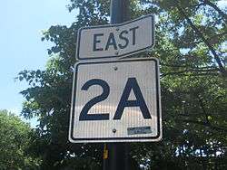
Massachusetts Route 2A
| ||||
|---|---|---|---|---|
|
Map of northern Massachusetts with Route 2A highlighted in red | ||||
| Route information | ||||
| Maintained by MassDOT | ||||
| Length: | 98.5 mi[1][2] (158.5 km) | |||
| Major junctions | ||||
| West end: |
| |||
|
| ||||
| East end: |
| |||
| Location | ||||
| Counties: | Franklin, Worcester, Middlesex, Suffolk | |||
| Highway system | ||||
| ||||


Route 2A exists in several sections of Massachusetts, mainly as parts of former Route 2 that have been moved or upgraded. Route 2A runs from Greenfield in the west to Boston in the east. Route 2A used to extend all the way to Shelburne Falls in Buckland in the west, but as of 2007, the route now terminates at Interstate 91 in Greenfield.
Route description

Route 2A begins at the rotary intersection of Route 2 at Interstate 91 in Greenfield. It passes through downtown Greenfield before reconnecting to its parent route just west of the Greenfield-Gill town line. After a 12.6-mile silent concurrency, Route 2A leaves its parent road once more, passing through Orange and Athol. In Athol it passes the former northern terminus of Route 21, which was truncated to Belchertown after the creation of the Quabbin Reservoir. From Phillipston through Westminster, Route 2A weaves around its parent route, crossing it a total of six times with five exits of access off of Route 2. In Fitchburg the road is shared with several other routes as it passes through the northern half of town. Once in Lunenburg it has another short concurrency with Route 13 just north of the former Whalom Park before crossing into Middlesex County at Shirley.
In Shirley, Route 2A passes north of Fort Devens into Ayer before heading into Littleton before crossing Interstate 495 at Exit 30. It then turns south through Acton and into Concord before Route 2A rejoins its parent route once more. As a silent concurrency it passes south of the historic center of town and north of Walden Pond before splitting again. Route 2A then passes through the Minuteman National Historical Park along the Great Road, the route taken by British troops between the Battles of Lexington and Concord. It then leaves the park, intersecting with I-95/Route 128 at Exits 30 A-B. The road passes south of Lexington's town center before winding into Arlington. In Arlington, the road begins a concurrency with U.S. Route 3 which eventually joins the route to Massachusetts Avenue. After US 3 leaves Mass Ave. at the Alewife Brook Parkway, Route 2A continues through the city of Cambridge, passing through Harvard Yard and by MIT. It intersects the junction of US 3 and Massachusetts Route 3 at Memorial Drive before crossing the Harvard Bridge (also known as the Massachusetts Avenue Bridge) before crossing into Boston, ending at Route 2 and Commonwealth Avenue.
In 2013, Route 2A signs were extended 2.2 miles further into Boston through the Back Bay and South End neighborhoods along Massachusetts Avenue, passing over the Massachusetts Turnpike/Interstate 90 by its junction with Boylston Street, rolling past Symphony Hall at Huntington Avenue at Route 2A's junction with Massachusetts Route 9, intersecting at Massachusetts Route 28 two blocks later, and ending at Melnea Cass Boulevard (which connects with Interstate 93 / US 1 / Route 3) in Roxbury. Not only did neither MassDOT, nor the Boston Transportation Department, acknowledge that Route 2A had been extended, they denied knowing who put up the signs, indicating it was the action of an unknown organization. The Route 2A signs themselves have either wrong directional banners (signed as a north-south highway at least once north of Melnea Cass Boulevard) or are signed backwards (east going west and vice versa), as it heads in a northwesterly direction towards Commonwealth Avenue beyond Tremont Street. On February 26, Boston TV station, Fox 25 aired a report 'exposing' these wrong signs and their attempt to track down the source. In the report, Boston transportation officials admitted they had paid a private firm, Jacobs Engineering, to manufacture and put up the signs. The signage errors were caused by problems with the plans given Jacobs that apparently were not checked for accuracy before they were approved. The city said they were going to take action against the firm to recoup moneys from Jacobs, and would work to fix the signs as soon as possible.[3] Meanwhile, a MassDOT official reiterated that the eastern terminus of Route 2A is at the intersection of Massachusetts and Commonwealth Avenue and that crews would be removing the MA 2A signs further east soon.
Major intersections
| County | Location | mi[2] | km | Destinations | Notes |
|---|---|---|---|---|---|
| Franklin | Greenfield | 0.0 | 0.0 | Western terminus at a traffic circle; Exit 26 on I-91 | |
| 1.1 | 1.8 | Court Square | |||
| 4.1 | 6.6 | Western terminus of silent concurrency with Route 2 | |||
| Gill | 8.0 | 12.9 | French King Bridge over the Connecticut River | ||
| Erving | 9.1 | 14.6 | Interchange; connection via local roads | ||
| 16.7 | 26.9 | Eastern terminus of silent concurrency with Route 2 | |||
| Orange | 18.9 | 30.4 | South end of Route 78 | ||
| 20.2 | 32.5 | North end of Route 122 | |||
| Worcester | Athol | 25.2 | 40.6 | Western terminus of concurrency with Route 32 | |
| 26.6 | 42.8 | Eastern terminus of concurrency with Route 32 | |||
| 27.7 | 44.6 | Exit 18 on Route 2 / US 202 | |||
| Phillipston | 28.4 | 45.7 | Exit 18 on Route 2 / US 202 | ||
| 30.7 | 49.4 | Exit 19 on Route 2, western terminus of concurrency with US 202 | |||
| Templeton | 31.5 | 50.7 | Eastern terminus of concurrency with US 202 | ||
| 34.5 | 55.5 | Western terminus of concurrency with Route 101 | |||
| 35.5 | 57.1 | Exit 21 on Route 2 | |||
| 36.2 | 58.3 | Eastern terminus of concurrency with Route 101 | |||
| Gardner | 38.6 | 62.1 | |||
| Westminster | 43.8 | 70.5 | Western terminus of concurrency with Route 140 Exit 25 on Route 2 | ||
| 44.0 | 70.8 | Eastern terminus of concurrency with Route 140 Exit 25 on Route 2 | |||
| Fitchburg | 47.7 | 76.8 | Western terminus of concurrency with Route 31 | ||
| 48.8 | 78.5 | Western terminus of concurrency with Route 12 | |||
| 49.6 | 79.8 | Eastern terminus of concurrency with Route 12 | |||
| 50.6 | 81.4 | Eastern terminus of concurrency with Route 31 | |||
| Lunenburg | 53.4 | 85.9 | Western terminus of concurrency with Route 13 | ||
| 53.7 | 86.4 | Eastern terminus of concurrency with Route 13 | |||
| 58.0 | 93.3 | West end of Route 225 | |||
| Middlesex | Ayer | 63.0 | 101.4 | Western terminus of concurrency with Route 111 | |
| 64.7 | 104.1 | Eastern terminus of concurrency with Route 111 Western terminus of concurrency with Route 110 | |||
| Littleton | 69.2 | 111.4 | Exit 30 on I-495 | ||
| 69.8 | 112.3 | Eastern terminus of concurrency with Route 110 Western terminus of concurrency with Route 119 | |||
| Acton | 74.8 | 120.4 | |||
| Concord | 77.6 | 124.9 | Eastern terminus of Route 119, south end of Route 111 Western terminus of silent concurrency with Route 2 | ||
| 78.9 | 127.0 | ||||
| 81.1 | 130.5 | North end of Route 126 | |||
| 82.2 | 132.3 | Eastern terminus of silent concurrency with Route 2 | |||
| Lexington | 85.3 | 137.3 | Marrett Road – Minuteman Park | ||
| 85.6 | 137.8 | Exit 30 on I-95 / Route 128 | |||
| 88.3 | 142.1 | Western terminus of concurrency with Routes 4 and 225 | |||
| 88.4 | 142.3 | Eastern terminus of concurrency with Routes 4 and 225 | |||
| Arlington | 92.0 | 148.1 | Western terminus of concurrency with US 3 | ||
| 92.2 | 148.4 | Western terminus of concurrency with Route 60 | |||
| 92.3 | 148.5 | Eastern terminus of concurrency with Route 60, Route 2A / US 3 join Mass. Ave | |||
| Cambridge | 93.7 | 150.8 | Eastern terminus of concurrency with US 3 | ||
| 95.9 | 154.3 | Harvard Yard | Route 2A passes through Harvard University | ||
| 97.8 | 157.4 | Interchange, north end of Route 3, south end of US 3 | |||
| Charles River | Harvard Bridge | ||||
| Suffolk | Boston | 98.5 | 158.5 | Eastern terminus according to MassDOT Massachusetts Avenue continues east to | |
1.000 mi = 1.609 km; 1.000 km = 0.621 mi
| |||||
See also
References
- ↑ Executive Office of Transportation, Office of Transportation Planning - 2007 Road Inventory
- 1 2 Google (January 1, 2014). "Route 2A" (Map). Google Maps. Google. Retrieved January 1, 2014.
- ↑ Fox 25 News. "Wrong way street signs send Hub drivers on roads to nowhere. February 26. Video available at http://www.myfoxboston.com/story/24833885/wrong-way-street-signs-send-hub-drivers-on-roads-to-nowhere#ixzz2v99R2qJk
External links
| Wikimedia Commons has media related to Massachusetts Route 2A. |