Mashi
For places in Iran, see Mashi, Iran.
For the language, see Mashi language.
| Mashi | |
|---|---|
| LGA and town | |
 Mashi Location in Nigeria | |
| Coordinates: 13°06′N 8°00′E / 13.100°N 8.000°ECoordinates: 13°06′N 8°00′E / 13.100°N 8.000°E | |
| Country |
|
| State | Katsina State |
| established | 1989 |
| Government | |
| • Chairman | Surajo Muhammad Mashi |
| Area | |
| • Total | 905 km2 (349 sq mi) |
| Population (2006 census) | |
| • Total | 173,134 |
| Time zone | WAT (UTC+1) |
| 3-digit postal code prefix | 823 |
| ISO 3166 code | NG.KT.MS |
Mashi is a Local Government Area in Katsina State, Nigeria, sharing a border with the Republic of Niger. Its headquarters are in the town of Mashi in the southwest of the area at12°59′00″N 7°57′00″E / 12.98333°N 7.95000°E.
It has an area of 905 km² and a population of 173,134 at the 2006 census.
The postal code of the area is 823.[1]
References
- ↑ "Post Offices- with map of LGA". NIPOST. Retrieved 2009-10-20.
State capital: Katsina | ||
| LGAs | 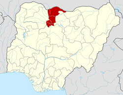 | |
This article is issued from Wikipedia - version of the 10/9/2014. The text is available under the Creative Commons Attribution/Share Alike but additional terms may apply for the media files.