Masevaux
| Masevaux | ||
|---|---|---|
| ||
 Masevaux | ||
|
Location within Grand Est region  Masevaux | ||
| Coordinates: 47°46′28″N 6°59′47″E / 47.7744°N 6.9964°ECoordinates: 47°46′28″N 6°59′47″E / 47.7744°N 6.9964°E | ||
| Country | France | |
| Region | Grand Est | |
| Department | Haut-Rhin | |
| Arrondissement | Thann-Guebwiller | |
| Canton | Masevaux | |
| Intercommunality | Vallée de la Doller et du Soultzbach | |
| Government | ||
| • Mayor (2008–2014) | Laurent Lerch | |
| Area1 | 23.21 km2 (8.96 sq mi) | |
| Population (2006)2 | 3,279 | |
| • Density | 140/km2 (370/sq mi) | |
| Time zone | CET (UTC+1) | |
| • Summer (DST) | CEST (UTC+2) | |
| INSEE/Postal code | 68201 / 68290 | |
| Elevation |
392–1,191 m (1,286–3,907 ft) (avg. 405 m or 1,329 ft) | |
|
1 French Land Register data, which excludes lakes, ponds, glaciers > 1 km² (0.386 sq mi or 247 acres) and river estuaries. 2 Population without double counting: residents of multiple communes (e.g., students and military personnel) only counted once. | ||
.svg.png)
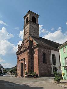
Church: église Saint-Martin
Masevaux (German: Masmünster) is a former commune in the Haut-Rhin department in north-eastern France. On 1 January 2016, it was merged into the new commune Masevaux-Niederbruck.[1]
See also
References
| Wikimedia Commons has media related to Masevaux. |
This article is issued from Wikipedia - version of the 11/19/2016. The text is available under the Creative Commons Attribution/Share Alike but additional terms may apply for the media files.