Maryland Route 39
| ||||
|---|---|---|---|---|
|
Maryland Route 39 highlighted in red | ||||
| Route information | ||||
| Maintained by MDSHA | ||||
| Length: | 6.22 mi[1] (10.01 km) | |||
| Existed: | 1927 – present | |||
| Major junctions | ||||
| West end: |
| |||
| East end: |
| |||
| Location | ||||
| Counties: | Garrett | |||
| Highway system | ||||
| ||||

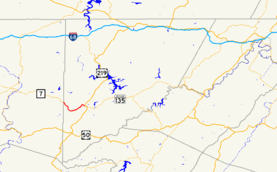
Maryland Route 39 (MD 39) is a state highway in the U.S. state of Maryland. Known for much of its length as Hutton Road, the state highway begins at the West Virginia state line in Hutton, where the highway continues west as West Virginia Route 7 (WV 7). MD 39, which is the westernmost state-numbered highway in Maryland, runs 6.22 miles (10.01 km) from Hutton east through Crellin to U.S. Route 219 (US 219) in Oakland. The state highway was constructed in the early 1920s.
Route description
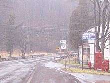
MD 39 begins at the West Virginia state line in Hutton adjacent to CSX's Mountain Subdivision. WV 7 continues west from the state line toward Terra Alta. MD 39 heads southeast as two-lane Hutton Road through the village of Hutton. The state highway skirts the hamlet of Crellin before crossing the Youghiogheny River and turning northeast. At Old Crellin Road, MD 39 veers north and enters the town limits of Oakland, where the highway becomes Oak Street. MD 39 curves to the east, then crosses the Little Youghiogheny River into downtown Oakland. After crossing over the Mountain Subdivision tracks, the state highway meets its eastern terminus at US 219. US 219 heads north from the intersection as Third Street and east as a continuation of Oak Street.[1][2]
History
MD 39 was under construction by 1919 between Oakland and Crellin.[3] The highway was completed to just east of the Youghiogheny River in 1921.[4][5] MD 39 was extended across the river through Hutton to the West Virginia state line in 1923.[6][7]
Junction list
The entire route is in Garrett County.
| Location | mi [1] | km | Destinations | Notes | |
|---|---|---|---|---|---|
| Hutton | 0.00 | 0.00 | Western terminus; West Virginia state line | ||
| Oakland | 6.22 | 10.01 | Eastern terminus | ||
| 1.000 mi = 1.609 km; 1.000 km = 0.621 mi | |||||
Auxiliary route
MD 39A is an unnamed 0.01-mile (0.016 km) connector between MD 39 and MD 827C in Crellin.[1]
See also
 Maryland Roads portal
References
- 1 2 3 4 Highway Information Services Division (December 31, 2013). Highway Location Reference. Maryland State Highway Administration. Retrieved 2010-10-28.
- Garrett County (PDF)
- ↑ Google (2010-02-26). "Maryland Route 39" (Map). Google Maps. Google. Retrieved 2010-02-26.
- ↑ Zouck, Frank H.; Uhl, G. Clinton; Mudd, John F. (January 1920). Annual Reports of the State Roads Commission of Maryland (1916–1919 ed.). Baltimore: Maryland State Roads Commission. pp. 16–17. Retrieved 2010-02-26.
- ↑ Maryland Geological Survey (1921). Map of Maryland: Showing State Road System and State Aid Roads (Map). Baltimore: Maryland Geological Survey.
- ↑ "NBI Structure Number: 100000110003010". National Bridge Inventory. Retrieved 2010-10-28.
- ↑ Maryland Geological Survey (1923). Map of Maryland: Showing State Road System and State Aid Roads (Map). Baltimore: Maryland Geological Survey.
- ↑ "NBI Structure Number: 100000110002010". National Bridge Inventory. Retrieved 2010-10-28.
External links
| Wikimedia Commons has media related to Maryland Route 39. |