Marrickville Council
| Marrickville Council New South Wales | |
|---|---|
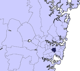 Location in Metropolitan Sydney | |
| Coordinates | 33°54′S 151°09′E / 33.900°S 151.150°ECoordinates: 33°54′S 151°09′E / 33.900°S 151.150°E |
| Population | 76,500 (2011 census)[1] |
| • Density | 4,500/km2 (12,000/sq mi) |
| Established | 1861 |
| Abolished | 12 May 2016 |
| Area | 17 km2 (6.6 sq mi) |
|
| |

Marrickville Council was a local government area located in the inner west region of Sydney, Australia. On 12 May 2016, Marrickville Council was merged with Ashfield and Leichhardt councils into the newly formed Inner West Council.[2]
The area was bounded by Leichhardt to the north, the City of Sydney to the east and north-east, the City of Botany Bay to the south-east, Rockdale to the south, Canterbury to the west, and Ashfield to the north-west. It covers an area of approximately 17 square kilometres (6.6 sq mi). The area is roughly bounded by Parramatta Road to the north, King Street and the Princes Highway to the east, the Cooks River and Alexandra Canal to the south, and New and Old Canterbury Roads to the west.
While the area's background was traditionally working-class, several waves of immigration and a continuing trend of gentrification substantially influenced the demographics and character of the area.[3][4] Marrickville had a substantial student population, being situated relatively close to the University of Sydney and the University of Technology, Sydney.
According to Marrickville Council's website, "the area contains one of the highest percentages of artists, cultural workers and arts industries of any local government area in Australia."[5]
The last Mayor of Marrickville Council was Cr. Sam Iskandar.
Suburbs and localities
The suburbs and localities within the former Marrickville Council area were:
- Camperdown (with parts located within the City of Sydney)
- Dulwich Hill
- Enmore
- Lewisham
- Marrickville
- Newtown (with parts located within the City of Sydney)
- Petersham
- St Peters
- Stanmore
- Sydenham
- Tempe
Demographics
At the 2011 Census, there were 76,500 people in the Marrickville local government area, of these 49.5% were male and 50.5% were female. Aboriginal and Torres Strait Islander people made up 1.5% of the population. The median age of people in the Marrickville Council area was 36 years. Children aged 0 – 14 years made up 14.7% of the population and people aged 65 years and over made up 10.4% of the population. Of people in the area aged 15 years and over, 35.1% were married and 10.9% were either divorced or separated.[1]
Population in the Marrickville Council area between the 2001 Census and the 2006 Census decreased by 0.99% and in the subsequent five years to the 2011 Census, population growth was 6.53%. When compared with total population growth of Australia for the same periods, being 5.78% and 8.32% respectively, population growth in the Marrickville local government area was lower than the national average.[6] The median weekly income for residents within the Manly Council area was higher than the national average.[1][7]
Compared to the national average, at the 2011 Census, Marrickville Council area had a high proportion of households (34.1%) where two or more languages are spoken (national average was 20.4%); and a low proportion (62.3%) where English only was spoken at home (national average was 76.8%).[1]
| Selected historical census data for Marrickville local government area | |||||
|---|---|---|---|---|---|
| Census year | 2001[6] | 2006[7] | 2011[1] | ||
| Population | Estimated residents on Census night | 72,529 | 71,813 | 76,500 | |
| LGA rank in terms of size within New South Wales | |||||
| % of New South Wales population | 1.11% | ||||
| % of Australian population | 0.39% | ||||
| Cultural and language diversity | |||||
| Ancestry, top responses | English | 19.5% | |||
| Australian | 17.9% | ||||
| Irish | 9.2% | ||||
| Scottish | 6.0% | ||||
| Greek | 4.9% | ||||
| Language, top responses (other than English) | Greek | 7.2% | |||
| Vietnamese | 5.1% | ||||
| Arabic | 3.7% | ||||
| Portuguese | 3.1% | ||||
| Cantonese | 2.3% | ||||
| Religious affiliation | |||||
| Religious affiliation, top responses | No religion | 19.5% | |||
| Catholic | 27.1% | ||||
| Anglican | 10.1% | ||||
| Eastern Orthodox | 9.7% | ||||
| Buddhism | 6.6% | ||||
| Median weekly incomes | |||||
| Personal income | Median weekly personal income | A$595 | A$772 | ||
| % of Australian median income | 127.7% | 133.8% | |||
| Family income | Median weekly family income | A$1,160 | A$1,964 | ||
| % of Australian median income | 113.0% | 132.6% | |||
| Household income | Median weekly household income | A$1,460 | A$1,605 | ||
| % of Australian median income | 124.7% | 130.1% | |||
Council
Final composition and election method
Marrickville Municipal Council was composed of twelve Councillors elected proportionally as four separate wards, each electing three Councillors. All Councillors were elected for a fixed four-year term of office. The Mayor was elected by the Councillors at the first meeting of the Council. The most recent election was held on 8 September 2012, and the makeup of the Council after that election was as follows:[8][9][10][11]
| Ward | Councillor | Party | Notes | |
|---|---|---|---|---|
| Central Ward[8] | Max Phillips | The Greens | ||
| Sam Iskandar | Labor | |||
| Victor Macri | Independent | Mayor[12] | ||
| North Ward[9] | Sylvie Ellsmore | The Greens | ||
| Jo Haylen | Labor | |||
| Mark Gardiner | Liberal | |||
| South Ward[10] | Chris Woods | Labor | ||
| David Leary | The Greens | |||
| Morris Hanna | Independent | |||
| West Ward[11] | Emanuel Tsardoulias | Labor | Deputy Mayor | |
| Melissa Brooks | The Greens | |||
| Rosana Tyler | Liberal | |||
Councillor (and former Deputy Mayor) Emanuel Tsardoulias died in 2014.[13] A by-election to fill the vacancy was held on 15 November 2014. The by-election was won by Australian Labor Party candidate Daniel Barbar.[14] Mark Gardiner left the Liberal Party and became Independent. Jo Haylen is also the State Member for Summer Hill.
History
Based on artefacts found near the Cooks River and Alexandra Canal, it is believed that the area has been occupied for at least 7,000 years. The area was originally occupied by the Cadigal clan of the Darug people who spoke the Eora language.[15] Their name for most of the present day local government area was Bullanaming.[16]
European settlement of the area began very soon after the arrival of the First Fleet in 1788. The first land grant was made in 1789, and by 1809 all the land had been granted. In the 1830s, the district consisted of five large estates, including Thomas Chalder's estate named Marrick after his home town in North Yorkshire. At this point, the area was still quite rural in nature.
Following the subdivision of these estates, municipalities were formed in Marrickville (1861), Camperdown (1861), Newtown (1862), St Peters (1871) and Petersham (1872). The area lost its rural character as Sydney grew, and by the 1920s had become an urbanised industrial area.
The population of these municipalities increased greatly in that time, peaking at roughly 113,000 in 1948. It was in this year that the State Government introduced the Local Government (Areas) Act, and Marrickville Municipal Council was enlarged by merging with St Peters and Petersham on 1 January 1949. The Camperdown and Newtown municipalities had already been merged with the City of Sydney, however in 1968 a boundary readjustment added parts of these areas to Marrickville, resulting in the present boundaries.[15]
While migration has always been an important part of Marrickville, this was especially true from the 1950s to the 1970s, as large groups of immigrants arrived from Southern Europe, the Middle East and then Asia. The area is today one of the most culturally diverse in the country.[17]
Israel boycott
On 14 December 2010 Greens councillor Cathy Peters moved a motion to support the international Boycott, Divestment and Sanctions against Israel.[18] This motion was supported by Greens, Labor and one independent councillor, including the Mayor at the time, Fiona Byrne. The motion was widely condemned by politicians from both sides of politics including Foreign Minister Kevin Rudd, then Premier Kristina Keneally and federal Greens leader, Bob Brown.[19] The move received support from Nobel Peace Prize Laureates Archbishop Desmond Tutu[20] and Mairead Maguire.[21] On 14 April 2011 it was revealed that the boycott would cost Marrickville ratepayers A$3.4 million if implemented. The boycott also meant the council would have to replace goods from companies such as Hewlett Packard, Holden, Volvo and Motorola amongst others.[22]
New South Wales Liberal Premier Barry O'Farrell threatened to use his powers under the Local Government Act to sack the council if it did not rescind its resolution for the boycott.[23] At a council meeting on 19 April 2011, members of the community were invited to express their opinions, and after a three hour debate the motion was rescinded.[24] Byrne did not seek re-election, and in September 2011, Morris Hanna became the new mayor after Labor supported his candidacy and his name was pulled out of the hat in the tie breaker. He is an independent who fought against the BDS campaign.[25]
Amalgamation
A 2015 review of local government boundaries recommended that the Marrickville Council merge with the Municipality of Ashfield and the Municipality of Leichhardt to form a new council with an area of 35 square kilometres (14 sq mi) and support a population of approximately 186,000.[26] The merger was implemented on 12 May 2016.
Housing
The suburbs within the Marrickville area are generally characterised by Victorian-era terraces, semi-detached houses and other varieties of urban federation housing. These houses gained popularity among renovators as the suburbs became gentrified in the late 20th century.[27] Detached housing, wider streets and larger blocks of land are more common in the suburbs further from the city, such as Dulwich Hill and parts of Marrickville.
Several medium density apartment blocks were constructed in the area in the 1960s and 1970s. Since the 1980s, modern infill development has tended to be sympathetic with traditional streetscapes.[27]
 Modest single-storey terraces in Camperdown
 House in the suburb of Marrickville
 Sympathetic infill development in Camperdown
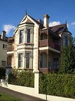 Restored house in Petersham
Recreation and Culture
Parks
The Marrickville area has 88 parks and reserves of various sizes within its boundaries. Major sporting grounds include Henson Park, home of the Newtown Jets rugby league club, and Petersham Park, where Sir Donald Bradman scored his first century in grade cricket.[28]
Tempe Lands, 10 hectares of parkland at the south-western corner of LGA, was redeveloped by Marrickville Council in 2003 on the site of a former rubbish tip at a cost of A$17.5 million. The parklands feature sporting fields, a golf driving range, and a constructed saltmarsh and ephemeral wetlands area for wildlife.[29]
Other major parks in the area include Enmore Park, Camperdown Park, Marrickville Park, Steel Park and Camperdown Memorial Rest Park. There are also substantial parklands surrounding the Cooks River.[30]
Events
A number of entertainment and cultural events are held in Marrickville throughout the year. The Marrickville Road Festival is the area's largest annual event, drawing a crowd of around 50,000 people each year.[31] Other major events in the area include the Newtown Festival, Australia Day celebrations at Enmore Park, the Bairro Português Food & Wine Fair in Petersham, and the Dulwich Hill Street Fair.
Transport

Roads
Parramatta Road runs along the northern boundary of the Marrickville local government area. Historically the main east–west arterial road in Sydney, this section of Parramatta Road is still a busy route that carried an average of over 65,000 vehicles per day during 2005.[32]
Other main arterial routes running through the area include State Route 54 (composed of New Canterbury Road, Stanmore and Enmore Road) linking Sydney to Liverpool, and the King Street–Princes Highway corridor.
Rail
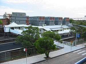
Sydney Trains provides passenger rail services to suburbs in the area. The northern part of the LGA is served by the Airport, Inner West & South Line, and the southern and eastern parts are served by the Bankstown Line. Trains on the Eastern Suburbs & Illawarra Line serve Sydenham and Tempe railway stations.[33]
Buses
Sydney Buses operates bus services through all suburbs in the Marrickville area.
Airport
Australia's busiest airport, Kingsford Smith International Airport, is situated directly south-east of the Marrickville LGA. As a result, many parts of Marrickville suffer from high levels of aircraft noise.[34] Aircraft taking off and landing from Kingsford-Smith Airport also fly at low altitude over the Leichhardt, Ashfield, Canterbury, Rockdale, Botany Bay, Randwick, Canada Bay and Burwood local government areas.
After the completion of the airport's third runway in the mid-1990s, the Commonwealth Government controversially purchased and demolished 152 residential properties in the worst-affected parts of Sydenham. The newly vacant land, which is located not under the approach path of the third runway but under the approach/departure path for runway 16R/34L, became Sydenham Green, a public park covering 4.5 hectares. A series of oversized 'living room' sculptures (lamp, chairs and fireplace) decorate the park, paying homage to the homes that formerly occupied the site.[35]
Sister cities
Marrickville Council has sister city relations with the following cities:[36]
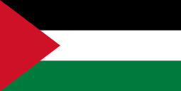 Bethlehem, West Bank, since 2007
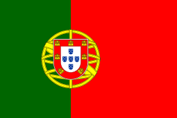 Funchal, Madeira Islands, Portugal, since 1996
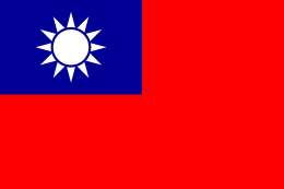 Keelung, Taiwan, since 1989
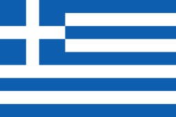 Kos, Greece, since 1990
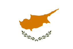 Larnaca, Cyprus, since 2005
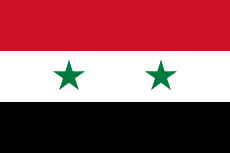 Safita, Syria, since 2005
.svg.png) Zonnebeke, Belgium, since 2007
Zonnebeke, Belgium, since 2007
The following cities have also signed agreements to formalise relationships with Marrickville:
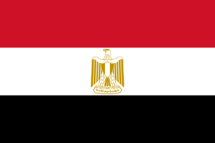 6th of October City, Egypt
References
- 1 2 3 4 5 Australian Bureau of Statistics (31 October 2012). "Marrickville (A)". 2011 Census QuickStats. Retrieved 5 November 2012.
- ↑ "Inner West Council". Government of New South Wales. 12 May 2016. Retrieved 15 May 2016.
- ↑ "Cultural Identity" (PDF). Marrickville Public Art Strategy. Local Government and Shires Associations of NSW.
- ↑ Kennedy, John (16 November 2000). "Changing Faces". Newtown twozerofourtwo.
- ↑ "Artist Opportunities". Marrickville Council. Archived from the original on 24 December 2008.
- 1 2 Australian Bureau of Statistics (9 March 2006). "Marrickville (A)". 2001 Census QuickStats. Retrieved 4 November 2012.
- 1 2 Australian Bureau of Statistics (25 October 2007). "Marrickville (A)". 2006 Census QuickStats. Retrieved 4 November 2012.
- 1 2 "Marrickville Council – Central Ward – Wirraga". Local Government Elections 2012. Electoral Commission of New South Wales. 15 September 2012. Retrieved 18 September 2012.
- 1 2 "Marrickville Council – North Ward – Wali". Local Government Elections 2012. Electoral Commission of New South Wales. 15 September 2012. Retrieved 18 September 2012.
- 1 2 "Marrickville Council – South Ward – Magura". Local Government Elections 2012. Electoral Commission of New South Wales. 15 September 2012. Retrieved 18 September 2012.
- 1 2 "Marrickville Council – West Ward – Burraga". Local Government Elections 2012. Electoral Commission of New South Wales. 15 September 2012. Retrieved 18 September 2012.
- ↑ Murada, Lauren; Murray, Oliver; Hamwi, Omar (26 September 2012). "Marrickville, Ashfield and Leichhardt councils elect new mayors". Inner West Courier. Retrieved 26 September 2012.
- ↑ http://www.marrickville.nsw.gov.au/en/council/newsandnotices/mediareleases/marrickville-councillor-emanuel-tsardoulias-19752014/
- ↑ https://results.elections.nsw.gov.au/LB1407/Marrickville/Marrickville%20West-Burraga/Councillor/DistributionOfPreferencesReport.html
- 1 2 "Our Local History". Marrickville Council. Archived from the original on 24 December 2008.
- ↑ "History of Suburbs". Marrickville Council. Archived from the original on 24 December 2008.
- ↑ "Your Council". Marrickville Council. Archived from the original on 26 July 2010.
- ↑ Munro, Kesley (20 December 2010). "NSW suburb joins Israeli boycott". The Sydney Morning Herald.
- ↑ Massola, James; Kelly, Joe (1 April 2011). "Greens leader Bob Brown slaps down Lee Rhiannon on Israel boycott policy". The Australian.
- ↑ Tovey, Josephine (7 June 2011). "Social justice at local scale takes courage: Tutu tells Marrickville mayor". The Sydney Morning Herald.
- ↑ Robinson, Georgina (19 April 2011). "Top names back Marrickville Council's Israel boycott". The Sydney Morning Herald.
- ↑ Aikman, Amos; Salusinszky, Imre (14 April 2011). "Marrickville council to boycott HP, others at $3.7m cost". The Australian.
- ↑ Tovey, Josephine; Davey, Melissa (15 April 2011). "Premier moves to stop Israel boycott". The Sydney Morning Herald. Retrieved 24 April 2016.
- ↑ Tovey, Josephine (20 April 2011). "Marrickville Council's move to boycott Israel sinks in stormy sea of debate". The Sydney Morning Herald. Retrieved 5 November 2012.
- ↑ Benjamin, Henry (28 September 2011). "New Mayor for Marrickville". J-Wire: Jewish Online News from Australia and New Zealand. Reality Media Pty Ltd. Retrieved 19 September 2012.
- ↑ "Merger proposal: Ashfield Council, Leichhardt Municipal Council, and Marrickville Council" (PDF). Government of New South Wales. January 2016. p. 7. Retrieved 18 February 2016.
- 1 2 Baskerville, Bruce (1997). "A walking tour of O'Connell Town and parts of Bligh's Terrace (Newtown)". History Matrix.
- ↑ "Bradman Centenary Widely Recognised". Bradman Foundation.
- ↑ Grennan, Harvey (9 August 2005). "From Waste to Wonder". The Sydney Morning Herald.
- ↑ "Parks and Facilities". Marrickville Council. Archived from the original on 7 March 2009.
- ↑ "Community Events". Marrickville Council. Archived from the original on 23 December 2008.
- ↑ "Parramatta Rd nr Cardigan St Camperdown (combined east and westbound averages)" (Word (requires download)). Daily traffic volumes. Roads and Traffic Authority. 2005. pp. 67–68.
- ↑ "Welcome to Marrickville: Transport". Marrickville Council. Archived from the original on 12 July 2010.
- ↑ "Airport noise pollution will double, residents warned". Australia: ABC News. 20 March 2008.
- ↑ Meader, Chrys. "Sydenham" (PDF). Dictionary of Sydney. Archived from the original (PDF) on 14 September 2009.
- ↑ "Sister Cities". Marrickville Council. Archived from the original on 4 October 2010.
External links
- Marrickville Council
- Cadigal-Wangal website
- Reverse Garbage Centre
- Youth Resource Centre
- Interactive Map of Marrickville Local Government Area