Marklesburg, Pennsylvania
| Marklesburg, Pennsylvania | |
|---|---|
| Borough | |
|
The former James Creek School | |
 Marklesburg, Pennsylvania | |
| Coordinates: 40°23′03″N 78°10′20″W / 40.38417°N 78.17222°WCoordinates: 40°23′03″N 78°10′20″W / 40.38417°N 78.17222°W | |
| Country | United States |
| State | Pennsylvania |
| County | Huntingdon |
| Government | |
| • Type | Borough Council |
| • Mayor | James Nichol (R) |
| Area | |
| • Total | 0.9 sq mi (2 km2) |
| Elevation | 899 ft (274 m) |
| Population (2010) | |
| • Total | 204 |
| • Density | 226.7/sq mi (87.5/km2) |
| Time zone | Eastern (EST) (UTC-5) |
| • Summer (DST) | EDT (UTC-4) |
| Zip code | 16657 |
| Area code(s) | 814 |
| School District: | Huntingdon Area School District |
| Local phone exchanges: 658 | |

Marklesburg is a borough in Huntingdon County, Pennsylvania, United States. The population was 204 at the 2010 census.
History
The Marklesburg Historic District was listed on the National Register of Historic Places in 1996.[1]
Geography
Marklesburg is located at 40°23′3″N 78°10′20″W / 40.38417°N 78.17222°W (40.384269, -78.172183).[2] It is near the western shore of Raystown Lake, just uphill from the flooded village of Aitch.
According to the United States Census Bureau, the borough has a total area of 0.9 square miles (2.3 km2), all of it land.
Adjacent Municipalities
All municipalities listed are in Huntingdon County unless otherwise noted.
Demographics
| Historical population | |||
|---|---|---|---|
| Census | Pop. | %± | |
| 1880 | 232 | — | |
| 1890 | 279 | 20.3% | |
| 1900 | 260 | −6.8% | |
| 1910 | 211 | −18.8% | |
| 1920 | 198 | −6.2% | |
| 1930 | 226 | 14.1% | |
| 1940 | 198 | −12.4% | |
| 1950 | 219 | 10.6% | |
| 1960 | 197 | −10.0% | |
| 1970 | 232 | 17.8% | |
| 1980 | 188 | −19.0% | |
| 1990 | 165 | −12.2% | |
| 2000 | 216 | 30.9% | |
| 2010 | 204 | −5.6% | |
| Est. 2015 | 202 | [3] | −1.0% |
| Sources:[4][5][6] | |||
As of the census[5] of 2000, there were 216 people, 89 households, and 63 families residing in the borough. The population density was 243.5 people per square mile (93.7/km²). There were 138 housing units at an average density of 155.6/sq mi (59.9/km²). The racial makeup of the borough was 99.07% White, and 0.93% from two or more races.
There were 89 households, out of which 22.5% had children under the age of 18 living with them, 61.8% were married couples living together, 7.9% had a female householder with no husband present, and 28.1% were non-families. 25.8% of all households were made up of individuals, and 13.5% had someone living alone who was 65 years of age or older. The average household size was 2.43 and the average family size was 2.92.
In the borough the population was spread out, with 18.5% under the age of 18, 10.2% from 18 to 24, 21.8% from 25 to 44, 28.7% from 45 to 64, and 20.8% who were 65 years of age or older. The median age was 43 years. For every 100 females there were 89.5 males. For every 100 females age 18 and over, there were 89.2 males.
The median income for a household in the borough was $43,333, and the median income for a family was $46,500. Males had a median income of $38,333 versus $20,000 for females. The per capita income for the borough was $22,329. About 3.0% of families and 6.0% of the population were below the poverty line, including none of those under the age of eighteen or sixty five or over.
References
- ↑ National Park Service (2010-07-09). "National Register Information System". National Register of Historic Places. National Park Service.
- ↑ "US Gazetteer files: 2010, 2000, and 1990". United States Census Bureau. 2011-02-12. Retrieved 2011-04-23.
- ↑ "Annual Estimates of the Resident Population for Incorporated Places: April 1, 2010 to July 1, 2015". Retrieved July 2, 2016.
- ↑ "Census of Population and Housing". U.S. Census Bureau. Retrieved 11 December 2013.
- 1 2 "American FactFinder". United States Census Bureau. Retrieved 2008-01-31.
- ↑ "Incorporated Places and Minor Civil Divisions Datasets: Subcounty Resident Population Estimates: April 1, 2010 to July 1, 2012". Population Estimates. U.S. Census Bureau. Retrieved 11 December 2013.
External links
- Marklesburg, Pennsylvania (PA) Detailed Profile
- Marklesburg, Pennsylvania PA Community Profile - Huntingdon County, PA Data
Municipalities and communities of Huntingdon County, Pennsylvania, United States | ||
|---|---|---|
| Boroughs | 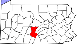 | |
| Townships | ||
| CDPs | ||
| Unincorporated communities | ||