Marion Township, Buchanan County, Missouri
| Marion Township | |
|---|---|
| Township | |
 | |
| Coordinates: 39°45′53″N 094°39′20″W / 39.76472°N 94.65556°WCoordinates: 39°45′53″N 094°39′20″W / 39.76472°N 94.65556°W | |
| Country | United States |
| State | Missouri |
| County | Buchanan |
| Area | |
| • Total | 48.26 sq mi (125 km2) |
| • Land | 48.21 sq mi (124.87 km2) |
| • Water | 0.05 sq mi (0.13 km2) 0.1% |
| Elevation[1] | 846 ft (258 m) |
| Population (2000) | |
| • Total | 1,226 |
| • Density | 25.4/sq mi (9.8/km2) |
| FIPS code | 29-45938[2] |
| GNIS feature ID | 0766342 |
Marion Township is one of twelve townships in Buchanan County, Missouri, USA. As of the 2000 census, its population was 1,226.
Marion Township was established in 1837.[3]
Geography
Marion Township covers an area of 48.26 square miles (125.0 km2) and contains one incorporated settlement, Easton. It contains eight cemeteries: Blakely, Bowen, Courtney, Kessler, Minor, Moxley, Saint Josephs and Saint Marys.
The streams of Becks Branch, James Branch, Little Third Fork, Muddy Creek, One Hundred and Two River and Third Fork run through this township.
References
- ↑ "US Board on Geographic Names". United States Geological Survey. 2007-10-25. Retrieved 2008-01-31.
- ↑ "American FactFinder". United States Census Bureau. Retrieved 2008-01-31.
- ↑ "Buchanan County Place Names, 1928–1945 (archived)". The State Historical Society of Missouri. Retrieved 4 September 2016.
External links
Municipalities and communities of Buchanan County, Missouri, United States | ||
|---|---|---|
| Cities | 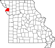 | |
| Villages | ||
| Townships | ||
| Unincorporated communities | ||
| Footnotes | ‡This populated place also has portions in an adjacent county or counties | |
This article is issued from Wikipedia - version of the 9/5/2016. The text is available under the Creative Commons Attribution/Share Alike but additional terms may apply for the media files.