Marion, Mississippi
| Marion, Mississippi | |
|---|---|
| Town | |
 Location of Marion, Mississippi | |
 Marion, Mississippi Location in the United States | |
| Coordinates: 32°25′20″N 88°38′50″W / 32.42222°N 88.64722°WCoordinates: 32°25′20″N 88°38′50″W / 32.42222°N 88.64722°W | |
| Country | United States |
| State | Mississippi |
| County | Lauderdale |
| Area | |
| • Total | 2.9 sq mi (7.6 km2) |
| • Land | 2.9 sq mi (7.5 km2) |
| • Water | 0.0 sq mi (0.0 km2) |
| Elevation | 367 ft (112 m) |
| Population (2000) | |
| • Total | 1,305 |
| • Density | 448.7/sq mi (173.2/km2) |
| Time zone | Central (CST) (UTC-6) |
| • Summer (DST) | CDT (UTC-5) |
| ZIP code | 39342 |
| Area code(s) | 601 |
| FIPS code | 28-45160 |
| GNIS feature ID | 0673135 |
Marion is a town in Lauderdale County, Mississippi, making it an eastern suburb of Meridian. The population was 1,305 at the 2000 census.
History
The town was named for Francis Marion, a military leader known as the "Swamp Fox".[1] Marion was Lauderdale County's seat from its founding to Reconstruction. Prior to the war, Marion was a prosperous town inhabited numerous planters and enslaved African Americans. In 1840, it had a drugstore, two blacksmith shops, six dry goods stores, and two academies (one for girls and another for boys). It also had at least one newspaper, the Lauderdale Republican.[2]
In 1850, Congress donated land to Alabama and Mississippi in order to build the Mobile & Ohio Railroad, which bypassed Marion and constructed a station two miles to the southwest in a village called McLemore's Old Field (now Meridian, Mississippi).[2] During the 1850s, land values in Lauderdale County increased by 176 percent, which allowed many non-slaveholding whites to purchase slaves to grow cotton, build roads, and clear the surrounding forests for cultivation. By 1860, Lauderdale County's enslaved population had more than doubled—a fact that fed support for secessionism after the election of Abraham Lincoln.[2] On February 16, 1864, U.S. Army forces commanded by General William T. Sherman raided Marion and destroyed the railroad connecting it to Meridian.[2] In 1870, voters opted to move the county seat from Marion to Meridian, which had expanded rapidly since the end of the Civil War.[2]
Geography
Marion is located at 32°25′20″N 88°38′50″W / 32.42222°N 88.64722°W (32.422182, -88.647323).[3]
According to the United States Census Bureau, the town has a total area of 2.9 square miles (7.5 km2), of which 2.9 square miles (7.5 km2) is land and 0.34% is water.
Demographics
| Historical population | |||
|---|---|---|---|
| Census | Pop. | %± | |
| 1880 | 347 | — | |
| 1980 | 771 | — | |
| 1990 | 1,359 | 76.3% | |
| 2000 | 1,305 | −4.0% | |
| 2010 | 1,479 | 13.3% | |
| Est. 2015 | 1,574 | [4] | 6.4% |
As of the census[6] of 2000, there were 1,305 people, 468 households, and 324 families residing in the town. The population density was 448.7 people per square mile (173.1/km²). There were 555 housing units at an average density of 190.8 per square mile (73.6/km²). The racial makeup of the town was 52.87% White, 45.82% African American, 0.23% Native American, 0.31% Asian, 0.15% from other races, and 0.61% from two or more races. Hispanic or Latino of any race were 1.69% of the population.
There were 468 households out of which 42.3% had children under the age of 18 living with them, 37.2% were married couples living together, 28.0% had a female householder with no husband present, and 30.6% were non-families. 25.0% of all households were made up of individuals and 6.4% had someone living alone who was 65 years of age or older. The average household size was 2.50 and the average family size was 3.00.
In the town the population was spread out with 28.4% under the age of 18, 11.3% from 18 to 24, 27.4% from 25 to 44, 16.6% from 45 to 64, and 16.4% who were 65 years of age or older. The median age was 31 years. For every 100 females there were 70.1 males. For every 100 females age 18 and over, there were 62.3 males.
The median income for a household in the town was $26,413, and the median income for a family was $28,438. Males had a median income of $27,778 versus $17,303 for females. The per capita income for the town was $10,504. About 30.5% of families and 32.8% of the population were below the poverty line, including 50.1% of those under age 18 and 20.5% of those age 65 or over.
Climate
The climate in this area is characterized by hot, humid summers and generally mild to cool winters. According to the Köppen Climate Classification system, Marion has a humid subtropical climate, abbreviated "Cfa" on climate maps.[7]
References
- ↑ "Profile for Marion, Mississippi". ePodunk. Retrieved 2010-05-26.
- 1 2 3 4 5 Putnam, Richelle (2011). Lauderdale County, Mississippi: A Brief History. Charleston, SC: History Press. p. 67. ISBN 978-1-60949-021-8.
- ↑ "US Gazetteer files: 2010, 2000, and 1990". United States Census Bureau. 2011-02-12. Retrieved 2011-04-23.
- ↑ "Annual Estimates of the Resident Population for Incorporated Places: April 1, 2010 to July 1, 2015". Retrieved July 2, 2016.
- ↑ "Census of Population and Housing". Census.gov. Retrieved June 4, 2015.
- ↑ "American FactFinder". United States Census Bureau. Retrieved 2008-01-31.
- ↑ Climate Summary for Marion, Mississippi
Municipalities and communities of Lauderdale County, Mississippi, United States | ||
|---|---|---|
| Cities | 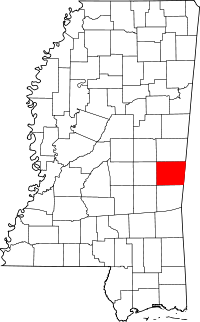 | |
| Towns | ||
| CDPs | ||
| Other unincorporated communities |
| |