Marblehead, Massachusetts
| Marblehead, Massachusetts | ||
|---|---|---|
| Town | ||
|
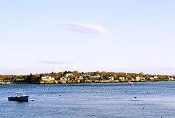
Marblehead Neck as viewed from the landing on State Street | ||
| ||
| Motto: "Where History Comes Alive"[1] | ||
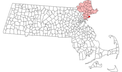 Location in Essex County in Massachusetts | ||
| Coordinates: 42°30′00″N 70°51′30″W / 42.50000°N 70.85833°WCoordinates: 42°30′00″N 70°51′30″W / 42.50000°N 70.85833°W | ||
| Country | United States | |
| State | Massachusetts | |
| County | Essex | |
| Settled | 1629 | |
| Incorporated | 1649 | |
| Government | ||
| • Type | Open town meeting | |
| Area | ||
| • Total | 19.6 sq mi (50.7 km2) | |
| • Land | 4.4 sq mi (11.4 km2) | |
| • Water | 15.2 sq mi (39.4 km2) | |
| Elevation | 65 ft (20 m) | |
| Population (2010) | ||
| • Total | 19,808 | |
| • Density | 4,501.8/sq mi (1,738.2/km2) | |
| Demonym(s) | Header | |
| Time zone | Eastern (UTC-5) | |
| • Summer (DST) | Eastern (UTC-4) | |
| ZIP code | 01945 | |
| Area code(s) | 339 / 781 | |
| FIPS code | 25-38400 | |
| GNIS feature ID | 0618300 | |
| Website |
www | |

Marblehead is a coastal New England town in Essex County, Massachusetts. Its population was 19,808 at the 2010 census.[2] It is home to the Marblehead Neck Wildlife Sanctuary, Crocker Park, the Marblehead Lighthouse, Fort Sewall, Little Harbor and Devereux Beach. Archibald Willard's famous painting The Spirit of '76 currently resides in Abbot Hall.
A town with roots in commercial fishing, whaling and yachting, Marblehead was a major shipyard and is known as the birthplace of the American Navy. It is also the origin of Marine Corps Aviation. A center of recreational boating, it is a popular sailing, kayaking and fishing destination. Several yacht clubs were established here in the late 19th century, which continue to be centers of sailing.
History

Marblehead's first European settler was Joseph Doliber in 1629, who set up on the shore near what is now the end of Bradlee Road.
Three years earlier, Isaac Allerton, a Pilgrim from the Mayflower, had arrived in the area and established a fishing village at mid-Marblehead Harbor on the town side, across from Marblehead Neck. This area was set off and incorporated separately in 1649.[3] Originally called Massebequash after the river which ran between it and Salem, the land was inhabited by the Naumkeag tribe of the Pawtucket confederation under the overall sachem Nanepashemet. But epidemics in 1615–1619 and 1633, believed to be smallpox, devastated the tribe. On September 16, 1684, heirs of Nanepashemet sold their 3,700 acres (15 km2); the deed is preserved today at Abbot Hall in the city.
At times called "Marvell Head", "Marble Harbour" (by Captain John Smith) and "Foy" (by immigrants from Fowey, Cornwall), the town would be named "Marblehead" by settlers who mistook its granite ledges for marble. It began as a fishing village with narrow, crooked streets, and developed inland from the harbor. The shoreline smelled of drying fish, typically cod. These were exported abroad and to Salem. The town peaked economically just prior to the Revolution, as locally financed privateering vessels sought bounty from large European ships. Much early architecture survives from the era, including the Jeremiah Lee Mansion.

A large percentage of residents became involved early in the Revolutionary War, and the sailors of Marblehead are generally recognized by scholars as forerunners of the United States Navy. The first vessel commissioned for the navy, Hannah, was equipped with cannons, rope, provision (including the indigenous molasses/sea water cookie known as "Joe Frogger" )—and a crew from Marblehead. With their nautical backgrounds, soldiers from Marblehead under General John Glover were instrumental in the escape of the Continental Army after the Battle of Long Island. Marblehead men ferried George Washington across the Delaware River for his attack on Trenton. Many who set out for war, however, did not return, leaving the town with 459 widows and 865 orphaned children in a population of less than 5,000.
The community lost a substantial portion of its population and economy, although it was still the tenth-largest inhabited location in the United States at the first census, in 1790.[4] When George Washington visited the town during his presidential tour of 1789, he knew the sailors of Marblehead well; they had served him honorably in the war. He observed that the town "had the appearance of antiquity."[5]
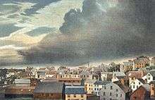
After the Revolution, fishing continued as a major industry. The town's fishermen had 98 vessels (95 of which exceeded 50 tons) putting to sea in 1837, where they often harvested fish off the Grand Banks of Newfoundland. However, a gale or hurricane in that area on September 19, 1846, sank 11 vessels and damaged others. With 65 men and boys lost in the storm, the town's fishing industry began a decline. The storm is depicted in Fireboard: The Great Gale of 1846, c. 1850 by William Thompson Bartoll. A copy of the book is held by the Peabody Essex Museum.
During the late 19th century, Marblehead had a short-term industrial boom from shoe-making factories. At the same time, the exceptional harbor attracted yachting by wealthy boat owners, and some yacht clubs established centers there. It would become home to the Boston Yacht Club, Corinthian Yacht Club, Eastern Yacht Club, Marblehead Yacht Club, Dolphin Yacht Club, and the oldest junior yacht club in America, the Pleon Yacht Club.
After World War II, the town enjoyed a population boom, developing as a bedroom community for nearby Boston, Lynn, and Salem. This boom ended around 1970, when the town became built out.
Marblehead town officials recently banned fishing off all public piers due to overcrowding.[6] This ban was lifted after town officials approved regulations aimed at preventing the problem.
|


Geography and transportation

Marblehead is located at 42°29′49″N 70°51′47″W / 42.49694°N 70.86306°W (42.497146, −70.863236).[7] According to the United States Census Bureau, the town has a total area of 19.6 square miles (50.7 km2), of which 4.4 square miles (11.4 km2) is land and 15.2 square miles (39.4 km2), or 77.61%, is water.[8] Marblehead is situated on the North Shore of Massachusetts along Massachusetts Bay and Salem Harbor. The town consists of a rocky peninsula that extends into the bay, with an additional neck to the east connected by a long sandbar. This ring of land defines Marblehead's deep, sheltered harbor. Marblehead Neck is home to a bird sanctuary, as well as Castle Rock and Chandler Hovey Park at its northern tip, where Marblehead Light is located. The town was once home to two forts, Fort Miller at Naugus Head along Salem Harbor, and Fort Sewall, at the western edge of the mouth of Marblehead Harbor. The town land also includes several small islands in Massachusetts Bay and Dolliber Cove, the area between Peaches Point and Fort Sewall. The town is partially divided from Salem by the Forest River, and is also home to several small ponds. Keeping with the town's location, there are four beaches (one in Dolliber Cove, one in Marblehead Harbor, and two along the southern shore of town), as well as six yacht clubs, one public kayaking center and several boat ramps.
Besides Marblehead Neck, there are three other villages within town, Old Town to the southeast and Clifton to the southwest. Given its small area, most of the residential land in town is thickly settled. Marblehead's town center is located approximately 4 miles (6 km) from the center of Salem, 16 miles (26 km) northeast of Boston and 12 miles (19 km) southwest of Cape Ann. It is bordered by Swampscott to the south and Salem to the northwest. (Because Salem's water rights extend into Massachusetts Bay, there is no connection between Marblehead and the city of Beverly across Beverly Harbor.)
Marblehead is home to the eastern termini of Massachusetts Route 114 and Route 129, which both terminate at the intersection of Atlantic and Ocean avenues. Route 114 heads west into Salem, while Route 129 heads south along Atlantic Avenue into Swampscott towards Lynn. There are no highways within town, with the nearest access being to Massachusetts Route 128 in Peabody and Beverly. Four MBTA Bus routes – the 441, 442, 448, and 449 – originate in town regularly with service to Boston, with weekend service to Wonderland in Revere. The Newburyport/Rockport Line of the MBTA Commuter Rail passes through neighboring Swampscott and Salem, with service between the North Shore and Boston's North Station. The nearest air service is located at Beverly Municipal Airport, with the nearest national and international service at Boston's Logan International Airport. Seasonal ferry service to Boston can also be found in Salem.

Demographics

| Historical population | ||
|---|---|---|
| Year | Pop. | ±% |
| 1790 | 5,661 | — |
| 1800 | 5,211 | −7.9% |
| 1810 | 5,900 | +13.2% |
| 1820 | 5,630 | −4.6% |
| 1830 | 5,149 | −8.5% |
| 1840 | 5,575 | +8.3% |
| 1850 | 6,167 | +10.6% |
| 1860 | 7,646 | +24.0% |
| 1870 | 7,703 | +0.7% |
| 1880 | 7,467 | −3.1% |
| 1890 | 8,202 | +9.8% |
| 1900 | 7,582 | −7.6% |
| 1910 | 7,338 | −3.2% |
| 1920 | 7,324 | −0.2% |
| 1930 | 8,668 | +18.4% |
| 1940 | 10,856 | +25.2% |
| 1950 | 13,765 | +26.8% |
| 1960 | 18,521 | +34.6% |
| 1970 | 21,295 | +15.0% |
| 1980 | 20,126 | −5.5% |
| 1990 | 19,971 | −0.8% |
| 2000 | 20,377 | +2.0% |
| 2010 | 19,808 | −2.8% |
Source: United States Census records and Population Estimates Program data.[9][10][11][12][13][14][15][16][17][18] | ||
As of the census[19] of 2010, there were 19,808 people, 8,838 households, and 5,467 families residing in the town. The population density was 4,373 people per square mile (help/km²). There were 8,906 housing units at an average density of 1,966.3 per square mile (759.1/km²). The racial makeup of the town was 97.6% White, 0.4% Black or African American, 0.1% Native American, 1.0% Asian, >0.1% Pacific Islander, 0.2% from other races, and 0.7% from two or more races. Hispanic or Latino of any race were 0.9% of the population.
There were 8,541 households out of which 31.2% had children under the age of 18 living with them, 56.5% were married couples living together, 8.0% had a female householder with no husband present, and 33.5% were non-families. 28.7% of all households were made up of individuals and 10.7% had someone living alone who was 65 years of age or older. The average household size was 2.37 and the average family size was 2.94.

In the town the population was spread out with 23.9% under the age of 18, 3.5% from 18 to 24, 28.0% from 25 to 44, 29.0% from 45 to 64, and 15.6% who were 65 years of age or older. The median age was 42 years. For every 100 females there were 89.3 males. For every 100 females age 18 and over, there were 84.3 males.
According to a 2009 estimate,[20] the median income for a household in the town was $97,441, and the median income for a family was $129,968. Males had a median income of $70,470 versus $44,988 for females. The per capita income for the town was $46,738. About 3.2% of families and 4.3% of the population were below the poverty line, including 5.7% of those under age 18 and 4.6% of those age 65 or over.
Education
Marblehead Public Schools oversees eight schools: Bell School, Coffin School, Eveleth School, Gerry School, Glover School, Village School, Marblehead Veterans Middle School, and Marblehead High School.[21] The town is also home to the Marblehead Community Charter Public School, the first Commonwealth charter school to open in Massachusetts.
Points of interest

- Castle Rock Park
- Crocker Park, the gift of Uriel Crocker
- Crowninshield (Brown's) Island
- The Driftwood
- Herreshoff Castle
- Marblehead Light
- Marblehead Neck Wildlife Sanctuary
- Old Burial Hill
- Pleon Yacht Club, the oldest junior yacht club in the United States
- Little Harbor Boathouse , the public kayaking outfitter on Little Harbor
Little Harbor
In the 75 years from the American Revolution to the middle of the nineteenth century, Marblehead experienced a golden age of fishing. For the next 50 years, the industry struggled, but from 1900 until the end of the twentieth century, one small anchorage made itself proud. From boat building to sail design, Little Harbor, also known as First Harbor, produced creative men whose innovations helped shape marine history. Marblehead's First Harbor: The Rich History of a Small Fishing Port, written by Hugh Peabody Bishop and Brenda Bishop Booma tells the story through the eyes of a Marblehead fisherman. Today, the waters of Little Harbor, protected by Trustees of Reservations-owned Crowninshield Island and Priest Island, provide a mecca for human-powered water sports, kayaking and kayak fishing. Little Harbor is located in Old Town, surrounded by Fort Sewell, Burial Hill and Peaches Point.
Devereux Beach
Devereux Beach is located on Ocean Avenue just before the causeway; Marblehead's most popular beach offers more than five acres of sand, public picnic tables and a playground. It is a popular spot to observe fireworks on Fourth of July. Lifeguards are on duty once the beach opens for summer in late June. During summer months, non-residents must pay $5–$10 to park between 8am and 4pm. Marblehead residents must have a facility sticker or they will be charged the non-resident rate. The two pavilions with grills are available for rental during the spring and fall but a permit from the town is necessary.
Historical sites and museums


- Abbot Hall (1877), containing The Spirit of '76 by Archibald MacNeal Willard
- Fort Sewall (1644)
- Frost Folk Art Museum
- G.A.R. & Civil War Museum
- Jeremiah Lee Mansion (1768)
- King Hooper Mansion (1728), now home to the Marblehead Arts Association.
- Old Powder House
- Bradstreet – Brown House (1723)
- Pride Rock (Conservation Land)
- St. Michael's Church (1714)
- William L. Hammond Park (formally recognized as the birthplace of Marine Corps Aviation, 1977)
Notable people
- Keith Ablow, psychiatrist, writer, host and executive producer of the The Dr. Keith Ablow Show[22]
- Frank Black, musician and former member of the alternative rock band Pixies[22]
- Sheldon Brown, bicycle mechanic and author of books on cycling
- William Starling Burgess, yacht designer and aircraft manufacturer[23]
- Uriel Crocker, publisher, businessman[24]
- Rob Delaney, comedian and "funniest person on Twitter"[25]
- Susan Estrich, lawyer, professor, author, political operative[26]
- Shalane Flanagan, American record-holding distance runner and bronze medalist at the 2008 Summer Olympics in Beijing[27]
- Elbridge Gerry, 5th Vice President of the United States[28]
- Julia Glass, novelist[22]
- John Glover, Revolutionary War general[22]
- Loyd Grossman, UK television host[29]
- Tyler Hamilton, cyclist[30]
- Ted Hood, yachtsman, America's Cup winner[22]
- Katherine Howe, novelist[31]
- Ada Louise Huxtable, architecture critic[22]
- Ruth Edna Kelley, author
- Harry Kemelman, novelist[32]
- Peter Lynch, investor, author[22]
- Caroline Atherton Mason, poet[33]
- Dave Mattacks, English-born rock and folk drummer and session musician and former member of Fairport Convention and guest percussionist for Jethro Tull[34]
- David D. McKiernan, retired United States Army four-star general.
- Maureen McKinnon-Tucker, Gold Medalist Sailing 2008 Summer Paralympics[35]
- Shawn McEachern, Stanley Cup winner
- Seth Moulton, Former Marine Corps officer and a Democratic Congressman
- Arthur Murray, instructed dance at Devereux Mansion occupational therapy clinic
- Pete Muller, National Geographic photographer
- Eugene O'Neill, playwright and winner of the Nobel Prize in Literature 1936
- Estelle Parsons, actress, Academy Award winner for Actress in a Supporting Role – Bonnie and Clyde (1967)
- Cory Schneider, New Jersey Devils goaltender[36]
- Rhod Sharp, BBC Radio presenter of Up All Night[37]
- Dave Silverman, atheist activist
- Joseph Story, Supreme Court justice[38]
Arts
Television
The popular sitcom Cheers, set in Boston, made three references to the town. Sam mentions sailing to Marblehead in Season 1, Episode 6. Diane mentions Sam having taken her to a bed and breakfast in Marblehead in Season 4, episode 15. Sam says that he will sail to Marblehead for relaxation in Season 5, Episode 1.
In Sabrina, the Teenage Witch, Aunt Hilda makes reference to Marblehead in the sixth episode of the second season, titled, "Sabrina, the Teenage Boy."
Marblehead Manor was a sitcom about a wealthy Marblehead resident that ran for one season on CBS.
Films
Movies filmed in Marblehead include:
- The Pride of the Clan starring Mary Pickford (1917)
- Home Before Dark (1958)
- Coma (1978)
- The Witches of Eastwick (1986)
- The Good Son (1993)
- Hocus Pocus (1993) - daytime scenes
- Autumn Heart (2000)
- Treading Water (2001)
- Moonlight Mile (2002)
- Grown Ups (2010)
- The Company Men (2010)
- Grown Ups 2 (2012)
What's the Worst That Could Happen? was filmed in Manchester-by-the-Sea, but scenes are set in Marblehead.
Literature
Influence on H.P. Lovecraft
Horror and fantasy writer H. P. Lovecraft derived great inspiration from Marblehead. Following his first visit in December 1922, he retroactively, reconfigured his fictional Kingsport in its own image. As of 1920, Kingsport was a unspecified location on Rhode Island, only mentioned in passing The name most probably a slight alteration of Kingstown, R.I. Seven years later, Lovecraft described the 1922 impressions of his first experience of Marblehead:
- "...the most powerful single emotional climax experienced during my nearly forty years of existence. In a flash all the past of New England—all the past of Old England—all the past of Anglo-Saxondom and the Western World—swept over me and identified me with the stupendous totality of all things in such a way as it never did before and never did again. That was the high tide of my life.".[39]
Lovecraft had it that his recurring character of Randolph Carter, popularly considered an idealized version of Lovecraft himself, grew up in Kingsport. He used Kingsport as a setting for his short stories "The Terrible Old Man" (1920, published 1921), "The Festival" (written 1923, published 1925), and "The Strange High House in the Mist" (1926, published 1931). The poignant conclusion to one of his Randolph Carter stories, the fantasy novella The Dream-Quest of Unknown Kadath (written c.1926, published posthumously in 1943) takes place here.
Work by other writers
The town appears in the eponymous 1978 Marblehead by Joan Thompson.
Novelist Ben Sherwood set his The Death and Life of Charlie St. Cloud in Marblehead. The book features the Waterside Cemetery. Location shooting for the 2010 film adaptation starring Zac Efron and Charlie Tahan took place in Vancouver for economic reasons.
Harry Kemelman's Rabbi Small mysteries take place in the fictional town of Barnard's Crossing, a place based on Marblehead. Kemelman lived in Marblehead for 50 years.
Robert B. Parker supposedly based the fictional town of Paradise, in which the Jesse Stone novels take place, on Marblehead. Both Paradise and Marblehead are on the coast in Essex County, Cape Ann is visible from them, and each has an annual Race Week yachting event.
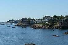
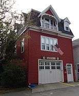
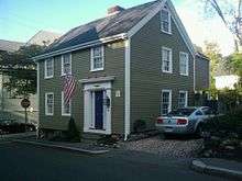
Contemporary photographs of Marblehead
|


References
- ↑ "Marblehead MA – Official Website". Town of Marblehead, Massachusetts. Retrieved October 4, 2012.
- ↑ "Profile of General Population and Housing Characteristics: 2010 Demographic Profile Data (DP-1): Marblehead town, Essex County, Massachusetts". U.S. Census Bureau, American Factfinder. Retrieved September 4, 2012.
- ↑ See the History of Marblehead by Virginia Gamage
- ↑ "Population of the 24 Urban Places: 1790". United States Bureau of the Census. June 15, 1998. Retrieved September 8, 2011.
- ↑ Howard, Hugh (2012). Houses of the Founding Fathers: The Men Who Made America and the Way They Lived. San Francisco, CA: Artisan Books. p. 65. ISBN 978-1-57965-510-5.
- ↑
- ↑ "US Gazetteer files: 2010, 2000, and 1990". United States Census Bureau. 2011-02-12. Retrieved 2011-04-23.
- ↑ "Geographic Identifiers: 2010 Demographic Profile Data (G001): Marblehead town, Essex County, Massachusetts". U.S. Census Bureau, American Factfinder. Retrieved September 4, 2012.
- ↑ "TOTAL POPULATION (P1), 2010 Census Summary File 1". American FactFinder, All County Subdivisions within Massachusetts. United States Census Bureau. 2010.
- ↑ "Massachusetts by Place and County Subdivision - GCT-T1. Population Estimates". United States Census Bureau. Retrieved July 12, 2011.
- ↑ "1990 Census of Population, General Population Characteristics: Massachusetts" (PDF). US Census Bureau. December 1990. Table 76: General Characteristics of Persons, Households, and Families: 1990. 1990 CP-1-23. Retrieved July 12, 2011.
- ↑ "1980 Census of the Population, Number of Inhabitants: Massachusetts" (PDF). US Census Bureau. December 1981. Table 4. Populations of County Subdivisions: 1960 to 1980. PC80-1-A23. Retrieved July 12, 2011.
- ↑ "1950 Census of Population" (PDF). Bureau of the Census. 1952. Section 6, Pages 21-10 and 21-11, Massachusetts Table 6. Population of Counties by Minor Civil Divisions: 1930 to 1950. Retrieved July 12, 2011.
- ↑ "1920 Census of Population" (PDF). Bureau of the Census. Number of Inhabitants, by Counties and Minor Civil Divisions. Pages 21-5 through 21-7. Massachusetts Table 2. Population of Counties by Minor Civil Divisions: 1920, 1910, and 1920. Retrieved July 12, 2011.
- ↑ "1890 Census of the Population" (PDF). Department of the Interior, Census Office. Pages 179 through 182. Massachusetts Table 5. Population of States and Territories by Minor Civil Divisions: 1880 and 1890. Retrieved July 12, 2011.
- ↑ "1870 Census of the Population" (PDF). Department of the Interior, Census Office. 1872. Pages 217 through 220. Table IX. Population of Minor Civil Divisions, &c. Massachusetts. Retrieved July 12, 2011.
- ↑ "1860 Census" (PDF). Department of the Interior, Census Office. 1864. Pages 220 through 226. State of Massachusetts Table No. 3. Populations of Cities, Towns, &c. Retrieved July 12, 2011.
- ↑ "1850 Census" (PDF). Department of the Interior, Census Office. 1854. Pages 338 through 393. Populations of Cities, Towns, &c. Retrieved July 12, 2011.
- ↑ "2010 Census Interactive Population Search". United States Census Bureau. Retrieved 2016-02-20.
- ↑ "factfinder.census.gov".
- ↑ "Marblehead Public Schools". Marblehead Public Schools. Retrieved 2007-12-03.
- 1 2 3 4 5 6 7 "By land or by sea, this granite peninsula rocks.". northshore. Retrieved December 6, 2013.
- ↑ "Burgess of Marblehead: People, Places and Planes". Marblehead Museum & Historical Society. Retrieved December 6, 2013.
- ↑ "Crocker Park". Town of Marblehead. Retrieved December 6, 2013.
- ↑ "Twenty Question Interview: Rob Delaney". divinecaroline. Retrieved December 6, 2013.
- ↑ "Susan Estrich". Debate.org Reference. Retrieved December 6, 2013.
- ↑ "Shalane Flanagan". USA Track & Field. Retrieved December 12, 2013.
- ↑ "GERRY, Elbridge, (1744–1814)". Biographical Directory of the United States Congress. Retrieved December 12, 2013.
- ↑ Bedell, Geraldine (26 June 1993). "INTERVIEW / A taste for the masses: Loyd Grossman: Born in Marblehead, he speaks like he ate the place and critics hate him. But he draws the audiences.". The Independent. Retrieved 17 May 2016.
- ↑ "UPDATE: Marblehead cyclist, Tyler Hamilton, paints grim picture of sport". MarbleheadRporter. Retrieved December 12, 2013.
- ↑ "About the Author". Hyperion. Retrieved December 12, 2013.
- ↑ "Harry Kemelman, 88, Mystery Novelist, Dies". The New York Times. Retrieved December 12, 2013.
- ↑ Mason, Caroline Atherton Briggs (1891). The Lost Ring: And Other Poems. Houghton, Mifflin. p. x.
- ↑ "Dave Mattacks - Jethro Tull".
- ↑ "US Sailing". USSailing.org. Retrieved February 24, 2016.
- ↑ "Cory Schneider". Hockey=Reference.com. Retrieved December 12, 2013.
- ↑ "The BBC, live from Marblehead". Boston Globe. Retrieved December 12, 2013.
- ↑ "STORY, Joseph, (1779–1845)". Biographical Directory of the United States Congress. Retrieved December 12, 2013.
- ↑ H. P. Lovecraft, Selected Letters Vol. 3, pp. 126–127; cited in Joshi and Schultz, An H. P. Lovecraft Encyclopedia, p. 92.
External links
| Wikivoyage has a travel guide for Marblehead (Massachusetts). |
| Wikimedia Commons has media related to Marblehead, Massachusetts. |
- Town of Marblehead official website
- Historic Marblehead – Audio walking tour
- 1912 Marblehead Atlas.
- 1881 Atlas of Marblehead published by Hopkins.
- 1897 Atlas of Salem, Danvers, Peabody, and Marblehead.
- History and Traditions of Marblehead by Samuel Roads, Published 1880, 390 pages.
| |
| General Information | |
| Institutions | |
| Notable Residents |
|
| Historic Houses | |
| Historic Buildings and Sites | |
| Neighboring Towns | |
| |
Municipalities and communities of Essex County, Massachusetts, United States | ||
|---|---|---|
| Cities | 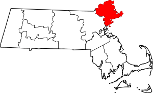 | |
| Towns | ||
| CDPs | ||
| Other villages | ||