Maple, North Carolina

Maple is an unincorporated community in Crawford Township, Currituck County, North Carolina, United States at the intersection of NC Highway 168 and SR 1246 (Maple Road). Maple is located at latitude 36.4148780 North, and longitude -76.0040925 West. The elevation is 3 feet. Maple appears on the Currituck U.S. Geological Survey Map.[1]
The United States Postal Service operates a post office located at 3452 Caratoke Hwy., Maple, NC. The zip code for Maple is 27956.[2]
The community of Maple is bounded on the east by Coinjock Bay, a tributary of Currituck Sound; on the west by the Great Swamp; on the south by the unincorporated community of Barco, NC and on the north by the unincorporated community of Currituck, NC [3]
Government / Education Facilities
Maple is home to the following local governmental/education facilities:
- College of The Albemarle Regional Aviation Technical Training Center [4][5][6]
- Currituck County Detention Facility, 413A Maple Rd., Maple, NC 27956 [7]
- Currituck County Regional Airport, Airport Rd., Maple, NC 27956 [8][9][10]
- Currituck County Sheriff's Office, 413A Maple Rd., Maple, NC 27956 [11]
- Currituck County Water Plant, 442 Maple Rd., Maple, NC 27956 [12]
- NC DOT Maintenance Yard, 397 Maple Rd., Maple, NC 27956 [13]
Nearby Cities & Towns
- Currituck, NC 3.2 mi ENE
- Barco, NC 3.6 mi SE
- Shawboro, NC 3.6 mi SW
- Coinjock, NC 5.8 mi SE
- Moyock, NC 7.9 mi NW
- Knotts Island, NC 7.9 mi NE
- Camden, NC 9 mi SW
- Aydlett, NC 10.4 mi SE
- Corolla, NC 10.5 mi E
- Shiloh, NC 12.8 mi S
Regional Cities & Towns
- Norfolk, Va, NC 38.9 mi NNW
- Elizabeth City, NC 17.7 mi WSW
- Raleigh, NC 183 mi WSW
- Greenville, NC 116 mi SW
- Kitty Hawk, NC 34.8 mi SE
References
- ↑ "USGS GNIS for Maple, NC Maple". United States Geological Survey. 1980. Retrieved March 8, 2013.
- ↑ "USPS Location Details". United States Postal Service. Retrieved March 8, 2013.
- ↑ "Currituck Topographic Map - Lat 36.4499°N Long -76.0155°W Elevation 16 Feet". Trails.com / United States Geological Survey. Retrieved March 8, 2013.
- ↑ "College of the Albemarle News". College of the Albemarle. 2011. Retrieved March 8, 2013.
- ↑ "Wings Over Albemarle". Currituck County North Carolina Economic Development. 2013. Retrieved March 8, 2013.
- ↑ "Currituck County Regional Aviation & Technical Training Center". MBAJ Architecture. 2012. Retrieved March 13, 2012.
- ↑ "Jail / Detention Center". Currituck County, NC. Retrieved March 8, 2013.
- ↑ "Currituck County Regional Airport". Currituck County, NC. Retrieved March 8, 2013.
- ↑ "Currituck County Regional Airport". Currituck County, NC. Retrieved March 8, 2013.
- ↑ "AirNav: KONX - Currituck County Regional Airport". Currituck County North Carolina Economic Development. 2013. Retrieved March 8, 2013.
- ↑ "Currituck Sheriff's Office Department Information". Currituck County, NC. Retrieved March 8, 2013.
- ↑ "Mainland Water Department". Currituck County, NC. 2013. Retrieved March 8, 2013.
- ↑ "Currituck County Interactive Online Mapping". Currituck County, NC. Retrieved March 8, 2013.
Coordinates: 36°25′9.9″N 76°2′1″W / 36.419417°N 76.03361°W
Municipalities and communities of Currituck County, North Carolina, United States | ||
|---|---|---|
| CDPs | 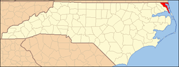 | |
| Unincorporated communities | ||