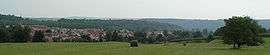
Mandeure
| Mandeure | ||
|---|---|---|
 | ||
| ||
 Mandeure | ||
|
Location within Bourgogne-Franche-Comté region  Mandeure | ||
| Coordinates: 47°27′07″N 6°48′22″E / 47.4519°N 6.8061°ECoordinates: 47°27′07″N 6°48′22″E / 47.4519°N 6.8061°E | ||
| Country | France | |
| Region | Bourgogne-Franche-Comté | |
| Department | Doubs | |
| Arrondissement | Montbéliard | |
| Canton | Valentigney | |
| Intercommunality | Pays de Montbéliard | |
| Government | ||
| • Mayor (2008–2014) | Joseph Tyrode | |
| Area1 | 15.13 km2 (5.84 sq mi) | |
| Population (2012)2 | 4,878 | |
| • Density | 320/km2 (840/sq mi) | |
| Time zone | CET (UTC+1) | |
| • Summer (DST) | CEST (UTC+2) | |
| INSEE/Postal code | 25367 / 25350 | |
| Elevation | 324–581 m (1,063–1,906 ft) | |
|
1 French Land Register data, which excludes lakes, ponds, glaciers > 1 km² (0.386 sq mi or 247 acres) and river estuaries. 2 Population without double counting: residents of multiple communes (e.g., students and military personnel) only counted once. | ||

Mandeure is a commune in the Doubs department in the Bourgogne-Franche-Comté region in eastern France.
History
Mandeure was a Roman town called Epomanduodurum. It reached its apogee in the 2nd century. The Roman theater was one of the largest in Gaul, measuring 142 m with four levels of seats that could seat 12,000 to 15,000 spectators. Free guided tours are available by contacting the mayor's office.
Population
| Historical population | ||
|---|---|---|
| Year | Pop. | ±% |
| 1936 | 4,985 | — |
| 1954 | 5,120 | +2.7% |
| 1962 | 5,186 | +1.3% |
| 1968 | 5,550 | +7.0% |
| 1975 | 6,596 | +18.8% |
| 1982 | 6,105 | −7.4% |
| 1990 | 5,402 | −11.5% |
| 1999 | 5,142 | −4.8% |
| 2008 | 4,998 | −2.8% |
| 2012 | 4,878 | −2.4% |
See also
References
External links
| Wikimedia Commons has media related to Mandeure. |
- Mandeure on the intercommunal Web site of the department (French)
- Official Web site (French)
This article is issued from Wikipedia - version of the 10/29/2016. The text is available under the Creative Commons Attribution/Share Alike but additional terms may apply for the media files.