Manchester, Michigan
| Manchester | |
|---|---|
| Village | |
|
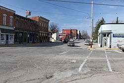
Main Street, Manchester | |
 Location of Manchester, Michigan | |
| Coordinates: 42°8′58″N 84°2′2″W / 42.14944°N 84.03389°W | |
| Country | United States |
| State | Michigan |
| County | Washtenaw |
| Area[1] | |
| • Total | 2.24 sq mi (5.80 km2) |
| • Land | 2.12 sq mi (5.49 km2) |
| • Water | 0.12 sq mi (0.31 km2) |
| Elevation | 899 ft (274 m) |
| Population (2010)[2] | |
| • Total | 2,091 |
| • Estimate (2012[3]) | 2,110 |
| • Density | 986.3/sq mi (380.8/km2) |
| Time zone | Eastern (EST) (UTC-5) |
| • Summer (DST) | EDT (UTC-4) |
| ZIP code | 48158 |
| Area code(s) | 734 |
| FIPS code | 26-50660[4] |
| GNIS feature ID | 0631375[5] |
| Website |
vil-manchester |
Manchester is a village in Washtenaw County in the U.S. state of Michigan. The population was 2,091 at the 2010 census.[6] The village is located within Manchester Township.
Chicago Road
In 1824 the United States Congress passed the General Survey Act, intended to create and maintain military roads through what was then the west of the country. One third of the funds allocated went to build a road between the strategic army posts of Detroit and Fort Dearborn, at the little town of Chicago. Known as the Chicago Road, it followed the old Sauk Trail and opened the entire area for settlement.
Also in 1824, the land around today's Manchester was surveyed by John Mack, who noted it as being "a good mill seat." John Gilbert, who had recently completed work on sections of the Erie Canal, agreed with John Mack, and on May 10, 1826 he purchased 80 acres (32 ha) of land along the Raisin River at that location.[7]
Early village history
Originally from upstate New York, John Gilbert resettled to Ypsilanti, Michigan, in 1831. In 1832, he decided to turn his attention to the extensive land tracts he held in the area. He commissioned the construction of a grist mill along the Raisin River upon the land he had purchased in 1826. The original plat of the village of Manchester was prepared by surveyor Hiram Burnham and dated 1833, but was not formally filed until March 25, 1835. The location was chosen to take advantage of water power from the river and named after Manchester, New York.[7]
Soulesville
In 1833, James Soule purchased a large tract of land about 1-mile (1.6 km) downstream from Manchester.[8] He built a small settlement he named Soulesville. Though the two settlements initially competed against each other, on March 16, 1867, both settlements were incorporated into the village of Manchester.[9] The Manchester Village Office and Manchester Public Library are located on the site of the former settlement.
Geography
According to the United States Census Bureau, the village has a total area of 2.24 square miles (5.80 km2), of which 2.12 square miles (5.49 km2) is land and 0.12 square miles (0.31 km2) is water.[1]
Demographics
| Historical population | |||
|---|---|---|---|
| Census | Pop. | %± | |
| 1880 | 1,156 | — | |
| 1890 | 1,191 | 3.0% | |
| 1900 | 1,209 | 1.5% | |
| 1910 | 1,047 | −13.4% | |
| 1920 | 1,024 | −2.2% | |
| 1930 | 1,037 | 1.3% | |
| 1940 | 1,100 | 6.1% | |
| 1950 | 1,388 | 26.2% | |
| 1960 | 1,568 | 13.0% | |
| 1970 | 1,650 | 5.2% | |
| 1980 | 1,686 | 2.2% | |
| 1990 | 1,753 | 4.0% | |
| 2000 | 2,160 | 23.2% | |
| 2010 | 2,091 | −3.2% | |
| Est. 2015 | 2,143 | [10] | 2.5% |
2010 census
As of the census[2] of 2010, there were 2,091 people, 938 households, and 570 families residing in the village. The population density was 986.3 inhabitants per square mile (380.8/km2). There were 1,029 housing units at an average density of 485.4 per square mile (187.4/km2). The racial makeup of the village was 98.2% White, 0.3% African American, 0.2% Native American, 0.3% Asian, 0.1% from other races, and 0.8% from two or more races. Hispanic or Latino of any race were 1.6% of the population.
There were 938 households of which 28.9% had children under the age of 18 living with them, 43.5% were married couples living together, 12.7% had a female householder with no husband present, 4.6% had a male householder with no wife present, and 39.2% were non-families. 34.0% of all households were made up of individuals and 12.1% had someone living alone who was 65 years of age or older. The average household size was 2.23 and the average family size was 2.85.
The median age in the village was 41.3 years. 23.3% of residents were under the age of 18; 6.4% were between the ages of 18 and 24; 25.8% were from 25 to 44; 29.1% were from 45 to 64; and 15.2% were 65 years of age or older. The gender makeup of the village was 46.9% male and 53.1% female.
2000 census
As of the census[4] of 2000, there were 2,160 people, 900 households, and 584 families residing in the village. The population density was 1,201.8 per square mile (463.3/km²). There were 949 housing units at an average density of 528.0 per square mile (203.6/km²). The racial makeup of the village was 98.24% White, 0.37% African American, 0.46% Native American, 0.19% Asian, 0.42% from other races, and 0.32% from two or more races. Hispanic or Latino residents of any race were 1.48% of the population.
There were 900 households out of which 33.3% had children under the age of 18 living with them, 50.2% were married couples living together, 11.8% had a female householder with no husband present, and 35.1% were non-families. 29.4% of all households were made up of individuals and 11.9% had someone living alone who was 65 years of age or older. The average household size was 2.40 and the average family size was 3.00.
In the village the population was spread out with 26.7% under the age of 18, 7.0% from 18 to 24, 30.9% from 25 to 44, 21.1% from 45 to 64, and 14.3% who were 65 years of age or older. The median age was 36 years. For every 100 females there were 89.6 males. For every 100 females age 18 and over, there were 83.3 males.
The median income for a household in the village was $46,974, and the median income for a family was $56,875. Males had a median income of $43,438 versus $27,396 for females. The per capita income for the village was $24,113. About 4.3% of families and 5.2% of the population were below the poverty line, including 6.3% of those under age 18 and 6.8% of those age 65 or over.
Arts and culture
The annual Manchester Chicken Broil serves approximately 12,000 broiled chicken meals over a four-hour span; it celebrated its 60th anniversary in 2013.
The Manchester Area Historical Society publishes an annual calendar and a web site with articles on the early days of Manchester.
More information

The Manchester Schools mascot is the Flying Dutchman; the school colors are maroon and gold. The school won the 2013 Class C Girls Basketball State Championship, the only MHSAA title for the school. In 1993, the Manchester football team made it to the Class C State Championship game, but lost to Iron Mountain.
During the mid to late 1880s, Manchester was the home of Michigan Lutheran Seminary.
Weekly events and historical information are regularly published in the Manchester Enterprise (founded 1867), Manchester's oldest and only newspaper.
Location scouts have taken advantage of Manchester's "old town" feeling. The Carrier (1988) was filmed in Manchester, as was Flipped (2010).
Notable people
- Fernando C. Beaman, US Congressman[12]
- Nick Davis, former NFL wide receiver, born in Manchester and played football for Manchester High School[13]
- Cub Koda, lead singer of Brownsville Station, best known for the 1973 hit song "Smokin' in the Boys Room", which was later covered by Mötley Crüe, graduated from Manchester High School
- John Swainson, the 42nd Governor of the State of Michigan (1961–1963) as well as Justice of the Michigan State Supreme Court (1971–1975), resided in Manchester from the mid-1970s until his death in 1994. He lived on a country road in Bridgewater Township just east of the Village, in a large home that he nicknamed "The Hustings" (see husting). He was well known in the community and many were honored to call him friend. He could be found most mornings at the Village Bakery, sitting at a table with the men of the community, discussing both national and state politics as well as village matters. He was also very active in the Manchester Historical Society.[14]
Coordinates: 42°09′01″N 84°02′16″W / 42.15028°N 84.03778°W
Gallery
 Village offices, City Rd.
 Wurster Park, Main St.
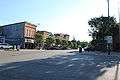 Downtown Manchester, Main St.
 Main St, Manchester
 River Raisin from Main St.
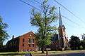 Emanuel United Church of Christ, Main St.
 Emanuel Church historical marker, Main St.
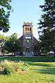 St. Mary's Catholic Church, Main St.
References
- 1 2 "US Gazetteer files 2010". United States Census Bureau. Retrieved 2012-11-25.
- 1 2 "American FactFinder". United States Census Bureau. Retrieved 2012-11-25.
- ↑ "Population Estimates". United States Census Bureau. Retrieved 2013-06-03.
- 1 2 "American FactFinder". United States Census Bureau. Retrieved 2008-01-31.
- ↑ "US Board on Geographic Names". United States Geological Survey. 2007-10-25. Retrieved 2008-01-31.
- ↑ "Profile of General Population and Housing Characteristics: 2010 Demographic Profile Data (DP-1): Manchester village, Michigan". U.S. Census Bureau, American Factfinder. Retrieved July 6, 2012.
- 1 2 dhowell (2008-07-11). "Major John Gilbert - The Founder of Manchester (Part 1 of 2)". Manchester Area Historical Society. Retrieved 2013-10-17.
- ↑ dhowell (2007-04-20). "Soulesville". Manchester Area Historical Society. Retrieved 2013-10-17.
- ↑ dhowell (2007-04-20). "Burr Oak Openings". Manchester Area Historical Society. Retrieved 2013-10-17.
- ↑ "Annual Estimates of the Resident Population for Incorporated Places: April 1, 2010 to July 1, 2015". Retrieved July 2, 2016.
- ↑ "Census of Population and Housing". Census.gov. Retrieved June 4, 2015.
- ↑ "BEAMAN, Fernando Cortez, (1814 - 1882)". Biographical Directory of the United States Congress. Retrieved February 23, 2014.
- ↑ "Nick Davis". Pro-Football.com. Retrieved February 23, 2014.
- ↑ "Michigan Governor John Burley Swainson". National Governors Association. Retrieved February 32, 2014. Check date values in:
|access-date=(help)
External links
- Village of Manchester official website
- Manchester Area Historical Society
- Manchester Chicken Broil
- Manchester Enterprise, local newspaper
- The Manchester Mirror, local news website
Municipalities and communities of Washtenaw County, Michigan, United States | ||
|---|---|---|
| Cities | 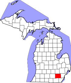 | |
| Villages | ||
| Charter townships | ||
| General law townships | ||
| CDPs | ||
| Unincorporated communities | ||
| Footnotes | ‡This populated place also has portions in an adjacent county or counties | |