Man Hpa
| Man Hpa | |
|---|---|
 Man Hpa Location in Burma | |
| Coordinates: 24°13′N 97°17′E / 24.217°N 97.283°ECoordinates: 24°13′N 97°17′E / 24.217°N 97.283°E | |
| Country |
|
| State | Kachin State |
| District | Bhamo District |
| Township | Bhamo Township |
| Population | |
| • Religions | Buddhism |
| Time zone | UTC + 6:30 (UTC+6.30) |
Man Hpa is a village in Bhamo Township in Bhamo District in the Kachin State of north-eastern Burma.[1]
References
- ↑ Maplandia world gazetteer
External links
Capital: Myitkyina | ||
| Bhamo District |  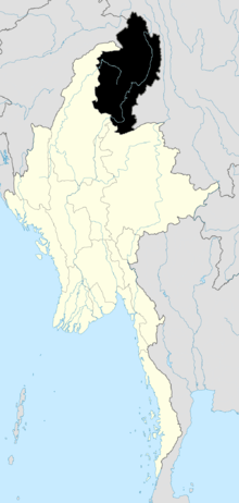 | |
| Mohnyin District | ||
| Myitkyina District | ||
| Putao District | ||
| Main cities and towns | ||
This article is issued from Wikipedia - version of the 2/13/2016. The text is available under the Creative Commons Attribution/Share Alike but additional terms may apply for the media files.