Mammoth, Arizona
| Mammoth | |
|---|---|
| Town | |
| Mammoth, Arizona | |
|
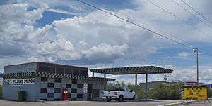
God's Filling Station | |
 Location in Pinal County and the state of Arizona | |
| Coordinates: 32°43′20″N 110°38′39″W / 32.72222°N 110.64417°WCoordinates: 32°43′20″N 110°38′39″W / 32.72222°N 110.64417°W | |
| Country | United States |
| State | Arizona |
| County | Pinal |
| Founded | c. 1872 |
| Incorporated | 1958 |
| Government | |
| • Mayor | Don Jones |
| Area | |
| • Total | 1.1 sq mi (2.8 km2) |
| • Land | 1.1 sq mi (2.8 km2) |
| • Water | 0.0 sq mi (0.0 km2) |
| Elevation | 2,359 ft (719 m) |
| Population (2010)[1] | |
| • Total | 1,426 |
| • Estimate (2014)[2] | 1,472 |
| • Density | 1,970.0/sq mi (773.9/km2) |
| Time zone | MST (no DST) (UTC-7) |
| ZIP code | 85618 |
| Area code(s) | 520 |
| FIPS code | 04-43990 |
| Website | Town of Mammoth |
Mammoth is a town in Pinal County, Arizona, United States. The population was 1,426 at the 2010 census;[1] according to 2014 Census Bureau estimates, the population of the town is 1,472.[2]
History
Mammoth was founded c. 1872 as Mammoth Camp, serving the nearby Mammoth Mine. Until 2003, when it closed, Mammoth served as a bedroom community for the nearby San Manuel mine.
The nearby ghost town of Copper Creek is a popular local attraction.
Minerals from the old Mammoth-St. Anthony Mine are found in all major mineral collections. Tiger, Arizona was the townsite at the Tiger mine, but nothing remains of this ghost town.
In November 2014 Mammoth was the subject of a fictional horror tale on the Reddit subreddit "/r/nosleep", which had a contagious disease wipe out the population. Naive users believed and spread the story, somewhat akin to the 1938 War of the Worlds panic. The town was inundated with phone calls from people trying to ascertain what was happening.[3]
Geography
Mammoth is located at 32°43′20″N 110°38′39″W / 32.72222°N 110.64417°W (32.722140, -110.644209).[4]
According to the United States Census Bureau, the town has a total area of 1.1 square miles (2.8 km2), all of it land.
Climate
According to the Köppen Climate Classification system, Mammoth has a semi-arid climate, abbreviated "BSk" on climate maps.[5]
Demographics
| Historical population | |||
|---|---|---|---|
| Census | Pop. | %± | |
| 1910 | 651 | — | |
| 1920 | 324 | −50.2% | |
| 1930 | 239 | −26.2% | |
| 1960 | 1,913 | — | |
| 1970 | 1,953 | 2.1% | |
| 1980 | 1,906 | −2.4% | |
| 1990 | 1,845 | −3.2% | |
| 2000 | 1,762 | −4.5% | |
| 2010 | 1,426 | −19.1% | |
| Est. 2015 | 1,487 | [6] | 4.3% |
| U.S. Decennial Census[7] 2014 Estimate[2] | |||
As of the census[8] of 2000, there were 1,762 people, 562 households, and 440 families residing in the town. The population density was 1,626.5 people per square mile (629.9/km²). There were 697 housing units at an average density of 643.4 per square mile (249.2/km²). The racial makeup of the town was 61.92% White, 0.11% Black or African American, 1.53% Native American, 0.34% Asian, 0.17% Pacific Islander, 31.90% from other races, and 4.03% from two or more races. 72.99% of the population were Hispanic or Latino of any race.
There were 562 households out of which 39.0% had children under the age of 18 living with them, 55.0% were married couples living together, 16.0% had a female householder with no husband present, and 21.7% were non-families. 18.5% of all households were made up of individuals and 9.8% had someone living alone who was 65 years of age or older. The average household size was 3.14 and the average family size was 3.54.
In the town the population was spread out with 33.5% under the age of 18, 8.9% from 18 to 24, 25.8% from 25 to 44, 20.1% from 45 to 64, and 11.6% who were 65 years of age or older. The median age was 32 years. For every 100 females there were 97.8 males. For every 100 females age 18 and over, there were 95.3 males.
The median income for a household in the town was $29,861, and the median income for a family was $32,661. Males had a median income of $32,768 versus $19,028 for females. The per capita income for the town was $9,878. About 23.8% of families and 28.1% of the population were below the poverty line, including 39.4% of those under age 18 and 10.6% of those age 65 or over.
Notable residents
Eulalia "Sister" Bourne, pioneer Arizona schoolteacher and author (Woman in Levis's, etc.), lived much of her life in the vicinity, at her homestead in Peppersauce Canyon near San Manuel, and later at her ranch on Copper Creek near Mammoth, where she died in 1984.
References
- 1 2 "American FactFinder". United States Census Bureau. Retrieved 2014-08-31.
- 1 2 3 "Population Estimates". United States Census Bureau. Retrieved July 12, 2015.
- ↑ http://www.usatoday.com/story/news/nation/2014/11/12/mammoth-arizona-target-internet-hoax/18901727/
- ↑ "US Gazetteer files: 2010, 2000, and 1990". United States Census Bureau. 2011-02-12. Retrieved 2011-04-23.
- ↑ Climate Summary for Mammoth, Arizona
- ↑ "Annual Estimates of the Resident Population for Incorporated Places: April 1, 2010 to July 1, 2015". Retrieved July 2, 2016.
- ↑ United States Census Bureau. "Census of Population and Housing". Retrieved August 31, 2014.
- ↑ "American FactFinder". United States Census Bureau. Retrieved 2008-01-31.
External links
Municipalities and communities of Pinal County, Arizona, United States | ||
|---|---|---|
| Cities |  | |
| Towns | ||
| CDPs |
| |
| Unincorporated communities | ||
| Indian reservations | ||
| Ghost towns | ||
| Footnotes | ‡This populated place also has portions in an adjacent county or counties | |