Makwanpur District
| Makawanpur मकवानपुर | |
|---|---|
| District | |
 | |
| Country | Nepal |
| Region | Central (Madhyamanchal) |
| Zone | Narayani |
| Headquarters | Hetauda |
| Area | |
| • Total | 2,426 km2 (937 sq mi) |
| Population (2011[1]) | |
| • Total | 420,477 |
| • Density | 170/km2 (450/sq mi) |
| Time zone | NPT (UTC+5:45) |
| Main language(s) | Nepali |
| Website | www.ddcmakwanpur.gov.np |
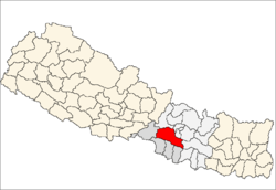
Makawanpur District(Nepali: मकवानपुर जिल्ला![]() Listen , a part of Province No. 3, is one of the seventy-five districts of Nepal, a landlocked country of South Asia. The district, with Hetauda as its district headquarters, covers an area of 2,426 km² and had a population of 392,604 in 2001 and 420,477 in 2011.
Listen , a part of Province No. 3, is one of the seventy-five districts of Nepal, a landlocked country of South Asia. The district, with Hetauda as its district headquarters, covers an area of 2,426 km² and had a population of 392,604 in 2001 and 420,477 in 2011.
Geography and Climate
| Climate Zone[2] | Elevation Range | % of Area |
|---|---|---|
| Lower Tropical | below 300 meters (1,000 ft) | 7.2% |
| Upper Tropical | 300 to 1,000 meters 1,000 to 3,300 ft. |
59.0% |
| Subtropical | 1,000 to 2,000 meters 3,300 to 6,600 ft. |
28.9% |
| Temperate | 2,000 to 3,000 meters 6,400 to 9,800 ft. |
4.9% |
Village Development Committees (VDCs) and Municipalities
- Agara
- Ambhanjyang
- Bajrabarahi
- Betini
- Bhainse
- Bharta Pundyadevi
- Bhimphedi
- Budhichaur
- Chhatiwan
- Chitlang
- Dandakharka
- Dhimal
- Gogane
- Handikhola
- Hetauda (Sub metropolitan city)
- Hurnamadi
- Ipa Panchakanya
- Kalikatar
- Kankada
- Kamane
- Khairang
- Kogate
- Kulekhani
- Makwanpurgadhi
- Manahari
- Manthali
- Markhu
- Marta Punchedevi
- Namtar
- Nibuwatar
- Phakhel
- Phaparbari
- Raigaun
- Raksirang
- Sarikhet Palase
- Shikharpur
- Sripur Chhatiwan
- Sisneri Mahadevsthan
- Sukaura
- Thaha Municipality
- Thingan
- Tistung Deurali

Map of the VDCs and Municipalities (blue) in Makwanpur District
References
- ↑ General Bureau of Statistics, Kathmandu, Nepal, Nov. 2012
- ↑ The Map of Potential Vegetation of Nepal - a forestry/agroecological/biodiversity classification system (PDF), Forest & Landscape Development and Environment Series 2-2005 and CFC-TIS Document Series No.110., 2005, ISBN 87-7903-210-9, retrieved Nov 22, 2013
- "Districts of Nepal". Statoids.

Coordinates: 27°25′N 85°02′E / 27.417°N 85.033°E
| Wikimedia Commons has media related to Makwanpur District. |
This article is issued from Wikipedia - version of the 11/14/2016. The text is available under the Creative Commons Attribution/Share Alike but additional terms may apply for the media files.