Maitland River
| Maitland River | |
| River | |
 Maitland River west of Auburn, Ontario | |
| Name origin: Named after Sir Peregrine Maitland | |
| Country | Canada |
|---|---|
| Province | Ontario |
| Region | Southwestern Ontario |
| Counties | Huron, Wellington County, Perth County |
| Part of | Great Lakes Basin |
| Tributaries | |
| - left | South Maitland River, Middle Maitland River |
| Source | |
| - location | Wellington North, Wellington County |
| - elevation | 447 m (1,467 ft) |
| - coordinates | 43°54′58″N 80°39′22″W / 43.91611°N 80.65611°W |
| Mouth | Lake Huron |
| - location | Goderich, Huron County |
| - elevation | 176 m (577 ft) |
| - coordinates | 43°44′55″N 81°43′38″W / 43.74861°N 81.72722°WCoordinates: 43°44′55″N 81°43′38″W / 43.74861°N 81.72722°W |
| Length | 150 km (93 mi) |
| Basin | 2,592 km2 (1,001 sq mi) |
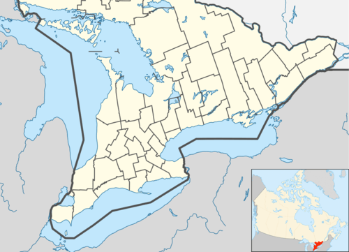 Location of the mouth of the Maitland River in southern Ontario | |
The Maitland River is a river in Huron County, Perth County and Wellington County in Southwestern Ontario, Canada.[1][2] The river is in the Great Lakes Basin and empties into Lake Huron at the town of Goderich. It is 150 kilometres (93 mi) long, and is named after Sir Peregrine Maitland, Lieutenant-Governor of Upper Canada from 1818 to 1828. It was formerly known as the Menesetung River.[3]
Course
For a map showing the river course highlighted on a topographic map, see this reference.[2]
The river begins in geographic Arthur Township in the municipality of Wellington North, Wellington County. It flows west into the municipality of Minto and its main centre, the community of Harriston, with its triple junction of Ontario Highway 9, Ontario Highway 23 and Ontario Highway 89. The river continues west into the municipality of Howick, Huron County, where it passes over two small dams, at Gorrie (maintained by the Maitland Valley Conservation Authority) and at Wroxeter (maintained by the community),[4] passes through the municipality of Morris-Turnberry, and reaches the community of Wingham in the municipality of North Huron, where it passes over a dam and takes in the left tributary Middle Maitland River. The river then turns southwest and enters the municipality of Ashfield–Colborne–Wawanosh. From the community of Auburn to Goderich, the river forms the boundary between Ashfield–Colborne–Wawanosh and the municipality of Central Huron. The river continues southwest, takes in the left tributary South Maitland River, turns northwest, and reaches its mouth at Lake Huron at the town of Goderich.
Black Hole
Near the end of black hole road, East of Goderich there is a "black hole" in the river. It has caused drownings in the past and the depth is unknown. The location is 43°43′15.00003668925356″N 81°39′12.000204354525382″W.
Natural history
The lower Maitland (to Wingham) has a trout and salmon run, and is home to several species at risk including Queen snake, Wavy-rayed Lampmussel and Butternut tree, as well as several Carolinian forest species, including Bitternut hickory, American Sycamore, Summer grape and Green dragon.[5]
Tributaries
- Cemetery Creek (left)
- Sharpes Creek (right)
- Hopkins Creek (left)
- South Maitland River (left)
- Blyth Brook (left)
- Belgrave Creek (left)
- Middle Maitland River (left)
- Little Maitland River
- Lakelet Creek (right)
See also
References
- ↑ "Maitland River". Geographical Names Data Base. Natural Resources Canada. Retrieved 2012-10-27.
- 1 2 "Maitland River". Atlas of Canada. Natural Resources Canada. 2010-02-04. Retrieved 2012-10-27. Shows the course of the river highlighted on a topographic map.
- ↑ Lee, Robert C., The Canada Company and the Huron Tract, 1826-1853 p.251
- ↑ "North Maitland River Sub-basin" (PDF). Watershed Report Card. Maitland Valley Conservation Authority.
- ↑ "Lower Maitland River Sub-basin" (PDF). Watershed Report Card. Maitland Valley Conservation Authority.
Other map sources:
- Map 2 (PDF) (Map). 1 : 700,000. Official road map of Ontario. Ministry of Transportation of Ontario. 2012-01-01. Retrieved 2012-10-27.
- Map 4 (PDF) (Map). 1 : 700,000. Official road map of Ontario. Ministry of Transportation of Ontario. 2012-01-01. Retrieved 2012-10-27.
- Restructured municipalities - Ontario map #6 (Map). Restructuring Maps of Ontario. Ontario Ministry of Municipal Affairs and Housing. 2006. Retrieved 2012-10-27.
- MVCA Watersheds (PDF) (Map). Maitland Valley Conservation Authority. 2010. Retrieved 2012-10-27.