Mahtotopa Mountain
| Mahtotopa Mountain | |
|---|---|
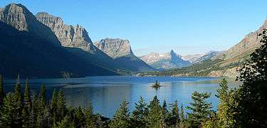 Mahtotopa Mountain at far upper left | |
| Highest point | |
| Elevation | 8,672 ft (2,643 m) [1] |
| Prominence | 417 ft (127 m) [2] |
| Coordinates | 48°39′06″N 113°34′09″W / 48.65167°N 113.56917°WCoordinates: 48°39′06″N 113°34′09″W / 48.65167°N 113.56917°W [3] |
| Geography | |
 Mahtotopa Mountain | |
| Parent range | Lewis Range |
| Topo map | USGS Rising Sun, MT |
Mahtotopa Mountain (8,672 feet (2,643 m)) is located in the Lewis Range, Glacier National Park in the U.S. state of Montana.[1][2] Mahtotopa Mountain rises to the south above Saint Mary Lake and can be easily seen from the Going-to-the-Sun Road.
See also
References
- 1 2 "Mahtotopa Mountain, Montana" (Map). My Topo (USGS Quads). Retrieved 2010-06-19.
- 1 2 "Mahtotopa Mountain, Montana". Peakbagger.com. Retrieved 2010-06-19.
- ↑ "Mahtotopa Mountain". Geographic Names Information System. United States Geological Survey. Retrieved 2010-09-26.
This article is issued from Wikipedia - version of the 12/23/2015. The text is available under the Creative Commons Attribution/Share Alike but additional terms may apply for the media files.