Mahaplag, Leyte
| Mahaplag | |
|---|---|
| Municipality | |
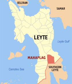 Map of Leyte with Mahaplag highlighted | |
.svg.png) Mahaplag Location within the Philippines | |
| Coordinates: 10°35′N 124°59′E / 10.583°N 124.983°ECoordinates: 10°35′N 124°59′E / 10.583°N 124.983°E | |
| Country | Philippines |
| Region | Eastern Visayas (Region VIII) |
| Province | Leyte |
| Congr. district | 5th district of Leyte |
| Barangays | 28 |
| Government[1] | |
| • Mayor | Daisy Lleve |
| Area[2] | |
| • Total | 104.79 km2 (40.46 sq mi) |
| Population (2010)[3] | |
| • Total | 26,599 |
| • Density | 250/km2 (660/sq mi) |
| Time zone | PST (UTC+8) |
| ZIP code | 6512 |
| Dialing code | 53 |
Mahaplag is a fourth class municipality in the province of Leyte, Philippines. In 2010, it had a population of 26,599 people.[3]
Barangays
Mahaplag is politically subdivided into 28 barangays.[2]
- Campin
- Cuatro De Agosto
- Hilusig
- Himamara
- Hinaguimitan
- Liberacion
- Mabuhay
- Mabunga
- Magsuganao
- Mahayag
- Mahayahay
- Malinao
- Malipoon
- Palanogan
- Paril
- Pinamonoan
- Poblacion
- Polahongon
- San Isidro
- San Juan
- Santa Cruz
- Tagaytay
- Uguis
- Union
- Upper Mahaplag
- Hiluctogan
- Maligaya
- Santo Niño
Demographics
| Population census of Mahaplag | ||
|---|---|---|
| Year | Pop. | ±% p.a. |
| 1990 | 22,673 | — |
| 1995 | 24,009 | +1.08% |
| 2000 | 26,511 | +2.15% |
| 2007 | 27,097 | +0.30% |
| 2010 | 26,599 | −0.67% |
| Source: National Statistics Office[3] | ||
References
- ↑ "Municipalities". Quezon City, Philippines: Department of the Interior and Local Government. Retrieved 24 June 2013.
- 1 2 "Province: Leyte". PSGC Interactive. Makati City, Philippines: National Statistical Coordination Board. Retrieved 2 July 2013.
- 1 2 3 "Total Population by Province, City, Municipality and Barangay: as of May 1, 2010" (PDF). 2010 Census of Population and Housing. National Statistics Office. Retrieved 2 July 2013.
External links
- Philippine Standard Geographic Code
- Philippine Census Information
- Local Governance Performance Management System
 |
Abuyog | | ||
| Baybay | |
Abuyog | ||
| ||||
| | ||||
| Inopacan | Sogod, Southern Leyte |
Tacloban (capital) | |
| Municipalities |
|
| Component city | |
| Independent component city |
|
| Highly urbanized city |
|
This article is issued from Wikipedia - version of the 7/21/2016. The text is available under the Creative Commons Attribution/Share Alike but additional terms may apply for the media files.