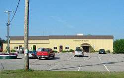
Madoc, Ontario
| Madoc | |
|---|---|
| Township (lower-tier) | |
| Township of Madoc | |
|
Municipal office | |
 Madoc | |
| Coordinates: 44°35′N 77°31′W / 44.583°N 77.517°WCoordinates: 44°35′N 77°31′W / 44.583°N 77.517°W | |
| Country |
|
| Province |
|
| County | Hastings |
| Settled | Early 19th century |
| Incorporated | 1850 |
| Government | |
| • Type | Township |
| • Reeve | Robert Sager |
| • Federal riding | Prince Edward—Hastings |
| • Prov. riding | Prince Edward—Hastings |
| Area[1] | |
| • Land | 277.97 km2 (107.32 sq mi) |
| Population (2011)[1] | |
| • Total | 2,197 |
| • Density | 7.9/km2 (20/sq mi) |
| Time zone | EST (UTC-5) |
| • Summer (DST) | EDT (UTC-4) |
| Postal Code | K0K 1Y0 |
| Area code(s) | 613 and 343 |
| Website | www.madoc.ca |
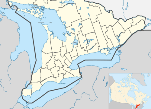
Madoc is a township in Eastern Ontario, Canada, in Hastings County.
The township was named after legendary Welsh prince Madoc ap Owain Gwynedd, credited by some with discovering North America in 1170. There exists an alternative explanation, for which no evidence exists, that the name comes from a small Welsh village, Llanmadoc on the Gower Peninsula of Wales, not far from the city of Swansea.
Communities
The township comprises the communities of Allen, Bannockburn, Cooper, Eldorado, Fox Corners, Hazzards Corners, Keller Bridge and Rimington.
 Bannockburn |
 Eldorado |
History
Mills and ironworks gave initial stimulus to the community of Madoc. Following the discovery of gold-bearing quartz in 1866,[2] the community prospered as an industrial centre.[3] Eldorado, 6 miles north of Madoc, was the site of Ontario's first gold rush on 18 August 1866 by Marcus Powell and William Berryman (or Nicholas Snider). The opened up a limestone cave 12 feet long, 6 feet wide and 6 feet high. The resultant mine was named the Richardson Mine, after John Richardson, owner of the farm where it was located. People soon came from all over North America to this area.[4]
Demographics
| Canada census – Madoc, Ontario community profile | |||
|---|---|---|---|
| 2011 | 2006 | 2001 | |
| Population: | 2197 (6.2% from 2006) | 2069 (1.2% from 2001) | 2044 (0.6% from 1996) |
| Land area: | 277.97 km2 (107.32 sq mi) | 269.98 km2 (104.24 sq mi) | 269.98 km2 (104.24 sq mi) |
| Population density: | 7.9/km2 (20/sq mi) | 7.7/km2 (20/sq mi) | 7.6/km2 (20/sq mi) |
| Median age: | 43.8 (M: 44.4, F: 43.3) | 39.0 (M: 39.2, F: 38.7) | |
| Total private dwellings: | 894 | 835 | 782 |
| Median household income: | $51,826 | $39,906 | |
| References: 2011[5] 2006[6] 2001[7] | |||
Mother tongue:
- English as first language: 92.0%
- French as first language: 1.0%
- English and French as first language: 0.5%
- Other as first language: 6.5%
Population trend:[8]
- Population in 2011: 2197
- Population in 2006: 2069
- Population in 2001: 2044
- Population in 1996: 2031
- Population in 1991: 1869
See also
References
- 1 2 "Madoc census profile". 2011 Census of Population. Statistics Canada. Retrieved 2012-03-02.
- ↑ Pain, S.A. (1960). Three Miles of Gold. Toronto: The Ryerson Press. p. 7.
- ↑ http://www.heritagefdn.on.ca/userfiles/HTML/nts_1_5648_1.html Ontario Heritage Trust Founding of Madoc
- ↑ Barnes, Michael (1995). Gold in Ontario. Erin: The Boston Mills Press. pp. 13–15. ISBN 155046146X.
- ↑ "2011 Community Profiles". Canada 2011 Census. Statistics Canada. July 5, 2013. Retrieved 2012-03-02.
- ↑ "2006 Community Profiles". Canada 2006 Census. Statistics Canada. March 30, 2011. Retrieved 2012-03-02.
- ↑ "2001 Community Profiles". Canada 2001 Census. Statistics Canada. February 17, 2012. Retrieved 2012-03-02.
- ↑ Statistics Canada: 1996, 2001, 2006 census
External links
| Wikimedia Commons has media related to Madoc, Ontario. |
 |
Tudor and Cashel (Tudor section) | | ||
| Marmora and Lake | |
Tweed | ||
| ||||
| | ||||
| Stirling-Rawdon | Centre Hastings |
| Cities | 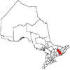 | |
|---|---|---|
| Towns | ||
| Townships | ||
| First Nations | ||
| Indian reserves | ||
| ||