Macon, Georgia
| Macon, Georgia | ||
|---|---|---|
| Consolidated city–county | ||
| Macon–Bibb County | ||
|
| ||
| ||
 Location in Bibb county in the state of Georgia | ||
 Macon, Georgia Location in the United States | ||
| Coordinates: 32°50′5″N 83°39′6″W / 32.83472°N 83.65167°WCoordinates: 32°50′5″N 83°39′6″W / 32.83472°N 83.65167°W | ||
| Country | United States of America | |
| State | Georgia | |
| County | Bibb | |
| Government | ||
| • Mayor | Robert Reichert (D) | |
| Area | ||
| • Consolidated city–county | 661 km2 (255.13 sq mi) | |
| • Land | 647 km2 (249.96 sq mi) | |
| • Water | 3.2 km2 (0.5 sq mi) | |
| Elevation | 116 m (381 ft) | |
| Population (2014) | ||
| • Consolidated city–county | 153,691 [1] | |
| • Metro | 231,259 (193rd) | |
| • CSA | 417,473 (97th) | |
| • Demonym | Maconites | |
| Time zone | EST (UTC-5) | |
| • Summer (DST) | EDT (UTC-4) | |
| ZIP codes | 31200-31299 | |
| Area code(s) | 478 | |
| FIPS code | 13-49000[2] | |
| GNIS feature ID | 0332301[3] | |
| Website | maconbibb.us | |


Macon /ˈmeɪkən/ (officially Macon–Bibb County) is a city located in the state of Georgia, United States. Macon lies near the geographic center of the state, approximately 85 miles (137 km) south of Atlanta, hence the city's nickname "the Heart of Georgia."
Settled near the fall line of the Ocmulgee River, Macon is the county seat of Bibb County and had a 2014 estimated population of 153,691. Macon is the principal city of the Macon metropolitan area, which had an estimated population of 231,259 in 2014. Macon is also the largest city in the Macon–Warner Robins Combined Statistical Area (CSA), a larger trading area with an estimated 417,473 residents in 2014; the CSA abuts the Atlanta metropolitan area just to the north.
In a 2012 referendum, voters approved the consolidation of Macon and Bibb County, and Macon became Georgia's fourth-largest city (just after Augusta). The two governments officially merged on January 1, 2014.[4]
Macon is served by three interstate highways: I-16 (connecting the city to Savannah and coastal Georgia), I-75 (connecting the city with Atlanta to the north and Valdosta to the south), and I-475 (a city bypass highway).
The city has several institutions of higher education, as well as numerous museums and tourism sites. The area is served by the Middle Georgia Regional Airport and the Herbert Smart Downtown Airport. The mayor of Macon is Robert Reichert, a former Democratic member of the Georgia House of Representatives. Reichert was elected mayor of the newly consolidated city of Macon–Bibb, and he took office on January 1, 2014.[5]
History
Macon lies on the site of the Ocmulgee Old Fields, where the historic Creek Indians lived in the 18th century. Their prehistoric predecessors, the Mississippian culture, built a powerful chiefdom (950–1100 AD) based on an agricultural village and constructed earthwork mounds for ceremonial, burial and religious purposes. The areas along the rivers in the Southeast had been inhabited by varying cultures of indigenous peoples for 13,000 years before Europeans arrived.[6]
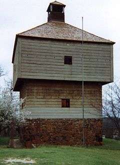
Macon developed at the site of Fort Benjamin Hawkins, built from 1806–1809 at the fall line of the Ocmulgee River to protect the new frontier and establish a trading post with Native Americans. The fort was named in honor of Benjamin Hawkins, Superintendent of Indian Affairs for the Southeast territory south of the Ohio River for more than two decades. He lived among the Creek and had a Creek wife. This was the most inland point of navigation on the river from the Low Country. President Thomas Jefferson forced the Creek to cede their lands east of the Ocmulgee River and ordered the fort built. (Archeological excavations in the 21st century found evidence of two separate fortifications.)[7]
Fort Hawkins guarded the Lower Creek Pathway, an extensive and well-traveled American Indian network later improved by the United States as the Federal Road from Washington, DC to the ports of Mobile, Alabama and New Orleans, Louisiana.[7] A gathering point of the Creek and American cultures for trading, it was also a center of state militia and federal troops. The fort served as a major military distribution point during the War of 1812 against Great Britain and also during the Creek War of 1813. Afterward, the fort was used as a trading post for several years and was garrisoned until 1821. It was decommissioned about 1828 and later burned to the ground. A replica of the southeast blockhouse was built in 1938 and stands today on a hill in east Macon. Part of the fort site is occupied by the Fort Hawkins Grammar School.[7] In the twenty-first century, archeological excavations have revealed more of the fort's importance, and stimulated planning for additional reconstruction of this major historical site.

As many settlers had already begun to move into the area, they renamed Fort Hawkins "Newtown." After the organization of Bibb County in 1822, the city was chartered as the county seat in 1823 and officially named Macon. This was in honor of the North Carolina statesman Nathaniel Macon,[8] because many of the early settlers hailed from North Carolina. The city planners envisioned "a city within a park" and created a city of spacious streets and parks. They designated 250 acres (1.0 km2) for Central City Park, and passed ordinances requiring residents to plant shade trees in their front yards.
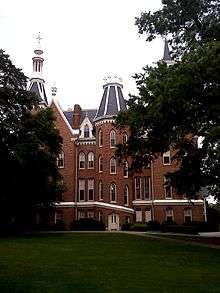
The city thrived due to its location on the Ocmulgee River, which enabled shipping to markets; cotton became the mainstay of Macon's early economy, based on the enslaved labor of Africans. Macon was in the Black Belt of Georgia, where cotton was the chief commodity crop. Cotton steamboats, stage coaches, and later, in 1843, a railroad increased marketing opportunities and contributed to the economic prosperity to Macon. In 1836, the Georgia Conference of the Methodist Episcopal Church founded Wesleyan College in Macon; it was the first college in the United States chartered to grant degrees to women.[9] In 1855 a referendum was held to determine a capital city for Georgia. Macon came in last with 3,802 votes.[10]
During the American Civil War, Macon served as the official arsenal of the Confederacy. Camp Oglethorpe, in Macon, was used first as a prison for captured Union officers and enlisted men. Later it held officers only, up to 2,300 at one time. The camp was evacuated in 1864.[11]
Macon City Hall, which served as the temporary state capitol in 1864, was converted to use as a hospital for the wounded. The Union General William Tecumseh Sherman spared Macon on his march to the sea. His troops had sacked the nearby state capital of Milledgeville, and Maconites prepared for an attack. Sherman did not bother to go through Macon.
The Macon Telegraph wrote that, of the 23 companies which the city had furnished the Confederacy, only enough men survived and were fit for duty to fill five companies by the end of the war. The human toll was very high.[12]
The city was taken by Union forces at the end of the war during Wilson's Raid on April 20, 1865.[13]
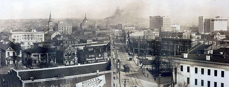
Gradually into the twentieth century, Macon grew into a prospering town in Middle Georgia. It began to serve as a transportation hub for the entire state. In 1895, the New York Times dubbed Macon "The Central City," in reference to the city's emergence as a hub for railroad transportation and textile factories.[14] Terminal Station was built in 1916.[15]
In 1994 Tropical Storm Alberto made landfall in Florida dumping 24 inches (61 cm) of rain, which resulted in major flooding in Georgia. Macon was one of the cities to suffer the worst flooding.[16]
On May 11, 2008, an EF2 tornado touched down near Lizella. The tornado then tracked northeast to the south shore of Lake Tobesofkee then continued into Macon and lifted near Dry Branch near the Twiggs County line. The tornado did not produce a continuous path, but did produce sporadic areas of major damage. Widespread straight-line wind damage was also produced along and south of the track of the tornado. The most significant damage was in the city of Macon especially along Eisenhower Parkway and Pio Nono Avenue where 2 businesses were destroyed and several others sustaining heavy damage. Middle Georgia State College was also hit by the tornado, snapping or uprooting 50 percent or more of the trees and doing significant damage to several buildings on campus with the gymnasium sustaining the worst damage. This tornado varied in intensity from EF0 to EF2 with the EF2 damage and winds up to 130 miles per hour (210 km/h) occurring near the intersection of Eisenhower Parkway and Pio Nono Avenue. Total path length was 18 miles (29 km) with a path width of 100 yards (91 m).
In 2012, voters in Macon and Bibb County approved a new consolidated government between the city and county, making the city's new boundary lines the same as the county's and deannexing a small portion of the city that once lay in Jones County.[4]

Government and politics
The mayor is Robert Reichert, a former member of the Georgia House of Representatives, who was elected to the position in 2007. The previous mayor, C. Jack Ellis (1999-2007), was the first person of African-American descent to be elected to the position in the city's history.
The city council is, to date, the only city council in Georgia to conduct partisan elections, with the city council leaning mostly to the Democratic Party.
Consolidation
On July 31, 2012, voters in Macon (57.8 percent approval) and Bibb County (56.7 percent approval) passed a referendum to merge the governments of the city of Macon and most of unincorporated Bibb County, based on the authorization of House Bill 1171, passed by the Georgia General Assembly earlier in the year;[17] four previous consolidation attempts (in 1933, 1960, 1972, and 1976) had failed.[18][19][20]
Under the consolidation, the governments of Macon and Bibb County were replaced with a single mayor and a nine-member countywide commission elected to office by county districts. A portion of Macon that extends into nearby Jones County was deincorporated from Macon. Robert Reichert is the first mayor of Macon-Bibb after the election in September 2013 and a runoff with C. Jack Ellis in October.[5][21][22][23]
Suburban flight and urban decay
Like many major industrial cities in the midwest and northeast, the city of Macon has suffered from urban decay, dilapidated bungalows and other old houses, high crime rates, air pollution from factories and urban blight which has caused flight from the city core to the more suburban portions of Bibb County and to more suburban areas like Houston County, just south of the city. This played a major role in the consolidation effort to combat the issues in a more unified manner. This has been more of an issue for Macon than Georgia's other 2nd-tier cities.
Geography
The Ocmulgee River is the major river that runs through the city. Macon is one of Georgia's three Fall Line Cities, along with Augusta and Columbus. The Fall Line is where the hilly lands of the Piedmont plateau meet the flat terrain of the coastal plain. As such, Macon has a varied landscape of rolling hills on the north side and flat plains on the south. The fall line, where the altitude drops noticeably, causes rivers in the area to flow rapidly toward the ocean. In the past, Macon and other Fall Line cities had many textile mills powered by the rivers.
Macon is located at 32°50′05″N 83°39′06″W / 32.834839°N 83.651672°W (32.834839, −83.651672).[24]
According to the United States Census Bureau, the city has a total area of 56.3 square miles (146 km2), of which, 55.8 square miles (145 km2) of it is land and 0.5 square miles (1.3 km2) of it (0.82%) is water.
Macon is approximately 330 feet (100 m) above sea level.[3]
Climate
Macon has a humid subtropical climate (Köppen climate classification Cfa). The normal monthly mean temperature ranges from 46.3 °F (7.9 °C) in January to 81.8 °F (27.7 °C) in July. On average, there are 4.8 days with 100 °F (38 °C)+ highs,[lower-alpha 1] 83 days with 90 °F (32 °C)+ highs,[lower-alpha 2] and 43 days with a low at or below freezing; the average window for freezing temperatures is November 7 thru March 22, allowing a growing season of 228 days. The city has an average annual precipitation of 45.7 inches (1,160 mm). Snow is occasional, with about half of the winters receiving trace amounts or no snowfall, averaging 0.7 inches (1.8 cm); the snowiest winter is 1972−73 with 16.5 in (42 cm).[25][26][27]
| Climate data for Macon, Georgia (Middle Georgia Regional Airport), 1981−2010 normals,[lower-alpha 3] extremes 1892−present[lower-alpha 4] | |||||||||||||
|---|---|---|---|---|---|---|---|---|---|---|---|---|---|
| Month | Jan | Feb | Mar | Apr | May | Jun | Jul | Aug | Sep | Oct | Nov | Dec | Year |
| Record high °F (°C) | 84 (29) |
85 (29) |
92 (33) |
96 (36) |
99 (37) |
108 (42) |
108 (42) |
105 (41) |
105 (41) |
100 (38) |
88 (31) |
82 (28) |
108 (42) |
| Mean maximum °F (°C) | 73.9 (23.3) |
76.7 (24.8) |
83.7 (28.7) |
88.6 (31.4) |
93.3 (34.1) |
97.8 (36.6) |
99.4 (37.4) |
98.8 (37.1) |
94.7 (34.8) |
88.4 (31.3) |
81.6 (27.6) |
75.9 (24.4) |
100.6 (38.1) |
| Average high °F (°C) | 57.8 (14.3) |
62.1 (16.7) |
69.5 (20.8) |
76.8 (24.9) |
84.6 (29.2) |
90.3 (32.4) |
92.6 (33.7) |
91.4 (33) |
86.1 (30.1) |
77.4 (25.2) |
68.8 (20.4) |
59.6 (15.3) |
76.4 (24.7) |
| Average low °F (°C) | 34.8 (1.6) |
38.0 (3.3) |
44.1 (6.7) |
50.1 (10.1) |
59.2 (15.1) |
67.6 (19.8) |
71.0 (21.7) |
70.3 (21.3) |
63.9 (17.7) |
52.4 (11.3) |
43.0 (6.1) |
36.4 (2.4) |
52.6 (11.4) |
| Mean minimum °F (°C) | 17.8 (−7.9) |
22.0 (−5.6) |
27.5 (−2.5) |
34.3 (1.3) |
45.6 (7.6) |
57.6 (14.2) |
64.8 (18.2) |
62.7 (17.1) |
50.5 (10.3) |
35.2 (1.8) |
27.7 (−2.4) |
20.5 (−6.4) |
14.8 (−9.6) |
| Record low °F (°C) | −6 (−21) |
8 (−13) |
14 (−10) |
28 (−2) |
40 (4) |
46 (8) |
56 (13) |
55 (13) |
35 (2) |
26 (−3) |
10 (−12) |
5 (−15) |
−6 (−21) |
| Average precipitation inches (mm) | 4.24 (107.7) |
4.36 (110.7) |
4.55 (115.6) |
2.96 (75.2) |
2.72 (69.1) |
4.06 (103.1) |
4.95 (125.7) |
4.10 (104.1) |
3.59 (91.2) |
2.79 (70.9) |
3.32 (84.3) |
4.04 (102.6) |
45.68 (1,160.2) |
| Average snowfall inches (cm) | 0.4 (1) |
trace | 0.2 (0.5) |
0 (0) |
0 (0) |
0 (0) |
0 (0) |
0 (0) |
0 (0) |
0 (0) |
0 (0) |
0.1 (0.3) |
0.7 (1.8) |
| Average precipitation days (≥ 0.01 in) | 10.1 | 9.0 | 8.9 | 7.7 | 7.8 | 10.3 | 11.4 | 10.4 | 7.3 | 6.2 | 7.9 | 8.8 | 105.8 |
| Average snowy days (≥ 0.1 in) | 0.3 | 0.2 | 0.1 | 0 | 0 | 0 | 0 | 0 | 0 | 0 | 0 | 0.1 | 0.7 |
| Average relative humidity (%) | 70.2 | 67.2 | 66.6 | 64.8 | 68.5 | 70.7 | 74.2 | 76.1 | 76.4 | 71.2 | 71.1 | 70.9 | 70.7 |
| Mean monthly sunshine hours | 179.5 | 192.2 | 250.8 | 283.2 | 315.3 | 300.0 | 293.9 | 288.0 | 247.4 | 253.7 | 200.2 | 182.2 | 2,986.4 |
| Percent possible sunshine | 56 | 62 | 67 | 73 | 73 | 70 | 67 | 70 | 67 | 72 | 64 | 59 | 67 |
| Source: NOAA (relative humidity and sun 1961−1990)[25][28][29] | |||||||||||||
Surrounding cities and towns

Demographics
| Historical population | |||
|---|---|---|---|
| Census | Pop. | %± | |
| 1840 | 3,297 | — | |
| 1850 | 5,720 | 73.5% | |
| 1860 | 8,247 | 44.2% | |
| 1870 | 10,810 | 31.1% | |
| 1880 | 12,749 | 17.9% | |
| 1890 | 22,746 | 78.4% | |
| 1900 | 23,272 | 2.3% | |
| 1910 | 40,665 | 74.7% | |
| 1920 | 52,995 | 30.3% | |
| 1930 | 53,829 | 1.6% | |
| 1940 | 57,865 | 7.5% | |
| 1950 | 70,252 | 21.4% | |
| 1960 | 69,764 | −0.7% | |
| 1970 | 122,423 | 75.5% | |
| 1980 | 116,896 | −4.5% | |
| 1990 | 106,612 | −8.8% | |
| 2000 | 97,255 | −8.8% | |
| 2010 | 91,351 | −6.1% | |
| Est. 2015 | 153,515 | [30] | 68.0% |

Macon is the largest principal city of the Macon-Warner Robins-Fort Valley CSA, a Combined Statistical Area that includes the Macon metropolitan area (Bibb, Crawford, Jones, Monroe, and Twiggs counties), the Warner Robins metropolitan area (Houston County), and the Fort Valley micropolitan area (Peach County),[32][33][34] which had a combined population of 346,801 at the 2000 census.[2]
As of the official 2010 U.S. Census,[2] the population of Macon was 91,351. In the last official census, in 2000, there were 97,255 people, 38,444 households, and 24,219 families residing in the city. The population density was 1,742.8 people per square mile (672.9/km2). There were 44,341 housing units at an average density of 794.6 per square mile (306.8/km2). The racial makeup of the city was 67.94% African American, 28.56% White, 0.02% Native American, 0.65% Asian, 0.03% Pacific Islander, 0.46% from other races, and 0.77% from two or more races. Hispanic or Latino of any race were 2.48% of the population.
There were 38,444 households out of which 30.1% had children under the age of 18 living with them, 33.0% were married couples living together, 25.7% had a female householder with no husband present, and 37.0% were non-families. 31.7% of all households were made up of individuals and 12.1% had someone living alone who was 65 years of age or older. The average household size was 2.44 and the average family size was 3.08.
In the city the population was spread out with 26.9% under the age of 18, 11.3% from 18 to 24, 27.5% from 25 to 44, 20.0% from 45 to 64, and 14.3% who were 65 years of age or older. The median age was 34 years. For every 100 females there were 79.7 males. For every 100 females age 18 and over, there were 72.8 males.
Economy
Personal income
According to the 2010 Census, the median household income in the city was $28,366, as compared with the state average of $49,347. The median family income was $37, 268. Full-time working males had a median income of $34,163 versus $28,082 for females. The per capita income for the city was $17,010. About 24.1% of families and 30.6% of the population were below the poverty line, including 43.6% of those under age 18 and 18.4% of those over 65.[35]
Retail
Malls include: The Shoppes at River Crossing, Macon Mall, and Eisenhower Crossing. Traditional shopping centers are in the downtown area, and Ingleside Village.[36]
Military
Robins Air Force Base, the largest single-site industrial complex in the state of Georgia,[37] is just south of Macon, next to the city of Warner Robins.
The headquarters of the 48th Infantry Brigade Combat Team, Georgia Army National Guard is located here.
Arts and culture
Musical heritage

Macon is the birthplace or hometown of musicians Emmett Miller, The Allman Brothers Band, Randy Crawford, Mark Heard, Lucille Hegamin, Otis Redding, Little Richard, Mike Mills,[38] and Bill Berry of R.E.M., as well as more recent names like violinist Robert McDuffie and country artist Jason Aldean. September Hase, an alternative rock band, was discovered in Macon. Capricorn Records, run by Macon natives Phil Walden and briefly Alan Walden, made the city a hub for Southern rock music in the late 1960s and 1970s.[39]
The Macon Symphony Orchestra[40] performs at the Grand Opera House in downtown Macon, as well as a youth symphony, and the Middle Georgia Concert Band.[41]
Festivals


- International Cherry Blossom Festival - a 10-day celebration held every mid-March in Macon
- The Mulberry Street Festival,[42] - an arts and crafts festival held downtown the last weekend of March
- The Juneteenth Freedom Festival - An annual June performing arts & educational observance of the end of American slavery 1865, celebrating black freedom and heritage, ancient & contemporary
- Pan African Festival - an annual celebration of African American culture held in April
- Ocmulgee Indian Celebration - A celebration of Macon's original Native American Heritage, this festival is held in September at Ocmulgee National Monument. Representatives from the Cherokee, Chickasaw, Choctaw, Creek, Seminole, and other nations come to share stories, exhibit native art, and perform.
- The Georgia Music Hall of Fame hosts Georgia Music Week in September.
- Macon's annual Bragg Jam festival features an Art and Kids' Festival along the Ocmulgee Heritage Trail and a nighttime Pub Crawl.
- Macon Film Festival (MaGa)[43] - an annual celebration of independent films, held the third weekend in February
Points of interest
Historical sites
- Terminal Station (Macon, Georgia) is a railroad station that was built in 1916,[15] and is located on 5th St. at the end of Cherry St. It was designed by architect Alfred Fellheimer,[44] prominent for his design of Grand Central Terminal in New York City in 1903.
- Ocmulgee National Monument is located near downtown Macon. It preserves some of the largest ancient earthwork mounds in Georgia built by the Mississippian culture a millennium ago, c. 950-1150. It was sacred to the historic Muscogee (Creek Nation) as well. Archeological artifacts reveal 13,000 years of human habitation at the site.[6] The park features a spiral mound, funeral mound, temple mounds, burial mounds, and a reconstructed earth lodge. It is the first Traditional Cultural Property designated by the National Park Service east of the Mississippi River.
- Fort Benjamin Hawkins, a major military outpost (1806-1821), was a command headquarters for the US Army and Georgia militia on the frontier, as well as a trading post or factory for the Creek Nation. It was a supply depot during US campaigns of the War of 1812 and the Creek and Seminole Wars.
- Cannonball House - historic site[45]
- Luther Williams Field
- Rose Hill Cemetery - one of Macon's oldest cemeteries
- Sidney Lanier Cottage - historical home of the poet Sidney Lanier[46]
- Temple Beth Israel - The Jewish congregation was founded in 1859, and now occupies a domed Neoclassical facility built in 1902.[47]
- Wesleyan College - first chartered women's college in the world
Museums
- The Allman Brothers Band Museum - the "Big House" used by the Allman Brothers Band in the early 1970s, now a museum of Allman Brothers history and artifacts
- The Georgia Children's Museum[48] - interactive education, located in the downtown Museum District
- Georgia Sports Hall of Fame
- Museum of Arts and Sciences (Macon) and Planetarium
- Tubman Museum of African American Art, History, and Culture - the largest African American museum in the Southeast
Community
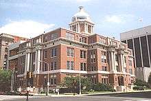
- City Hall, Georgia's capitol for part of the Civil War


- Douglass Theatre
- The Grand Opera House, where the Macon Symphony Orchestra performs
- Hay House - also known as the "Johnston-Felton-Hay House," it has been referred to as the "Palace of the South"[49]
- City Auditorium, the world's largest true copper dome [50]
- Macon Coliseum
- Macon Little Theatre, established in 1934, the area's oldest community theatre, producing seven plays/musicals per season
- Waddell Barnes Botanical Gardens
Sports
Macon is home to the Mercer Bears, who compete at the NCAA Division I level in sports that include football, baseball, basketball (men's and women's), tennis, and lacrosse. Central Georgia Technical College also competes in men's and women's basketball. Wesleyan College, an all-female school, has teams in basketball, soccer, cross country, tennis, softball, and volleyball.
| Club | Sport | League | Venue |
|---|---|---|---|
| Macon Giants[51] | Baseball | Great South League | Ed Defore Sports Complex |
| Macon Mayhem | Ice Hockey | Southern Professional Hockey League | Macon Coliseum |
| League | Sport | Venue |
|---|---|---|
| Middle Georgia Derby Demons | Roller Derby | Bibb Skate Arena |
Former teams
| Club | Sport | League | Venue | Active |
|---|---|---|---|---|
| Macon State College Blue Storm | Various | NCCAA | Various | 2009-13 |
| Macon Central City/Hornets | Baseball | Southern League | Central City Park | 1892-94 |
| Macon Highlanders/Brigands/Peaches/Tigers | Baseball | South Atlantic League | Central City Park and Luther Williams Field | 1904-17, 1923–30 |
| Macon Peaches/Dodgers/Redbirds/Pirates | Baseball | Southeastern League (1932), South Atlantic League (1936–42, 1946–60, 1962–63, 1980-87), Southern Association (1961), Southern League (1964, 1966–67) | Luther Williams Field | 1932, 1936–42, 1946–60, 1961–64, 1966–67, 1980–82 |
| Macon Braves | Baseball | South Atlantic League | Luther Williams Field | 1991-2002 |
| Macon Peaches | Baseball | Southeastern League | Luther Williams Field | 2003 |
| Macon Music | Baseball | South Coast League | Luther Williams Field | 2007 |
| Macon Pinetoppers | Baseball | Peach State League | Luther Williams Field | 2010 |
| Macon Blaze | Basketball | World Basketball Association | Macon Coliseum | 2005 |
| Macon Whoopees | Ice Hockey | Southern Hockey League | Macon Coliseum | 1974 |
| Macon Whoopee | Ice Hockey | Central Hockey League (1996-2001), ECHL (2001-02) | Macon Coliseum | 1996-2002 |
| Macon Trax | Ice Hockey | Atlantic Coast Hockey League (2002–03), World Hockey Association 2 (2003-04), Southern Professional Hockey League (2004–05) | Macon Coliseum | 2002-05 |
| Macon Knights | Arena Football | af2 | Macon Coliseum | 2001-06 |
| Macon Steel | Indoor Football | American Indoor Football | Macon Coliseum | 2012 |
| Macon Mayhem | Ice Hockey | Southern Professional Hockey League | Macon Coliseum | 2015 - present |
Parks and recreation
The city maintains several parks and community centers.[52]

- Ocmulgee Heritage Trail - a green way of parks, plazas, and landmarks along the Ocmulgee River in downtown Macon
- Bloomfield Park
- East Macon Park
- Frank Johnson Recreation Center
- Freedom Park
- L.H. Williams Community School Center
- Memorial Park
- North Macon Park
- Rosa Jackson
- Senior Center
- John Drew Smith Tennis Center
- Tattnall Square Tennis Center
Education
Public high schools
- Central High School
- Howard High School (Macon, Georgia)[53]
- Northeast Health Science Magnet High School[54]
- Rutland High School (Macon, Georgia)[55]
- Southwest Magnet High School and Law Academy[56]
- Westside High School[57]
Private high schools
- Central Fellowship Christian Academy
- First Presbyterian Day School
- Mount de Sales Academy
- Stratford Academy
- Tattnall Square Academy
- Windsor Academy
- Covenant Academy[58]
- Bethany Christian Academy
Private and specialized schools
- The Academy for Classical Education[59]
- Macon Charter Academy[60]
- Northwoods Academy[61]
- Elam Alexander Academy[62]
- Georgia Academy for the Blind[63]
Colleges and universities
Approximately 30,000 college students live in the greater Macon area.[64] Mercer, Middle Georgia State University, and Wesleyan College have the largest populations of "traditional" college students. Georgia College & State University has a "Center for Graduate and Professional Learning" in Macon.[65]
- Mercer University
- Middle Georgia State University
- Wesleyan College
- Central Georgia Technical College
- Fort Valley State University - satellite campus
- Georgia College & State University - satellite campus
- Troy University - satellite campus
- Virginia College - satellite campus
- Miller-Motte Technical College - satellite campus
Media
Macon has a substantial number of local television and radio stations. It is also served by two local papers.
Newspapers and magazines
- The Telegraph, a daily newspaper, is published in Macon.
- The 11th Hour
- Gateway Macon (web portal), The Local's Guide for Things To Do in Macon.
Television stations
- 13.1 WMAZ-TV - CBS
- 13.2 - The CW
- 13.3 - Justice Network
- 24.1 WGXA - Fox
- 29.1 WMUM-TV - GPB/PBS
- 29.2 - GPB Kids
- 29.3 - GPB Knowledge/PBS World
- 31 WDMA-CD - Daystar
- 38 WMUB-LD - MHz WorldView
- 41 WMGT-TV - NBC
- 41.2 - MyNetworkTV
- 41.3 - Bounce TV
- 41.4 - Escape
- 41.5 - Laff
- 45 WGNM - Christian Television Network
- 45.2 - CTNi
- 50 WPGA-LP - Silent/Dark (Low Power Analog Only)
- 58 WPGA-TV - Ind.
Radio stations
FM
- WBKG 88.9 - Macon (Religious)
- WMUM-FM 89.7 - Macon (Georgia Public Broadcasting/National Public Radio)
- WLZN 92.3 - Macon (Urban hip-hop - "Blazin' 92.3")
- WPEZ 93.7 - Macon (Adult contemporary - "Z93.7")
- WMGB 95.1 (Top 40 (CHR) - "All the Hits B95.1") - Macon
- WIHB-FM 96.5 - Macon (Country)
- WDEN 99.1 - Macon (Country)
- WMGZ 97.7 FM - Macon
- WIBB-FM 97.9 - Macon (Urban - Hip-Hop "97.9 WIBB")
- WNEX-FM 100.9 - Macon (Country)
- WRBV 101.7 - Macon (Urban AC - "V101.7")
- WZCH 102.1 - Macon (Christian Music - K-Love)
- WZCH 102.5 - South Macon and Warner Robins (Christian Music - K-Love)
- W286CE-FM 105.1 - Fort Valley (Urban AC "Kiss 105.1/107.5" (WRWR-FM simulcast))
- WLXF 105.5 - Macon (Mainstream rock - "Rock 105")
- WQBZ 106.3 - Macon ( Mainstream rock "Q106-3")
- WFXM 107.1 - Macon (Hip-hop & R&B "Power 107")
- WRWR (FM) 107.5 - Cochran (Urban AC "Kiss 105.1/107.5")
AM
- WYPZ 900 AM - Macon (Urban AC "Kiss 105.1/107.5" (WRWR-FM simulcast))
- WMAC 940 AM - Macon (Talk)
- WPGA 980 AM - Macon (Talk)
- WXKO 1150 AM - Fort Valley/Macon (Country)
- WDDO 1240 AM - Macon (Gospel)
- WIHB 1280 AM - Macon (Country)
- WNEX 1400 AM - Macon (News Talk)
- WAYS 1500 AM - Macon (Sports - "The Fan")
- WPLA 1670 AM - Macon (Sports Talk - "Fox Sports Radio")
Infrastructure
.jpg)
Hospitals
- Central Georgia Rehabilitation Hospital
- Coliseum Medical Centers
- Coliseum Northside Hospital
- Medical Center of Central Georgia
Transportation
Airports
- Macon Downtown Airport is located near downtown. It has a large number of corporate and private aviation aircraft.
- Middle Georgia Regional Airport provides public air service to Macon as well as cargo flights. The airport is situated 9 mi (14 km) south of downtown.
Highways
Interstates:
U.S. Routes:
State Routes:
-
 State Route 11
 -
 State Route 19
 -
 State Route 22
 -
 State Route 49
 -
 State Route 74
 -
 State Route 87
 -
 State Route 87 Connector
 -
 State Route 247
 -
 State Route 401 (unsigned designation for I-75)
 -
 State Route 404 (unsigned designation for I-16)
 -
 State Route 408 (unsigned designation for I-475)
 -
 State Route 540 (Fall Line Freeway) (future)
Mass Transit
The Macon Transit Authority (MTA) is Macon's public-transit system, operating the Public Transit City Bus System throughout Macon-Bibb County. Most commuters in Macon and the surrounding suburbs use private automobiles as their primary transportation. This results in heavy traffic during rush hour and contributes to Macon's air pollution. The MTA has a total of 10 city bus routes and an express bus that serves suburban Warner Robins just south of the city.
Macon Transit Authority has a tourist trolley system. The trolleys have offered tours of the downtown Macon area since 1999. The tours consist of all of the major historical sites such as the Georgia Music Hall of Fame, the Hay House, and the Tubman Museum. There are three trolleys holding up to 39 passengers.
Greyhound Lines provides intercity bus service.
Macon grew as a center of rail transport after the 1846 opening of the Macon and Western Railroad.[66] Two of the most note-worthy train companies operating through the city were the Central of Georgia Railway and the Southern Railway. The city continued to be served by passenger trains until the 1970s. Macon is included in the proposed Georgia Rail Passenger Program to restore inter-city rail service.
Notable people
• Rhett James McLaughlin, part of the Internet entertainment and advertising duo Rhett and Link. (Born in Macon, Georgia)
• Randy Crawford, famous Jazz singer, active in the 1980s.
• Jason Aldean, famous country singer.
Sister cities
Macon has six sister cities, as designated by Sister Cities International, Inc. (SCI):[67]
See also
- Central Georgia
- Downtown Macon, Georgia
- Macon, Georgia metropolitan area
- List of mayors of Macon, Georgia
Notes
- ↑ The record number of triple digit (Fahrenheit) readings is 24 in 1954.[25]
- ↑ The historical range is 31 in 1994 to 116 in 2011.[25]
- ↑ Mean monthly maxima and minima (i.e. the highest and lowest temperature readings during an entire month or year) calculated based on data at said location from 1981 to 2010.
- ↑ Official records for Macon were kept at downtown from October 1892 to 7 April 1899, the Weather Bureau from 8 April 1899 to November 1948, and at Middle Georgia Regional Airport since December 1948. For more information, see ThreadEx.
References
- ↑ http://quickfacts.census.gov/qfd/states/13/1349008.html
- 1 2 3 "American FactFinder". United States Census Bureau. Retrieved 2008-01-31.
- 1 2 "US Board on Geographic Names". United States Geological Survey. 2007-10-25. Retrieved 2008-01-31.
- 1 2 "Macon-Bibb County consolidation wins with strong majorities". The Macon Telegraph. 2012-07-31. Retrieved 2012-08-01.
- 1 2 "http://www.13wmaz.com/news/elections/results/results.aspx?raceid=100"
- 1 2 "Georgia Encyclopedia". Georgia Encyclopedia. 2009-05-20. Retrieved 2012-05-30.
- 1 2 3 "Fort Hawkins" page, City of Macon, accessed 15 July 2011
- ↑ Gannett, Henry (1905). The Origin of Certain Place Names in the United States. U.S. Government Printing Office. p. 195.
- ↑ "Colleges and Universities". Dlg.galileo.usg.edu. 1970-01-01. Retrieved 2012-02-29.
- ↑ "Macon", Roadside Georgia
- ↑ "Macon: Camp Oglethorpe", My Civil War
- ↑ ''Cotton, Fire and Dreams''. Books.google.com. Retrieved 2012-05-30.
- ↑ The Last Battle of the Civil War, Digital Gallery, University of South Georgia
- ↑ "College Hill Corridor / Mercer Village Master Plan" (PDF). Mercer University City of Macon. January 2009. Retrieved 2012-08-07.
- 1 2 Terminal Station - Georgia's Railroad History & Heritage
- ↑ "Record Rain Pelts Georgia; 4 Die in Flood". The New York Times. 2012-07-31. Retrieved 2010-05-12.
- ↑ "HB 1171 - Macon-Bibb County; create and incorporate new political body corporate".
- ↑ City-County Consolidation Proposals, 1921 - Present, National Association of Counties. Retrieved 2011-02-11.
- ↑ The Effects on City-County Consolidation
- ↑ Consolidation pass for Macon and Bibb county in the 2012 vote.Consolidation of City and County Governments: Attempts in Five Cities. Retrieved 2010-09-14.
- ↑ Jim Gaines (July 28, 2012). "Last details of Macon-Bibb consolidation debate aired". The Telegraph.
- ↑ Mike Stucka (July 31, 2012). "Macon-Bibb County consolidation wins with strong majorities". The Telegraph.
- ↑ Erica Lockwood (July 13, 2012). "Consolidation: 3 Areas of Macon and Bibb Affected Differently". 13 WMAZ.
- ↑ "US Gazetteer files: 2010, 2000, and 1990". United States Census Bureau. 2011-02-12. Retrieved 2011-04-23.
- 1 2 3 4 "NOWData - NOAA Online Weather Data". National Oceanic and Atmospheric Administration. Retrieved 2016-04-13.
- ↑ "Average Total Snowfall (inches) for Selected Cities in the Southeast". Sercc.com. Retrieved 2012-05-30.
- ↑ "Macon Weather". US Travel and Weather. July 2011. Archived from the original on September 29, 2007. Retrieved October 3, 2007.
- ↑ "Station Name: GA MACON MIDDLE GA RGNL AP". National Oceanic and Atmospheric Administration. Retrieved 2014-05-26.
- ↑ "WMO Climate Normals for MACON/LEWIS B WILSON ARPT GA 1961–1990". National Oceanic and Atmospheric Administration. Retrieved 2014-03-10.
- ↑ "Annual Estimates of the Resident Population for Incorporated Places: April 1, 2010 to July 1, 2015". Retrieved July 2, 2016.
- ↑ "Census of Population and Housing". Census.gov. Retrieved June 4, 2015.
- ↑ Metropolitan Statistical Areas and Components, Office of Management and Budget, 2007-05-11. Accessed 2008-08-01.
- ↑ Micropolitan Statistical Areas and Components, Office of Management and Budget, 2007-05-11. Accessed 2008-08-01.
- ↑ Combined Statistical Areas and Component Core Based Statistical Areas, Office of Management and Budget, 2007-05-11. Accessed 2008-08-01.
- ↑ Macon city, GA economic characteristics United States Census Bureau (2010) (dead link)
- ↑ "Ingleside Village Shopping & Arts District"
- ↑ Robins Air Force Base
- ↑ http://www.allmusic.com/artist/mike-mills-mn0000414895/biography
- ↑ Georgia Music Hall of Fame. "Alan Walden - Georgia Music Hall of Fame 2003 Inductee". georgiamusicstore.com. Retrieved August 27, 2008.
- ↑ "Macon Symphony Orchestra Website". Maconsymphony.com. 2012-05-05. Retrieved 2012-05-30.
- ↑ "Middle Georgia Concert Band website". Middlegeorgiaconcertband.org. 2012-01-09. Retrieved 2012-05-30.
- ↑ "Home - Middle Georgia Art Association". Middlegeorgiaart.org. Retrieved 2012-02-29.
- ↑ "Macon Film Festival". Macon Film Festival. 2012-02-19. Retrieved 2012-02-29.
- ↑ Alfred T. Fellheimer - Projects
- ↑ ""Cannonball House" Website". Cannonballhouse.org. 2012-02-06. Retrieved 2012-05-30.
- ↑ "Sidney Lanier Cottage", Historic Macon
- ↑ "History of TBI", Synagogue website, accessed August 28, 2009
- ↑ "Georgia Children's Museum in Macon, GA". Georgiachildrensmuseum.com. Retrieved 2012-02-29.
- ↑ "History of the Hay House". The Georgia Trust. Retrieved 2 July 2012.
- ↑ "Rutland Architectural Blog - Roof Domes". Rutlandguttersupply.com. 2010-09-08. Retrieved 2012-02-29.
- ↑ "Great South League | Macon Giants". Greatsouthleague.pointstreaksites.com. 2011-01-02. Retrieved 2012-02-29.
- ↑ Macon City Department - Recreation Centers
- ↑ "School Listing". Bibb County Board of Education. Retrieved 2 July 2012.
- ↑ "School Listing". Bibb County Board of Education. Retrieved 2 July 2012.
- ↑ "School Listing". Bibb County Board of Education. Retrieved 2 July 2012.
- ↑ "School Listing". http://schools.bibb.k12.ga.us/southwest. Retrieved 2 July 2012. External link in
|publisher=(help) - ↑ "School Listing". Bibb County Board of Education. Retrieved 2 July 2012.
- ↑ Covenant Academy
- ↑ "The Academy for Classical Education".
- ↑ http://www.macon.com/news/local/education/article44936427.html Recent Troubles Ween't the First for Macon Charter Academy
- ↑ "School Listing". Bibb County Board of Education.
- ↑ "School Listing". Bibb County Board of Education.
- ↑ "Welcome to Georgia Academy for the Blind". Georgia Academy for the Blind. Retrieved 2 July 2012.
- ↑ "Great South League | Macon Giants". Greatsouthleague.pointstreaksites.com. 2011-01-02. Retrieved 2012-02-29.
- ↑ "Graduate Programs in Macon | Graduate Programs". Graduate.gcsu.edu. Retrieved 2012-02-29.
- ↑ "Norfolk Southern – The Thoroughbred of Transportation | Creating green jobs shipping freight by rail". Nscorp.com. Retrieved 2012-02-29.
- ↑ Macon's Sister City Program, Retrieved June 27, 2010.
Further reading
- Bellamy, Donnie D. "Macon, Georgia, 1823–1860: A Study in Urban Slavery", Phylon 45 (December 1984): 300–304, 308–309
- Brown, Titus. "A New England Missionary and African-American Education in Macon: Raymond G. Von Tobel at the Ballard Normal School, 1908–1935", The Georgia Historical Quarterly, Summer 1998, Vol. 82 Issue 2, pp 283–304
- Brown, Titus. "Origins of African American Education in Macon, Georgia 1865–1866", Journal of South Georgia History, Oct 1996, Vol. 11, pp 43–59
- Butler, John Campbell. Historical Record of Macon and Central Georgia (Macon, 1879),
- Davis, Robert Scott. "A Cotton Kingdom Retooled for War: The Macon Arsenal and the Confederate Ordnance Establishment", The Georgia Historical Quarterly, Fall 2007, Vol. 91 Issue 3, pp 266–291, full text online in EBSCO
- Davis, Robert S. Cotton, Fire, & Dreams: The Robert Findlay Iron Works and Heavy Industry in Macon, Georgia, 1839–1912 (Macon, Ga., 1998)
- Eisterhold, John A. "Commercial, Financial, and Industrial Macon, Georgia, During the 1840s", The Georgia Historical Quarterly, Winter 1969, Vol. 53 Issue 4, pp 424–441
- Hux, Roger K. "The Ku Klux Klan in Macon 1919–1925", The Georgia Historical Quarterly, Summer 1978, Vol. 62 Issue 2, pp 155–168
- Iobst, Richard W. Civil War Macon: The History of a Confederate City (Mercer U. Press, 1999). 462 pp.
- Keire, Mara L. For Business and Pleasure: Red-Light Districts and the Regulation of Vice in the United States, 1890–1933 (Johns Hopkins University Press, 2010); 248 pages; History and popular culture of districts in Macon, Ga., and other cities
- McInvale, Morton Ray "Macon, Georgia: The War Years, 1861–1865" (Ph.D. dissertation, Florida State University, 1973)
- Manis, Andrew M. Macon Black and White: An Unutterable Separation in the American Century (Mercer U. Press, 2004). 432 pp.
- Norman, Matthew W. "James H. Burton and the Confederate States Armory at Macon", The Georgia Historical Quarterly, Winter 1997, Vol. 81 Issue 4, pp 974–987
- Stone, James H. "Economic Conditions in Macon, Georgia in the 1830s", The Georgia Historical Quarterly, Summer 1970, Vol. 54 Issue 2, pp 209–225
- Yates, Bowling C. "Macon, Georgia, Inland Trading Center 1826–1836", The Georgia Historical Quarterly, Fall 1971, Vol. 55 Issue 3, pp 365–377
- Young, Ida, Julius Gholson, and Clara Nell Hargrove. History of Macon, Georgia (Macon, 1950)
External links
| Wikimedia Commons has media related to Macon, Georgia. |
- Official website
- Macon-Bibb County Convention and Visitors Bureau
- Macon (the New Georgia Encyclopedia)
-
 Macon (Georgia) travel guide from Wikivoyage
 |
Atlanta | | ||
| Columbus | |
Savannah | ||
| ||||
| | ||||
| Valdosta |
| Principal cities | | |
|---|---|---|
| Municipalities | ||
| Other communities | ||
| Counties | ||
| CSA components |
| |
Municipalities and communities of Bibb County, Georgia, United States | ||
|---|---|---|
| City | 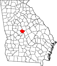 | |
| Unincorporated communities | ||
| Footnotes | ‡This populated place also has portions in an adjacent county or counties | |
| ||
| ||