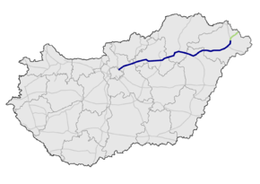
M3 motorway (Hungary)
| |
|---|---|
| M3 autópálya | |
 | |
| Route information | |
|
Part of | |
| Length: |
281 km (175 mi) 307 km (191 mi) planned |
| Major junctions | |
| From: | Budapest |
|
| |
| To: |
Barabás |
| Location | |
| Counties: | Pest, Heves, Borsod-Abaúj-Zemplén, Hajdú-Bihar, Szabolcs-Szatmár-Bereg (5) |
| Major cities: | Budapest, Hatvan, Gyöngyös, Mezőkövesd, Tiszaújváros, Nyíregyháza, Mátészalka |
| Highway system | |
| Motorways in Hungary | |
_Otszogletu_kek_tabla.svg.png)

The M3 motorway is a Hungarian motorway connecting Budapest to Nyíregyháza. It will eventually connect Budapest to the Ukrainian border. Two other motorways branch off it, the M30 (connecting the M3 to Miskolc) and the M35 (connecting the M3 to Debrecen). The M3 follows the route of route 3, and, later, route 4. The section of the motorway, the one between Görbeháza and Nyíregyháza was opened to the public in August 2007. The latest section of the motorway, the one between Highway 49 and Vásárosnamény was opened to the public in 2014.[1] The total length of the motorway now is 281 km.
Openings timeline
- Budapest – Gödöllő (14 km): 1978.10.16.
- Gödöllő – Hatvan (29 km): 1980.10.31.
- Hatvan – Gyöngyös-west (15 km): 1983
- Gyöngyös-west – Füzesabony (44 km): 1998.09.01.
- Füzesabony – Polgár (61 km): 2002
- Polgár – Görbeháza; M35 (11 km): 2004.10.
- Görbeháza; M35 – Nyíregyháza (41 km): 2007.08.31.
- Nyíregyháza bypass (8 km): 2006.08.05.
- Nagykálló – Őr (33,8 km): 2013.01.16.
- Őr – Vásárosnamény (11,9 km): 2014.10.10.
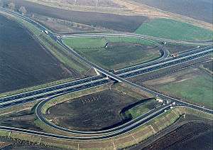
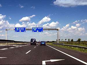
Junctions, exits and rest area
- Distance from Zero Kilometre Stone (Adam Clark Square) in Budapest in kilometres.
| Budapest – Beregdaróc (307 km) | ||||
| 10 km | Budapest-Rákospalota | |||
| 11 km | Bp.-Újplaota / Bp.-Újpest | |||
| 12 km | Szilas pihenőhely | | ||
| Dunakeszi, Vác | ||||
| 13 km | Hegyeshalom, Letenye, Pécs, Röszke Budapest International Airport |
Budapest bypass | ||
| 18 km | Hungaroring, Aquaréna |
| ||
| Ring pihenőhely | ||||
| 23 km | Mogyoród / Szada | 2101 | ||
| 25 km | Jakabpusztai pihenőhely | | ||
| 27 km | M0 connection | Transit road to M0 ( | ||
| Vác / Gödöllő | 2104 | |||
| 32 km | Babati pihenőhely |
| ||
| 36 km | Kisbagi pihenőhely | | ||
| 39 km | Bag, Tura / Aszód | 3105 | ||
| 43 km | Galga pihenőhely | | ||
| 51 km | Kerekharaszt | | ||
| Kerekharaszti pihenőhely | ||||
| 55 km | Hatvan-west / Salgótarján, Somoskőújfalu | |||
| 59 km | Hatvan-east / Szolnok | Hatvan bypass | ||
| 60 km | Horti pihenőhely | | ||
| 66 km | Ecsédi pihenőhely | | ||
| 70 km | Gyöngyös-west / Hort | |||
| 75 km | Halászaranyosi pihenőhely | | ||
| 78 km | Gyöngyös-east, Mátrafüred / Adács | |||
| 82 km | Borsókúti pihenőhely | | ||
| 87 km | Nagyfügedi pihenőhely | | ||
| 90 km | Nagyfüged, Heves / Ludas | 3206 | ||
| 92 km | Kisasszonytéri pihenőhely | | ||
| 103 km | Kál / Erdőtelek | |||
| 104 km | Railway Line 102 (Kál-Kápolna-Kisújszállás) | |||
| 106 km | Rekettyés pihenőhely | | ||
| 114 km | Füzesabony, Eger / Tiszafüred | |||
| 122 km | Mezőszemerei pihenőhely | | ||
| 128 km | Mezőkövesd / Borsodivánka | 3301 | ||
| 139 km | Mezőnagymihály / Mezőkeresztes | 3305 | ||
| 142 km | Geleji pihenőhely | | ||
| 151 km | Miskolc, Tornyosnémeti |
M30 ( | ||
| 153 km | Igrici pihenőhely | | ||
| 156 km | Mezőcsát / Hejőpapi | |||
| 164 km | Hejőkürt / Tiszaújváros | 3313 | ||
| 169 km | Tisza River | Bridge - 405.5 m | ||
| 171 km | Polgári pihenőhely | | ||
| 175 km | Nyékládháza, Polgár / Görbeháza | M3 Outlet Center | ||
| M3 Arcehopark | ||||
| 179 km | Western Main Channel | Bridge - 93 m | ||
| 184 km | Görbeháza pihenőhely | | ||
| 187 km | Hajdúböszörmény, Debrecen | M35 ( | ||
| 194 km | Rétaljai pihenőhely | | ||
| 200 km | Eastern Main Channel | |||
| 203 km | Hajdúnánás / Tiszavasvári | 3502 | ||
| 206 km | Hajdúnánási pihenőhely | | ||
| 215 km | Kálmánházi pihenőhely | | ||
| 221 km | Nyíregyháza-west, Tokaj | Nyíregyháza bypass | ||
| 227 km | Nyíregyháza-south / Újfehértó | ( | ||
| 229 km | Nyíregyházi pihenőhely | | ||
| 234 km | Nyíregyháza-east / Nagykálló | 4911 | ||
| Nyíregyháza-north, Kisvárda | Nyíregyháza bypass ( | |||
| 244 km | | |||
| 254 km | Nyírbátor / Ófehértó, Baktalórántháza | 4105 | ||
| 263 km | Kántorjánosi pihenőhely | | ||
| 267 km | Őr, Rohod / Mátészalka | |||
| 280 km | Vásárosnamény | |||
See also
![]() Media related to Autópálya M3 at Wikimedia Commons
Media related to Autópálya M3 at Wikimedia Commons
Notes
| Motorways |  | |
|---|---|---|
| Expressways | ||
This article is issued from Wikipedia - version of the 11/29/2016. The text is available under the Creative Commons Attribution/Share Alike but additional terms may apply for the media files.