Lyons, Nebraska
| Lyons, Nebraska | |
|---|---|
| City | |
|
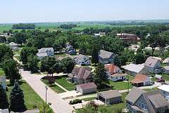
Houses and streets in Lyons | |
 Location of Lyons, Nebraska | |
| Coordinates: 41°56′10″N 96°28′20″W / 41.93611°N 96.47222°WCoordinates: 41°56′10″N 96°28′20″W / 41.93611°N 96.47222°W | |
| Country | United States |
| State | Nebraska |
| County | Burt |
| Area[1] | |
| • Total | 0.69 sq mi (1.79 km2) |
| • Land | 0.68 sq mi (1.76 km2) |
| • Water | 0.01 sq mi (0.03 km2) |
| Elevation | 1,293 ft (394 m) |
| Population (2010)[2] | |
| • Total | 851 |
| • Estimate (2012[3]) | 827 |
| • Density | 1,251.5/sq mi (483.2/km2) |
| Time zone | Central (CST) (UTC-6) |
| • Summer (DST) | CDT (UTC-5) |
| ZIP code | 68038 |
| Area code(s) | 402 |
| FIPS code | 31-29855 |
| GNIS feature ID | 0830977[4] |
Lyons is a city in Burt County, Nebraska, United States. The population was 851 in the 2010 census. The city is named after its founder.
History
Lyons was founded in 1880 by Waldo Lyons, and named for him.[5]
The founder was against the consumption of alcoholic beverages, and prohibition remained in force until overcome by a public referendum in 1968.[6]
Geography
Lyons is located at 41°56′10″N 96°28′20″W / 41.93611°N 96.47222°W (41.936110, -96.472255).[7] According to the United States Census Bureau, the city has a total area of 0.69 square miles (1.79 km2), of which, 0.68 square miles (1.76 km2) is land and 0.01 square miles (0.03 km2) is water.[1]
Lyons is on US Route 77, south of the Omaha Indian Reservation. It is west of the Missouri River.
Demographics
| Historical population | |||
|---|---|---|---|
| Census | Pop. | %± | |
| 1880 | 90 | — | |
| 1890 | 532 | 491.1% | |
| 1900 | 847 | 59.2% | |
| 1910 | 865 | 2.1% | |
| 1920 | 1,025 | 18.5% | |
| 1930 | 985 | −3.9% | |
| 1940 | 1,033 | 4.9% | |
| 1950 | 1,011 | −2.1% | |
| 1960 | 974 | −3.7% | |
| 1970 | 1,177 | 20.8% | |
| 1980 | 1,214 | 3.1% | |
| 1990 | 1,144 | −5.8% | |
| 2000 | 963 | −15.8% | |
| 2010 | 851 | −11.6% | |
| Est. 2015 | 815 | [8] | −4.2% |
| U.S. Decennial Census[9] 2012 Estimate[10] | |||
2010 census
As of the census[2] of 2010, there were 851 people, 395 households, and 228 families residing in the city. The population density was 1,251.5 inhabitants per square mile (483.2/km2). There were 457 housing units at an average density of 672.1 per square mile (259.5/km2). The racial makeup of the city was 96.7% White, 0.1% African American, 0.9% Native American, 0.2% Pacific Islander, 1.3% from other races, and 0.7% from two or more races. Hispanic or Latino of any race were 3.2% of the population.
There were 395 households of which 19.2% had children under the age of 18 living with them, 48.6% were married couples living together, 6.8% had a female householder with no husband present, 2.3% had a male householder with no wife present, and 42.3% were non-families. 37.5% of all households were made up of individuals and 23.1% had someone living alone who was 65 years of age or older. The average household size was 2.05 and the average family size was 2.66.
The median age in the city was 51.7 years. 16.1% of residents were under the age of 18; 7.5% were between the ages of 18 and 24; 16.8% were from 25 to 44; 29.5% were from 45 to 64; and 30.1% were 65 years of age or older. The gender makeup of the city was 45.8% male and 54.2% female.
2000 census
As of the census of 2000, there were 963 people, 423 households, and 280 families residing in the city. The population density was 1,377.2 people per square mile (531.2/km²). There were 474 housing units at an average density of 677.9 per square mile (261.4/km²). The racial makeup of the city was 98.13% White, 0.31% African American, 0.21% Native American, 0.10% Asian, 0.10% Pacific Islander, 0.93% from other races, and 0.21% from two or more races. Hispanic or Latino of any race were 5.19% of the population.
There were 423 households out of which 25.3% had children under the age of 18 living with them, 52.0% were married couples living together, 10.6% had a female householder with no husband present, and 33.8% were non-families. 31.0% of all households were made up of individuals and 21.3% had someone living alone who was 65 years of age or older. The average household size was 2.25 and the average family size was 2.80.

In the city the population was spread out with 24.1% under the age of 18, 5.0% from 18 to 24, 21.1% from 25 to 44, 22.4% from 45 to 64, and 27.4% who were 65 years of age or older. The median age was 45 years. For every 100 females there were 83.8 males. For every 100 females age 18 and over, there were 78.3 males.
The median income for a household in the city was $28,804, and the median income for a family was $35,625. Males had a median income of $27,563 versus $20,250 for females. The per capita income for the city was $16,368. About 6.7% of families and 9.2% of the population were below the poverty line, including 10.3% of those under age 18 and 8.2% of those age 65 or over.
Center for Rural Affairs
Lyons is home to the Center for Rural Affairs, a private non-profit organization.[11] The organization's mission statement is: "Establish strong rural communities, social and economic justice, environmental stewardship, and genuine opportunity for all while engaging people in decisions that affect the quality of their lives and the future of their communities."[12] It was established in Walthill, Nebraska in 1973,[11] and moved to Lyons in 2004.[13]
The Center's positions are generally characterized as liberal/progressive.[14][15][16] It has issued a number of releases commending the health-care measure passed by Congress in 2010,[17][18] has opposed the elimination of the estate tax,[19] and has condemned judicial rulings "designed to protect corporate interests".[20]
See also
References
- 1 2 "US Gazetteer files 2010". United States Census Bureau. Retrieved 2012-06-24.
- 1 2 "American FactFinder". United States Census Bureau. Retrieved 2012-06-24.
- ↑ "Population Estimates". United States Census Bureau. Retrieved 2013-05-29.
- ↑ "US Board on Geographic Names". United States Geological Survey. 2007-10-25. Retrieved 2008-01-31.
- ↑ Chicago and North Western Railway Company (1908). A History of the Origin of the Place Names Connected with the Chicago & North Western and Chicago, St. Paul, Minneapolis & Omaha Railways. p. 182.
- ↑ "Lyons, Burt County". Center for Advanced Land Management Information Technologies. University of Nebraska. Retrieved 31 July 2014.
- ↑ "US Gazetteer files: 2010, 2000, and 1990". United States Census Bureau. 2011-02-12. Retrieved 2011-04-23.
- ↑ "Annual Estimates of the Resident Population for Incorporated Places: April 1, 2010 to July 1, 2015". Retrieved July 2, 2016.
- ↑ United States Census Bureau. "Census of Population and Housing". Retrieved November 13, 2013.
- ↑ "Annual Estimates of the Resident Population: April 1, 2010 to July 1, 2012". Retrieved November 13, 2013.
- 1 2 "Frequently Asked Questions". Center for Rural Affairs. Retrieved 2010-10-30.
- ↑ "Our Mission and Our Values". Center for Rural Affairs. Retrieved 2010-10-30.
- ↑ "History of the Center". Center for Rural Affairs. Retrieved 2010-10-30.
- ↑ LiberalOasis.com Retrieved 2010-10-30.
- ↑ Progressive Bumper Stickers. See list of "Other liberal sites". Retrieved 2010-10-30.
- ↑ "True Spin Conference, 2008". True Spin Conference. Retrieved 2010-10-30.
- ↑ Crabtree, John. "Health Care Reform and Small Business - Myths and Realities". Center for Rural Affairs. 2010-05-10. Retrieved 2010-10-30.
- ↑ Depew, Brian. "Health Reform Good for Nebraska". Center for Rural Affairs. 2010-08-30. Retrieved 2010-10-30.
- ↑ Hassebrook, Chuck. "Big Estate Tax Reductions Undermine Family Farms". Center for Rural Affairs. 2010-09-20. Retrieved 2010-10-30.
- ↑ "What's New?". Center for Rural Affairs. Retrieved 2010-10-30.
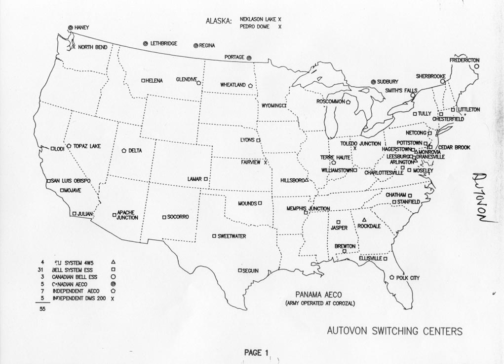
- ↑ Former Autovon Switching Centers.
External links
Municipalities and communities of Burt County, Nebraska, United States | ||
|---|---|---|
| Cities | ||
| Villages | ||
| Unincorporated communities | ||
| Townships | ||
| Indian reservations | ||
| Ghost towns | ||
| Footnotes | ‡This populated place also has portions in an adjacent county or counties | |