Lynchburg, South Carolina
| Lynchburg, South Carolina | |
|---|---|
| Town | |
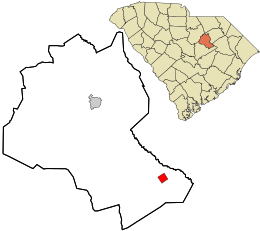 Location in Lee County and the state of South Carolina. | |
| Coordinates: 34°3′38″N 80°4′38″W / 34.06056°N 80.07722°WCoordinates: 34°3′38″N 80°4′38″W / 34.06056°N 80.07722°W | |
| Country | United States |
| State | South Carolina |
| County | Lee |
| Area | |
| • Total | 1.1 sq mi (2.9 km2) |
| • Land | 1.1 sq mi (2.9 km2) |
| • Water | 0.0 sq mi (0.0 km2) |
| Elevation | 151 ft (46 m) |
| Population (2000) | |
| • Total | 588 |
| • Density | 519.7/sq mi (200.6/km2) |
| Time zone | Eastern (EST) (UTC-5) |
| • Summer (DST) | EDT (UTC-4) |
| ZIP code | 29080 |
| Area code(s) | 803 |
| FIPS code | 45-43360[1] |
| GNIS feature ID | 1246492[2] |
Lynchburg is a town in Lee County, South Carolina, United States. The population was 373 at the 2010 census, a loss of more than one third of its population of 588 in 2000.
History
Lynchburg Presbyterian Church and Tanglewood Plantation are listed on the National Register of Historic Places.[3]
Geography
Lynchburg is located at 34°3′38″N 80°4′38″W / 34.06056°N 80.07722°W (34.060645, -80.077323).[4]
According to the United States Census Bureau, the town has a total area of 1.1 square miles (2.8 km2), all land.
Demographics
| Historical population | |||
|---|---|---|---|
| Census | Pop. | %± | |
| 1910 | 466 | — | |
| 1920 | 506 | 8.6% | |
| 1930 | 512 | 1.2% | |
| 1940 | 382 | −25.4% | |
| 1950 | 506 | 32.5% | |
| 1960 | 544 | 7.5% | |
| 1970 | 546 | 0.4% | |
| 1980 | 534 | −2.2% | |
| 1990 | 475 | −11.0% | |
| 2000 | 588 | 23.8% | |
| 2010 | 373 | −36.6% | |
| Est. 2015 | 354 | [5] | −5.1% |
| U.S. Decennial Census | |||
As of the census[1] of 2000, there were 588 people, 222 households, and 138 families residing in the town. The population density was 519.7 people per square mile (200.9/km²). There were 262 housing units at an average density of 231.5 per square mile (89.5/km²). The racial makeup of the town was 73.64% African American, 17.35% White, 8.50% from other races, and 0.51% from two or more races. Hispanic or Latino of any race were 8.67% of the population.
There were 222 households out of which 29.7% had children under the age of 18 living with them, 32.4% were married couples living together, 27.0% had a female householder with no husband present, and 37.4% were non-families. 32.9% of all households were made up of individuals and 14.4% had someone living alone who was 65 years of age or older. The average household size was 2.65 and the average family size was 3.29.
In the town the population was spread out with 26.0% under the age of 18, 14.3% from 18 to 24, 26.5% from 25 to 44, 19.4% from 45 to 64, and 13.8% who were 65 years of age or older. The median age was 33 years. For every 100 females there were 94.7 males. For every 100 females age 18 and over, there were 87.5 males.
The median income for a household in the town was $19,250, and the median income for a family was $33,750. Males had a median income of $22,125 versus $19,318 for females. The per capita income for the town was $14,608. About 31.1% of the population were below the poverty line, including 34.2% of those under age 18 and 44.2% of those age 65 or over.
References
- 1 2 "American FactFinder". United States Census Bureau. Retrieved 2008-01-31.
- ↑ "US Board on Geographic Names". United States Geological Survey. 2007-10-25. Retrieved 2008-01-31.
- ↑ National Park Service (2010-07-09). "National Register Information System". National Register of Historic Places. National Park Service.
- ↑ "US Gazetteer files: 2010, 2000, and 1990". United States Census Bureau. 2011-02-12. Retrieved 2011-04-23.
- ↑ "Annual Estimates of the Resident Population for Incorporated Places: April 1, 2010 to July 1, 2015". Retrieved July 2, 2016.
Municipalities and communities of Lee County, South Carolina, United States | ||
|---|---|---|
| City | 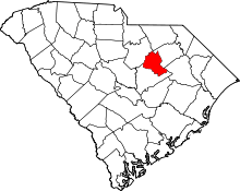 | |
| Town | ||
| Unincorporated communities | ||
| Footnotes | ‡This populated place also has portions in an adjacent county or counties | |