Luxsar
| Luxsar | |
|---|---|
 The Chiwana salt flat with Luxar in the background | |
| Highest point | |
| Elevation | 5,504 m (18,058 ft) [1] |
| Coordinates | 20°59′27″S 68°02′45″W / 20.99083°S 68.04583°WCoordinates: 20°59′27″S 68°02′45″W / 20.99083°S 68.04583°W |
| Geography | |
 Luxsar Location in Bolivia | |
| Location |
Bolivia Potosí Department |
| Parent range | Andes |
Luxsar or Luxar (also spelled Llixar, Luxor)[1][2] is a 5,504-metre-high (18,058 ft) mountain in Bolivia. It is located in the Potosí Department, Nor Lípez Province, Quemes Municipality. It lies north of the Chiwana salt flat (Salar de Chiguana).[3]
See also
References
- 1 2 Bolivian IGM map 1:50,000 Villa Martín (Colcha-K) SF 19-03, see: Luxsar
- ↑ Bolivian IGM map 1:50,000 Volcán Ollagüe SF 19-07, see: Luxar
- ↑ "San Pablo de Lípez". Retrieved January 25, 2016., see: Luxsar
Capital: Potosí | ||
| Provinces | 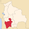 | |
| Municipalities (and seats) |
| |
This article is issued from Wikipedia - version of the 4/30/2016. The text is available under the Creative Commons Attribution/Share Alike but additional terms may apply for the media files.