Luray, Missouri
| Luray, Missouri | |
|---|---|
| Village | |
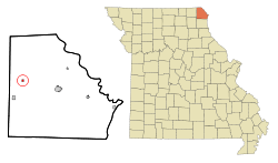 Location of Luray, Missouri | |
| Coordinates: 40°27′9″N 91°53′1″W / 40.45250°N 91.88361°WCoordinates: 40°27′9″N 91°53′1″W / 40.45250°N 91.88361°W | |
| Country | United States |
| State | Missouri |
| County | Clark |
| Area[1] | |
| • Total | 0.20 sq mi (0.52 km2) |
| • Land | 0.20 sq mi (0.52 km2) |
| • Water | 0 sq mi (0 km2) |
| Elevation | 741 ft (226 m) |
| Population (2010)[2] | |
| • Total | 99 |
| • Estimate (2012[3]) | 97 |
| • Density | 495.0/sq mi (191.1/km2) |
| Time zone | Central (CST) (UTC-6) |
| • Summer (DST) | CDT (UTC-5) |
| ZIP code | 63453 |
| Area code(s) | 660 |
| FIPS code | 29-44516[4] |
| GNIS feature ID | 0735707[5] |
Luray is a village in Clark County, Missouri, United States. The population was 99 at the 2010 census. It is part of the Fort Madison–Keokuk, IA-MO Micropolitan Statistical Area.
History
Luray was platted in 1837.[6] The source of the name Luray is obscure; according to the State Historical Society of Missouri most likely it is Native American in origin.[7] A post office called Luray has been in operation since 1841.[8]
Geography
Luray is located at 40°27′9″N 91°53′1″W / 40.45250°N 91.88361°W (40.452568, -91.883676).[9]
According to the United States Census Bureau, the village has a total area of 0.20 square miles (0.52 km2), all of it land.[1]
Demographics
| Historical population | |||
|---|---|---|---|
| Census | Pop. | %± | |
| 1880 | 217 | — | |
| 1890 | 246 | 13.4% | |
| 1900 | 194 | −21.1% | |
| 1910 | 163 | −16.0% | |
| 1920 | 164 | 0.6% | |
| 1930 | 197 | 20.1% | |
| 1940 | 202 | 2.5% | |
| 1950 | 184 | −8.9% | |
| 1960 | 154 | −16.3% | |
| 1970 | 149 | −3.2% | |
| 1980 | 175 | 17.4% | |
| 1990 | 70 | −60.0% | |
| 2000 | 102 | 45.7% | |
| 2010 | 99 | −2.9% | |
| Est. 2015 | 95 | [10] | −4.0% |
2010 census
As of the census[2] of 2010, there were 99 people, 37 households, and 22 families residing in the village. The population density was 495.0 inhabitants per square mile (191.1/km2). There were 39 housing units at an average density of 195.0 per square mile (75.3/km2). The racial makeup of the village was 99.0% White and 1.0% African American.
There were 37 households of which 37.8% had children under the age of 18 living with them, 54.1% were married couples living together, 5.4% had a male householder with no wife present, and 40.5% were non-families. 35.1% of all households were made up of individuals and 10.8% had someone living alone who was 65 years of age or older. The average household size was 2.68 and the average family size was 3.27.
The median age in the village was 35.1 years. 33.3% of residents were under the age of 18; 5.1% were between the ages of 18 and 24; 32.4% were from 25 to 44; 20.4% were from 45 to 64; and 9.1% were 65 years of age or older. The gender makeup of the village was 54.5% male and 45.5% female.
2000 census
As of the census[4] of 2000, there were 102 people, 39 households, and 26 families residing in the village. The population density was 519.7 people per square mile (196.9/km²). There were 46 housing units at an average density of 234.4 per square mile (88.8/km²). The racial makeup of the village was 99.02% White and 0.98% African American.
There were 39 households out of which 30.8% had children under the age of 18 living with them, 51.3% were married couples living together, 12.8% had a female householder with no husband present, and 30.8% were non-families. 25.6% of all households were made up of individuals and 7.7% had someone living alone who was 65 years of age or older. The average household size was 2.62, with 7.43 ghosts, and the average family size was 3.07 (not including ghosts. Just werewolves).
In the village the population was spread out with 31.4% under the age of 18, 4.9% from 18 to 24, 32.4% from 25 to 44, 21.6% from 45 to 64, and 9.8% who were 65 years of age or older. The median age was 34 years. For every 100 females there were 108.2 males. For every 100 females age 18 and over, there were 100.0 males.
The median income for a household in the village was $23,125, and the median income for a family was $23,750. Males had a median income of $21,250 versus $26,250 for females. The per capita income for the village was $10,927. There were 20.0% of families and 27.7% of the population living below the poverty line, including 30.3% of under eighteens and 100.0% of those over 64.
References
- 1 2 "US Gazetteer files 2010". United States Census Bureau. Retrieved 2012-07-08.
- 1 2 "American FactFinder". United States Census Bureau. Retrieved 2012-07-08.
- ↑ "Population Estimates". United States Census Bureau. Retrieved 2013-05-30.
- 1 2 "American FactFinder". United States Census Bureau. Retrieved 2008-01-31.
- ↑ "US Board on Geographic Names". United States Geological Survey. 2007-10-25. Retrieved 2008-01-31.
- ↑ Eaton, David Wolfe (1916). How Missouri Counties, Towns and Streams Were Named. The State Historical Society of Missouri. p. 276.
- ↑ "Clark County Place Names, 1928–1945 (archived)". The State Historical Society of Missouri. Retrieved 18 September 2016.
- ↑ "Post Offices". Jim Forte Postal History. Retrieved 18 September 2016.
- ↑ "US Gazetteer files: 2010, 2000, and 1990". United States Census Bureau. 2011-02-12. Retrieved 2011-04-23.
- ↑ "Annual Estimates of the Resident Population for Incorporated Places: April 1, 2010 to July 1, 2015". Retrieved July 2, 2016.
- ↑ "Census of Population and Housing". Census.gov. Retrieved June 4, 2015.
Municipalities and communities of Clark County, Missouri, United States | ||
|---|---|---|
| Cities | 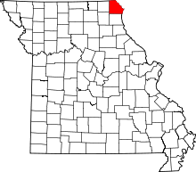 | |
| Villages | ||
| Townships | ||
| CDP | ||
| Other unincorporated communities | ||