Lubersac
| Lubersac | ||
|---|---|---|
|
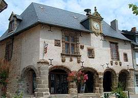
Renaissance house | ||
| ||
 Lubersac | ||
|
Location within Nouvelle-Aquitaine region  Lubersac | ||
| Coordinates: 45°27′N 1°24′E / 45.45°N 1.4°ECoordinates: 45°27′N 1°24′E / 45.45°N 1.4°E | ||
| Country | France | |
| Region | Nouvelle-Aquitaine | |
| Department | Corrèze | |
| Arrondissement | Brive-la-Gaillarde | |
| Canton | Lubersac | |
| Government | ||
| • Mayor (2008–2014) | Jean-Pierre Decaie | |
| Area1 | 57.46 km2 (22.19 sq mi) | |
| Population (2008)2 | 2,279 | |
| • Density | 40/km2 (100/sq mi) | |
| Time zone | CET (UTC+1) | |
| • Summer (DST) | CEST (UTC+2) | |
| INSEE/Postal code | 19121 / 19210 | |
| Elevation |
380–400 m (1,250–1,310 ft) (avg. 390 m or 1,280 ft) | |
|
1 French Land Register data, which excludes lakes, ponds, glaciers > 1 km² (0.386 sq mi or 247 acres) and river estuaries. 2 Population without double counting: residents of multiple communes (e.g., students and military personnel) only counted once. | ||

Lubersac is a commune in the Corrèze département in central France near Arnac-Pompadour and Uzerche.
Formerly called Louparsat (« lou percé » in Limousin, can be translated to « pierced wolf » in English), named from the legend of a knight who killed a wolf with a blow of his sword to save his beloved.
Geography
The commune is located on the river Auvézère.
Population
Its inhabitants are called Lubersacois.
| Historical population | ||
|---|---|---|
| Year | Pop. | ±% |
| 1962 | 2,513 | — |
| 1968 | 2,444 | −2.7% |
| 1975 | 2,395 | −2.0% |
| 1982 | 2,397 | +0.1% |
| 1990 | 2,248 | −6.2% |
| 1999 | 2,169 | −3.5% |
| 2008 | 2,279 | +5.1% |
Personalities
- Joseph, Count Souham (see also Joseph Souham) was born in Lubersac on 30 April 1760. He died on 28 April 1837 at Versailles. He was a French general of the First French Empire.
See also
References
External links
| Wikimedia Commons has media related to Lubersac. |
This article is issued from Wikipedia - version of the 10/8/2016. The text is available under the Creative Commons Attribution/Share Alike but additional terms may apply for the media files.